
Summary: Manaslu Circuit Trek is 177 km restricted-area circuit climbing to 5,160m at Larkya La Pass, requiring a licensed guide and permit. Rated strenuous, the route passes Tibetan Buddhist villages in the Nubri Valley with far fewer trekkers than Everest or Annapurna. October and April offer the clearest trail conditions, and total cost runs $1,200 to $2,800 per person depending on the trek type.
Manaslu Circuit Trek
- Duration11 Days
- Difficulty Level Moderate
- Max Altitude 5160 m
- Group Size 10
- Starts Machhakhola
- Ends Dharapani
Manaslu Circuit Trek Highlights
- Cross Larkya La Pass at 5,160 m, the trek's highest crossing point.
- Walk a remote circuit with far fewer trekkers than the Annapurna Circuit Trek or Everest Base Camp Trek.
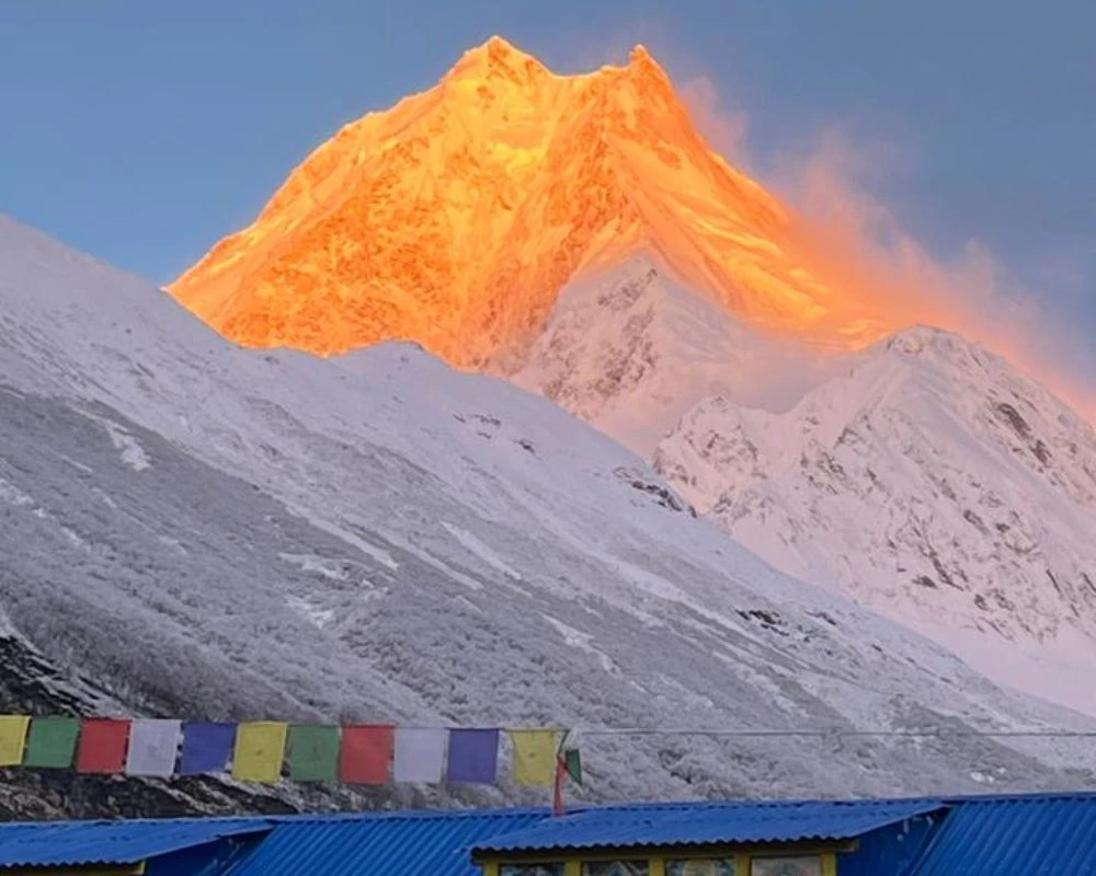
- Get unobstructed views of Mount Manaslu, the world's eighth-highest peak at 8,163 m; the trek offers a rare, uncrowded angle on an 8,000 m giant.
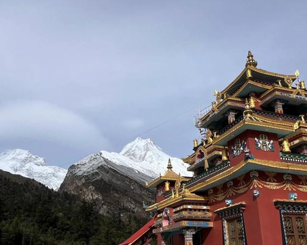
- Pass through villages with active Tibetan Buddhist monasteries and mani walls.
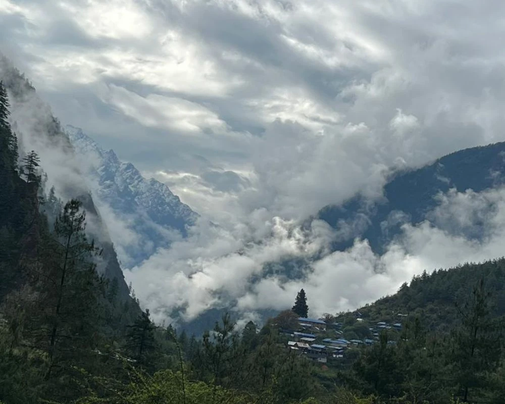
- Trek along the west bank of the Budhi Gandaki River through deep gorges and pine forests.
- Take an optional hike to Manaslu Base Camp from Sama Gaun on your acclimatisation day.
- Extend your journey with a Manaslu Tsum Valley trek for a deeper cultural experience.
- The scenery and trail solitude compare well with any valley trek in Nepal, and the trek offers a genuine sense of remoteness that is increasingly hard to find.
Manaslu Circuit Trek: Overview
The Manaslu Circuit Trek is a 177 km restricted-area circuit that climbs to 5,160 m at Larkya La Pass, open only to trekkers with a licensed guide and a valid restricted-area permit; that single fact, more than any other, explains why the route still feels so quiet. How does a trek this dramatic stay so uncrowded while trails one valley over fill up with visitors every October? This guide sets out to answer that question and walk through everything you need before departure.
Nepal's trekking industry has grown fast, and the Everest and Annapurna regions carry most of that growth. Teahouses there now offer WiFi and bakery menus at altitudes where neither existed two decades ago. Manaslu, however, took a different path, and the Manaslu region is a restricted area, which is exactly why alternatives to the busier circuits still exist. Because the trek passes through a restricted zone with permit checkpoints at every entry point, numbers on the trail stay naturally limited, and that scarcity is part of the appeal.
This detailed itinerary covers the full pass, permit costs, acclimatisation strategy, and the crossing that defines the trip. Readers can weigh the standard 11-day loop against a 13-day version with extra acclimatisation or the 18-day route with the Tsum Valley Trek extension. Among treks around the Manaslu region, the Manaslu Circuit Trek is one of the very few that still delivers genuine trail solitude, and the Circuit Trek is one of the last quiet high passes left in Nepal. Nepal Everest Base Camp provides the information and trekking support travellers need to choose the right itinerary. By the end, the choice should come down to time and appetite for altitude, not missing information.
Manaslu Circuit Trek Itinerary
Outline Itinerary
- Day 01:Drive from Kathmandu to Machha Khola (930 m / 3,051 ft)
- Day 02:Trek from Machha Khola to Jagat (1,410 m / 4,626 ft)
- Day 03:Trek from Jagat to Deng (1,804 m / 5,921 ft)
- Day 04:Trek from Deng to Namrung (2,630 m / 8,629 ft)
- Day 05:Trek from Namrung to Sama Gaun (3,530 m / 11,581 ft)
- Day 06:Day 6: Acclimatisation Day in Sama Gaun (3,530 m / 11,581 ft)
- Day 07:Trek from Sama Gaun to Samdo (3,910 m / 12,831 ft)
- Day 08:Trek from Samdo to Dharamshala (4,460 m / 14,632 ft)
- Day 09:Cross Larkya La Pass (5,160 m / 16,929 ft) to Bimthang (3,700 m / 12,139 ft)
- Day 10:Trek from Bimthang to Dharapani (1,860 m / 6,102 ft)
- Day 11:Drive from Dharapani to Besisahar, then to Kathmandu (760 m / 2,493 ft)
Kathmandu is the starting point of the trek, and the day begins with an early morning departure along the Prithvi Highway toward Arughat. The road then continues on progressively rougher mountain roads to Machha Khola in Gorkha. The drive takes 8 to 9 hours in total, and the first four hours run along a sealed road through the Trishuli Valley, passing market towns and terraced hillsides.
After Arughat, the road surface changes to gravel and rock. The vehicle works harder through a series of river crossings and steep switchbacks. Machha Khola marks the lower boundary of the Manaslu Conservation Area Project and the trailhead of the Manaslu Circuit, where most trekkers start the trek on foot the following morning.
The village has a cluster of teahouses catering to trekkers, with basic rooms, simple meals, and hot tea. Settle in early, eat a solid dinner, and check your gear carefully before the first walking day tomorrow.
- Altitude Loss: -390m
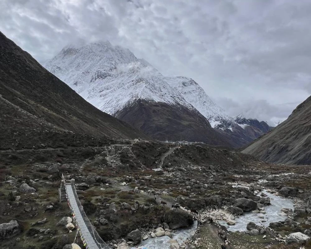
Today the trek begins on foot. The trail leaves Machha Khola and follows the Budhi Gandaki River, which stays a constant companion for the next several days. The path moves through subtropical forest, crossing numerous suspension bridges over fast-moving side channels and gorge tributaries.
The vegetation is dense and humid in the lower sections, with occasional views of terraced farmland on the far hillsides. The trail is well-defined, and the gradient is manageable, which makes this one of the easier days on the circuit.
Jagat, the day's destination, sits at a bend in the river with a collection of teahouses and a government permit checkpost. Your documents get verified here for the first time, so expect 6 to 7 hours of straightforward walking on a mix of stone-paved paths and dirt trails.
- Altitude Gain: +480 m
Stone-paved paths, narrow cliff sections, and multiple river crossings mark this part of the trek. The Budhi Gandaki gorge closes in noticeably today, and the trail demands careful footing where the path narrows to a shelf above the river. There are several suspension bridges to cross, some with excellent views up and down the gorge.
The settlements become smaller and more spread out as the valley deepens. Deng is a quiet village with basic teahouse facilities and a small monastery on the hillside above the main trail.
The day covers more ground than yesterday, and the seven hours of walking includes a few steeper sections. Even so, the overall effort stays moderate compared with what lies ahead.
- Altitude Gain: +394 m
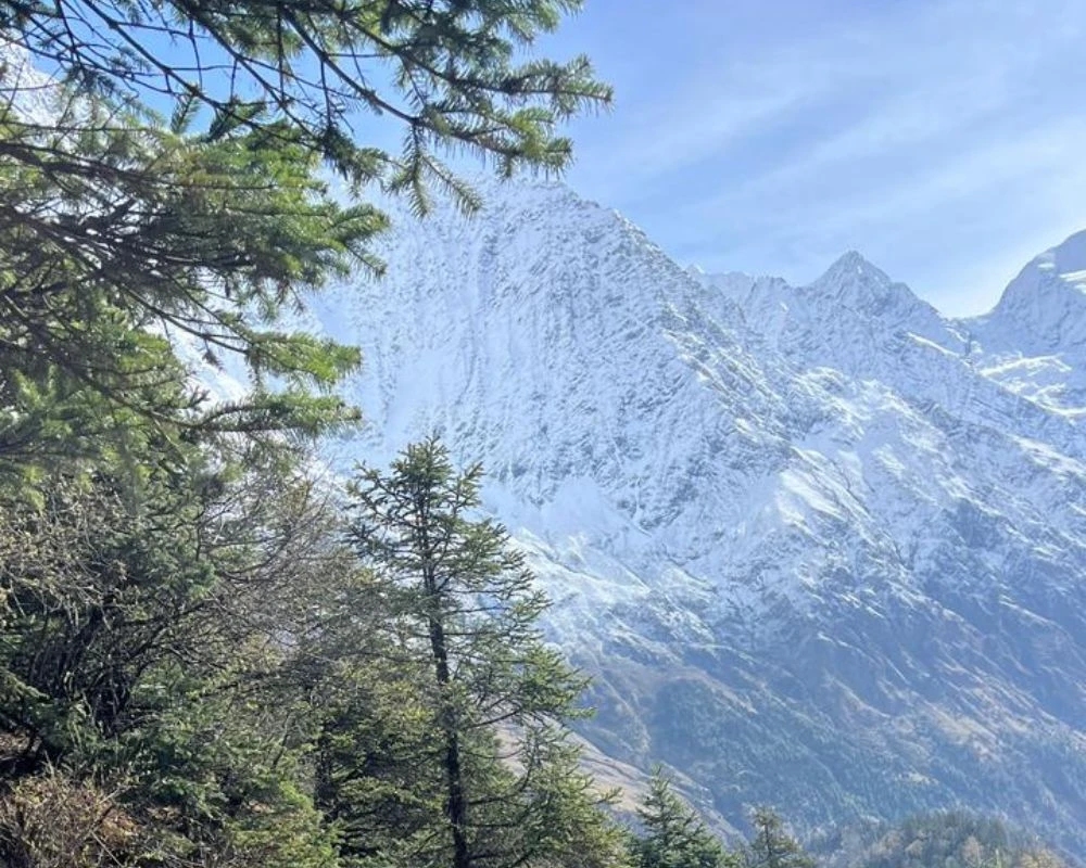
The route climbs steadily today through pine and rhododendron forest, leaving the deep gorge of the lower valley behind. The terrain opens into broader mountain scenery, and the first Himalayan peaks appear above the treeline as you gain elevation.
Trekkers pass through Ghap, a small village where a stone archway and a cluster of chortens mark the entry into the cultural zone of the Nubri Valley. The shift is noticeable: the architecture changes, mani walls line the trail, and the people you meet speak Tibetan rather than Nepali.
The air thins above 2,500 m, and the pace naturally slows. Namrung sits on a wide ridge at 2,630 m with cleaner stone construction than the lower villages and several well-run teahouses. This is a good evening to start paying attention to how your body is handling the altitude gain.
- Altitude Gain: +826 m
This is one of the most visually rewarding days on the Manaslu Circuit. The trail passes through Lho and Shyala, both with working monasteries, carved mani stones, and chortens set against glaciated ridgelines. The monastery at Lho is one of the oldest in the valley and worth a short stop if the resident monks are present.
From open sections of the trail above Shyala, the full south face of Mount Manaslu comes into clear view for the first time, arguably the single greatest highlight of the Manaslu Circuit. This first true view of Manaslu rises above the valley in a way that makes its 8,163 m height genuinely felt, and it rewards the altitude gain of the past two days.
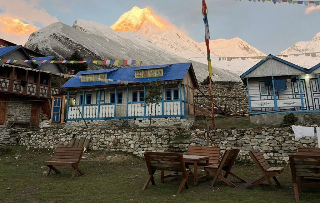
Sama Gaun is the largest and most developed village in the upper Budhi Gandaki, with multiple teahouses, a health post, a monastery, and good views from the stone terraces above the trail. It serves as the main acclimatisation hub before the pass crossing.
- Altitude Gain: +900 m
This acclimatisation day is essential, not optional. The significant elevation jump ahead, combined with the demands of Larkya La Pass two days later, makes proper adjustment on this day a practical safety requirement. Two-day hike options work well for altitude exposure.
The walk toward Manaslu Base Camp at roughly 4,800 m gives your body a meaningful high-altitude stimulus without carrying a full overnight pack. The base camp approach offers close glacier views and a clear line up the northwest face of Mount Manaslu. The shorter alternative is the climb to Pungyen Gompa, a monastery perched on a ridge above Sama Gaun with wide views toward the Tibetan border peaks.
Both options return to Sama Gaun for the night. Whichever route you choose, walk slowly, drink consistently, and rest in the afternoon, since the acclimatisation your body builds today directly affects how you perform on the pass. Trekkers who add a 13-day itinerary often use this stretch to build in a second rest day before the crossing.
- Options: Hike to Manaslu Base Camp or Pungyen Gompa
- Altitude Gain: +1270m
- Altitude Loss: -1270m
A shorter walking day that allows for continued acclimatisation without heavy exertion. The trail crosses open yak pastures and broad gravel flats, and the horizon fills steadily with Himalayan ridgelines running north toward the Tibetan border. On clear mornings, the peaks above Samdo reflect in the small glacial ponds along the route.
Samdo is a traditional trading village that historically sat on a cross-border route between Nepal and Tibet. That cultural and commercial connection still shows in the architecture, the dress, and the Tibetan-dialect speech of the residents.
The teahouses here are simple, with basic rooms and limited menus, but adequate for one night. Drink plenty of water this evening and eat as much as your appetite allows in preparation for the high-camp push tomorrow.
- Altitude Gain: +380 m
Dharamshala functions as the high-camp staging point for the Larkya La crossing. The walk from Samdo is short in distance but increasingly exposed as the valley narrows and the trail climbs above the last vegetation toward bare glacial terrain. The path stays mostly clear of serious obstacles, but the altitude makes even moderate effort feel heavier than it should.
Facilities at Dharamshala are genuinely minimal. There are one or two basic teahouses with small rooms, thin walls, limited food options, and no hot water.
Even so, arriving in the early afternoon gives you time to eat a proper hot meal, hydrate thoroughly, organise your pack, and rest. Most trekkers set an alarm for 3:30 to 4 AM, since crossing Larkya La is far easier in stable morning conditions before cloud and wind build in the afternoon.
- Altitude Gain: +550 m
This is the toughest day of the Manaslu Circuit. Departure is at 4 to 5 AM, with headlamps on and temperatures well below freezing. The first hour follows a dark, steep trail above Dharamshala through loose moraine and occasional snow patches.
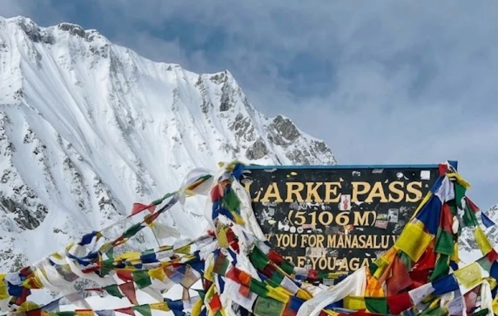
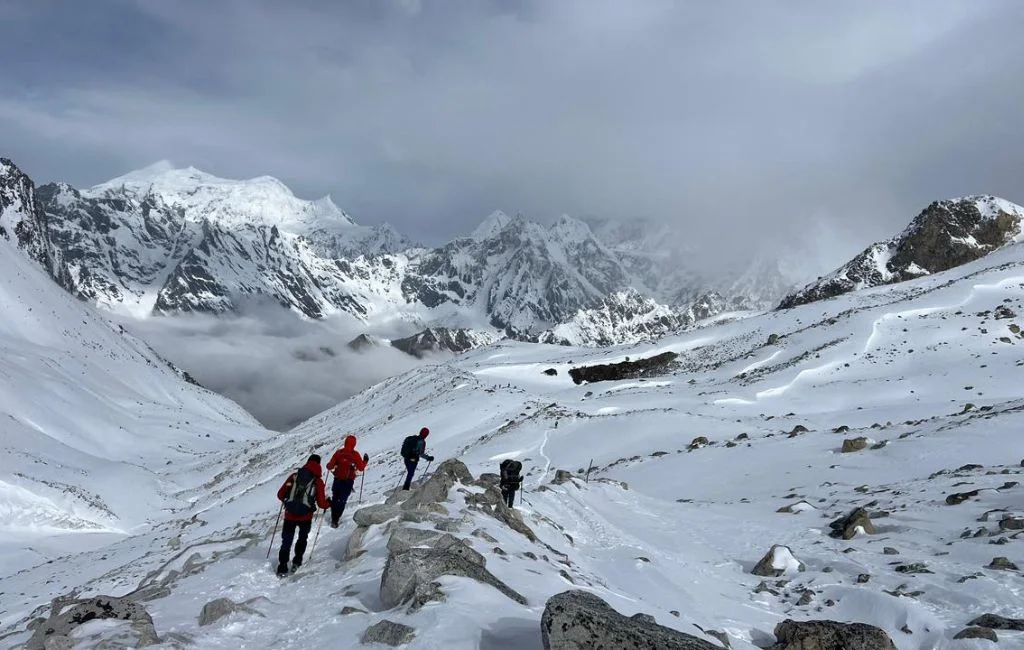
As dawn breaks, the scale of the surrounding landscape becomes clear. The trail crosses glacial snowfields and climbs a series of rocky switchbacks to the prayer-flag-marked col at 5,160 m, the highest point of the trek. From the pass, peaks stretch across the horizon in every direction.
The descent to Bimthang is long and physically demanding, dropping 1,460 m over steep and sometimes loose terrain. Most trekkers find the descent harder on the knees than the ascent. Bimthang sits in a wide glacial valley surrounded by birch forest and has better facilities than Dharamshala. The full day covers 8 to 9 hours of walking and defines the physical character of this high-altitude trek.
- Altitude Gain: +700 m
- Altitude Loss: -1,460 m
After the exertion of the pass crossing, this long descent through birch forest and open river valleys brings genuine physical relief. The trail drops steadily, rhododendrons reappear on the hillsides, and the air thickens noticeably with every few hundred metres lost.
The path crosses several bridges and passes through the small settlements of Kharche and Tilije before following the Marsyangdi River downstream to Dharapani. Dharapani sits at the junction where the Manang district ends and the lower Marsyangdi Valley begins, and it also marks the point where the circuit trail reconnects with the main Annapurna Circuit Trek route.
After days above 3,500 m, the warmth here feels almost disorienting. The teahouses are well-stocked, the menus are varied, and there is usually enough afternoon light left to wash clothes, rest properly, and think back on the crossing.
- Altitude Loss: -1,840 m
From Dharapani, a jeep follows the rough mountain road down the Marsyangdi Valley to Besisahar, the administrative town that also serves as the traditional starting point for the Annapurna Circuit Trek. From there, a sealed highway continues south through the Marsyangdi and Trishuli valleys for another 5 to 6 hours into Kathmandu.
Total road time for the day runs between 9 and 11 hours. This is the practical end of the trek. Most trekkers sleep through stretches of it, scroll back through photos, or finish whatever food is left in their pack.
The landscape through the lower valleys is pleasant enough. However, after two weeks in the mountains, the transition back to city traffic tends to land with some weight.
Route Map
Cost Details
What is Included
The cost of the Manaslu Circuit depends on group size, season, and whether you book a group departure or a private trek.
- Three meals per day during the trek
- Teahouse accommodation throughout the Manaslu Circuit Trek
- Licensed trekking guide and shared porter (a single supplement charge applies for solo travellers).
- Kathmandu - Machhakhola Local sharing transport by bus for client, guide, and porters.
- Dharapani - Kathmandu Sharing transport by bus/jeep for client, guide and porters.
- Guide and porter insurance, food, and accommodation
- Manaslu Conservation Area Permit
- Manaslu Restricted Area Permit
- Annapurna Conservation Area Permit.
- TIMS card (like a permit).
- Local Rural Municipality Permit.
- All government taxes and official fees
- Company T-shirt and company duffel bag (if needed)
- Basic first aid kit, always included in the trek package
What is not Included
- Nepal entry visa fee
- All expenses (accommodation, personal spending, food) in Kathmandu
- Travel and medical insurance
- Personal trekking equipment/expenses
- All drinks: tea, coffee, water, alcoholic, soft, and bottled water.
- Tips for guide and porters(Tips is expected for staff/crews).
- Extra nights caused by weather delays in the mountains.
Add-Ons & Options
1. Extra Days on Mountain:
For trekkers who want a buffer for weather delays, altitude acclimatisation, or simply a slower pace through a favourite village. Charged per additional day and covers guide, accommodation, and meals.
2. Private Transport (Kathmandu to Machha Khola or Dharapani to Kathmandu):
A private jeep or car for the start or end leg of the trek, instead of the shared local bus/jeep. Saves several hours of travel time and skips the crowded, bumpy public transport option to make it more comfortable.
3. Kathmandu Sightseeing Tour:
A guided day tour of Kathmandu's UNESCO World Heritage sites, usually Pashupatinath, Boudhanath, Swayambhunath, and Kathmandu Durbar Square. A good way to use a spare day before or after the trek.
4. Accommodation in Kathmandu (Tourist Standard):
Pre or post-trek hotel nights in a tourist-standard property in Thamel. Covers a comfortable base to rest, shower properly, and repack before flying out.
5. Single Supplement Charge for Porter:
An extra fee if a porter is carrying for only one trekker rather than the usual two-to-one load split. Covers the porter's full daily wage without a second client to share the cost.
Departure Dates
Select a Departure Month
Departure Date
Status
Price
Book
Start DateOct 28, 2026End DateNov 07, 2026
Available
PriceUS$1250Per Person
Start DateOct 30, 2026End DateNov 09, 2026
Available
PriceUS$1250Per Person
Manaslu Circuit Trek Photos
Good to Know
Best time for Manaslu Circuit trek
Spring and Autumn Seasons
Spring, from March to May, and autumn, from September to November, remain the best time for Manaslu Circuit Trek. Choosing the best time comes down to weighing clear skies against trail traffic, and both windows deliver settled weather, manageable temperatures at altitude, and steady trail conditions on the approach to Larkya La Pass.
October and April stand out as the peak months. October brings the clearest skies of the year once the monsoon has washed the atmosphere clean, while April pairs good visibility with the added colour of rhododendron blooms between 2,500 m and 3,500 m.
Afternoon cloud is common in both seasons above 4,000 m, which is why most trekkers start their high-altitude days before sunrise. Teahouses stay open and well-stocked during spring and autumn, and the trail sees its highest number of trekkers, though crowds remain modest compared with the Everest and Annapurna regions.
Winter and Monsoon Challenges
Winter, from December to February, is possible for experienced trekkers but carries real and practical risks. Larkya La Pass can close entirely under heavy snow, and teahouse availability above Samdo becomes unpredictable, with some lodges shutting for the season. Temperatures at the high camp drop fast, often well below -15°C overnight.
The Manaslu Circuit Trek in monsoon (June to August) is not advisable for most trekkers. Rain turns lower trails slippery and muddy, leeches are active below 2,000 m, and cloud cover blocks mountain views for most of the day. The restricted area permit does not change in price during poor-season treks, so the cost-to-experience ratio drops considerably.
In short, if you are deciding on the best time to trek the Manaslu Circuit, the answer is October or April, without exception.
Month-by-Month Trail Conditions
Month | Trail Conditions | Recommendation |
January | Cold, pass risk high, trail quiet | Experienced winter trekkers only |
February | Cold but slowly improving | Manageable with preparation |
March | Warming, rhododendron begins | Good |
April | Stable, clear views, moderate traffic | Best spring month |
May | Warm at low elevations, afternoon cloud | Good |
June | Drier trails, fewer trekkers early in the month | Generally possible |
July | Full monsoon, difficult conditions | Not recommended |
August | Monsoon continues; leeches common | Not recommended |
September | Monsoon clears, fresh trail conditions | Good |
October | Clear skies, cool nights, best views | Best overall month |
November | Cold mornings, excellent visibility | Very good |
December | Cold, pass closure risk rising | Experienced trekkers only |
The best time forManaslu Circuit trek is October for autumn and April for spring. Both months offer the best conditions for crossing Larkya La and the clearest chance of seeing Mount Manaslu free of cloud from the trail above Sama Gaun.
Permits, Rules and Trek Logistics
Restricted Area Rules and Guide Requirement
The Manaslu region sits inside a restricted zone under Nepalese law, so independent trekking without a licensed guide is not permitted under any circumstances. This rule applies regardless of whether you complete the standard 11-day loop, the 13-day version with an extra acclimatisation stop, or the longer 18-day version that includes the Tsum Valley Trek.
Your guide must carry original copies of all permits for inspection at every official checkpoint along the route. Guides must hold a current licence issued by the Nepal Tourism Board and carry valid identity documentation. Solo travellers who wish to stay independent rather than joining a group must still hire a licensed guide and recruit at least one extra trekker to meet the two-person minimum for the restricted area permit.
Entry Points and Checkposts
Checkpoint | Location | Documents Checked |
Jagat | Main restricted area trail entry | All permits |
Dharapani | Circuit exit point | All permits |
Road Access and Travel Time
Route Segment | Transport Mode | Approximate Duration |
Kathmandu to Machha Khola | Jeep or public bus | 8-9 hours |
Dharapani to Besisahar | Jeep | 3-4 hours |
Besisahar to Kathmandu | Tourist bus or private jeep | 5-6 hours |
Route, Map and Elevation Profile
Route Map Overview
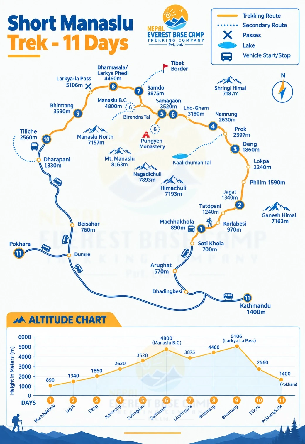
The Manaslu Circuit Trek map outlines a clockwise loop starting at Machha Khola (930 m) and running north along the Budhi Gandaki River through Jagat, Deng, Namrung, and Lho to Sama Gaun (3,530 m). From there, the route continues to Samdo (3,910 m) and the high camp at Dharamshala (4,460 m), crosses Larkya La Pass (5,160 m), then descends through Bimthang (3,700 m) and Tilije (1,860 m) to Dharapani, where a road connection leads back to Kathmandu via Besisahar.
The total distance of the Manaslu Circuit runs to approximately 177 km of trail, with a road approach and exit at each end. A printed Himalayan Map House edition should be carried on the trail, particularly for the upper section above Sama Gaun, where trail markers thin out.
Terrain and Trail Conditions
The lower route from Days 1 to 3 runs through river gorges with stone-paved paths, hanging sections on cliff faces, and multiple suspension bridges across the Budhi Gandaki and its tributaries. The trail is well-worn and straightforward to follow, though narrow in places.
The middle sections of the trek, from Days 4 to 7, open progressively into alpine meadows, wide ridgelines, and yak-pasture flats, with mountain views across the Manaslu area from Namrung upward. The upper sections from Days 8 to 9, however, turn to glacial moraine, exposed rock slabs, and snow.
The Larkya La approach above Dharamshala is the most technically demanding terrain on the circuit. Crampons or microspikes are strongly advised for the crossing itself, particularly in spring, when hard-packed snow can stay firm on the final switchbacks well into May.
Manaslu Circuit Trek Difficulty
Physical Demands and Daily Distance
The Manaslu Circuit Trek difficulty is considered strenuous by any honest measure, and the grading is fair. Daily walking distances range from 12 to 22 km, with most days needing 5 to 9 hours on uneven terrain while carrying a daypack of 8 to 12 kg. Unlike the Annapurna Circuit Trek or the standard Everest Base Camp Trek, there are few sections of flat or gentle trail.
The trail climbs or descends almost constantly. Trekkers who want a short Manaslu Circuit Trek usually still choose the standard 11-day route, since a genuinely condensed version sacrifices the acclimatisation margin that keeps the pass crossing safe.
The 13-day version, which adds an extra day at Samdo as a second acclimatisation stop, is a noticeably safer and more comfortable option for trekkers who want more time to adjust at altitude. Daily elevation gains of 400 to 900 m are the norm in the upper sections, and the number of days you allow for acclimatisation has more bearing on how the trek feels than raw fitness alone.
Altitude Challenges
Altitude sickness is a genuine concern on this circuit. The elevation profile climbs consistently from Day 1 to Day 8, with only one built-in acclimatisation day at Sama Gaun in the standard schedule. Trekkers who push through the middle section too quickly often get headaches, nausea, and persistent fatigue before they even reach Samdo.
Staying well hydrated, walking slowly, and watching for symptoms early are the most practical factors in completing the trek safely. Since the Manaslu Circuit Trek climbs steadily to 5,160 m, a 13-day itinerary with an extra acclimatisation day in Samdo is worth considering for anyone attempting a high-altitude trek above 4,000 m for the first time. The rule is simple: if symptoms appear, stop climbing; if symptoms worsen after 24 hours, descend.
Larkya La Pass Crossing
The Larkya La Pass crossing on Day 9 is the defining challenge of the Manaslu Circuit Trek, and the pass day alone runs 8 to 9 hours for most groups. At 5,160 m, the crossing demands a pre-dawn start, a steep ascent through snow and rock, a brief and windswept summit crossing marked by prayer flags and a long, steep descent to Bimthang that most trekkers find harder on the knees than the ascent.
Combined elevation change on that single day tops 2,100 m once gain and loss are added together. The main difficulty is not the ascent itself but the length of the full day. Trekking poles are strongly recommended and should have snow baskets fitted. Microspikes or crampons help too, particularly early in spring when the upper slopes hold firm ice from winter.
Food, Accommodation and Daily Life
Teahouse Standards
Accommodation on the Manaslu Circuit differs meaningfully from what you find on the Annapurna or Everest routes. The trail infrastructure is less developed here, and that is part of the appeal, but trekkers should arrive with calibrated expectations.
In lower villages like Jagat and Deng, rooms are basic but functional, with twin beds, thin foam mattresses, shared squat or Western toilets, and minimal heating. The communal dining room stays warmer than the sleeping rooms in the evening, so most trekkers spend as little time as possible in their rooms before sunrise.
Above Sama Gaun, expect thinner walls, colder temperatures, and fewer menu choices. Dharamshala, the high camp before the pass, is the most basic lodge on the circuit, with no hot water. Bring a sleeping bag rated to at least -10°C and use it from Day 5 onwards.
Meals and Menu Options
Meal | Common Options |
Breakfast | Porridge, eggs, toast, pancakes, Tibetan bread, chapati |
Lunch | Dal bhat, fried rice, noodle soup, momos, vegetable curry |
Dinner | Dal bhat, pasta, vegetable curry, tsampa porridge, garlic soup |
Snacks | Boiled potatoes, biscuits, peanuts, chocolate, energy bars |
Dal bhat is the most reliable option along the trek at every elevation and comes with free refills in most lodges, making it the best caloric value on the menu. Above Sama Gaun, however, menus shrink to a shorter list of carbohydrate-heavy dishes, fresh vegetables disappear, and cooking gas gets used sparingly. Carry high-calorie trail snacks from Kathmandu for the upper section, particularly for the long day over Larkya La.
Drinking Water and Availability
Drinking untreated tap or stream water is not safe at any elevation on this circuit. The practical options are straightforward, but each has a trade-off worth understanding before you leave Kathmandu.
Bottled water: Available in most villages but generates plastic waste. It becomes significantly more expensive above 3,500 m, where it can cost USD 3 per litre.
Boiled water: Provided by teahouses for a small fee and the most consistently reliable option across all villages on the circuit.
Water purification tablets or filter: Useful for filling from natural water sources between teahouses, particularly above Sama Gaun, where distances between lodges increase.
Electrolyte powder: Helpful above 4,000 m, where dehydration speeds up altitude sickness symptoms and plain water alone may not maintain electrolyte balance.
Aim for 3 to 4 litres of fluid per day, particularly above 4,000 m. Thirst is often a lagging indicator at altitude, meaning you can be meaningfully dehydrated before you feel thirsty.
Preparation and Packing
Fitness and Training
Start preparation and training at least three months before departure. The Manaslu Circuit Trek demands strong cardiovascular fitness and sustained leg endurance, particularly for the Larkya La crossing and the long descent days that follow. The goal is not peak athletic fitness but steady stamina across 10 consecutive days of mountain walking.
A useful training structure:
Aerobic base: Run, cycle, or swim four to five times per week for 45 to 60 minutes at a moderate pace.
Hill training: Hike with a weighted pack of 8 to 12 kg on steep terrain, simulating 6 to 8-hour walking days on consecutive weekends.
Leg and core strength: Squats, step-ups, and lunges twice weekly to build stability for uneven trails and long descents.
Long days: Build up to back-to-back long hikes in the final six weeks before departure to prepare for multi-day accumulated fatigue.
Prior trekking experience at altitude helps, though it is not strictly required. Trekkers who have completed a previous high-altitude trek above 4,000 m tend to handle the upper section of this circuit with noticeably more confidence and composure.
Essential Gear and Packing List
Packing for the Manaslu Circuit means planning for four distinct temperature zones in a single trek, from subtropical heat at Machha Khola to sub-zero cold at Dharamshala.
Clothing for spring and autumn:
Moisture-wicking base layers in merino wool or synthetic fabric
Mid-layer fleece or a light down jacket for evenings above 3,000 m
Waterproof and windproof outer shell for pass day and any afternoon rain
Quick-dry trekking trousers
A warm hat, sun hat, and a neck buff
Liner gloves and a pair of insulated waterproof gloves
Thermal underwear for nights above 3,500 m
Footwear:
Broken-in waterproof trekking boots with ankle support; this is non-negotiable since new boots are one of the most common causes of early trek withdrawal
Camp shoes or lightweight sandals for evenings in the teahouse
Gaiters for snow sections around Larkya La Pass
Microspikes or crampons for the pass crossing itself
Equipment and accessories:
Item | Notes |
Sleeping bag | Rated to -10°C minimum |
Trekking poles | Adjustable, with snow baskets fitted |
Headlamp with spare batteries | Essential for the 4 AM pass departure |
Sunglasses rated UV Category 4 | Critical above 4,000 m to prevent snow blindness |
Water bottles or hydration bladder | 2-litre minimum total capacity |
Sunscreen SPF 50 and lip balm | Reapply every two hours above 3,500 m |
Personal first aid kit | See the Health and Safety section for contents |
Manaslu Circuit Trek map | Carry a printed physical copy |
Documents and Insurance
Document | Requirement |
Passport valid for 6+ months | Original required at all checkposts |
Nepal entry visa | Obtainable on arrival at Kathmandu airport |
Restricted Area Permit | Arranged by your trekking company |
Manaslu Conservation Area Permit | Arranged by your trekking company |
Annapurna Conservation Area Permit | Required when the Manaslu Circuit route enters the Annapurna Conservation Area |
TIMS card | Arranged by your trekking company |
Travel insurance certificate | Must cover helicopter rescue above 5,000 m |
Emergency contact details | Carry a printed copy separately from your phone |
Travel insurance must explicitly cover trekking above 5,000 m and helicopter evacuation to that altitude. Check the exact policy wording before departure, since policies marketed as general travel insurance that do not specifically name high-altitude trekking are not adequate for this trek.
Guide, Porter and Trek Support
Why a Guide Is Mandatory
A licensed guide is legally required for the Manaslu Circuit. The region is a restricted zone under Nepalese law, and your guide carries the permits that allow checkpoint passage at Jagat, Sama Gaun, and Dharapani. Without those permits in the guide's possession, trekkers cannot legally continue past the restricted area boundary.
Beyond the legal requirement, an experienced guide gives altitude management advice drawn from multiple seasons on the trail. They watch for early altitude sickness symptoms before they escalate, talk with teahouse owners in the local dialect for accurate weather and trail condition information, and manage logistics that would otherwise need deep prior knowledge of the route. When you set out to experience the Manaslu region, your guide is your most important asset on the mountain.
Porter Support and Weight Limits
Item | Standard Practice |
Porter load limit | 20 to 25 kg per porter |
Porter-to-trekker ratio | 1 porter shared between 2 clients, included in package |
Extra porter, optional | USD 25 to 30 per day |
Porter insurance | Mandatory, included in standard packages |
Porter clothing and footwear | Verified and confirmed by your trekking company |
The guide and porter team works in demanding physical conditions throughout the trek. Make sure your porter has adequate cold-weather gear above 4,000 m, and if a porter is visibly struggling under the load on a steep or cold section, reduce the weight or hire an extra person rather than continuing. Ethical treatment of porters is not optional on a responsible trek operation.
Group and Private Trek Options
Group departure: The most cost-effective option. Groups of 4 to 12 trekkers share a guide and porter ratio on a fixed departure date during spring or autumn.
Private trek: Fully customisable timing, pace, and itinerary. Suitable for trekkers who need a modified acclimatisation schedule or want to add the Tsum Valley extension. Costs more per person but gives complete scheduling control.
Joining a group: Solo trekkers can join an existing group departure to meet the two-person restricted area permit minimum, typically at no extra cost beyond the standard per-person price.
For trekkers planning a slower pace or extra side trips, a private trek allows for a 13-day or longer itinerary without the fixed schedule of a group departure.
Health, Safety and Altitude Strategy
Altitude Sickness and Prevention
High Altitude sickness, or acute mountain sickness (AMS), is a real risk above 3,500 m on this circuit. Symptoms include a persistent headache, nausea, dizziness, fatigue, and reduced appetite. Mild AMS is common and usually clears with 24 hours of rest and consistent hydration at the same altitude.
The severe forms, High Altitude Pulmonary Edema (HAPE) and High Altitude Cerebral Edema (HACE), are medical emergencies that need immediate descent and evacuation. HAPE shows up as breathlessness at rest and a wet cough. HACE shows up as confusion, loss of coordination, and a severe persistent headache that does not respond to ibuprofen. Either condition calls for an immediate call to your guide.
Prevention strategies for this trek:
Ascend gradually and follow the itinerary's daily schedule without skipping rest days or shortening the acclimatisation stop at Sama Gaun.
Hydrate consistently: 3 to 4 litres of water per day above 3,000 m, regardless of whether you feel thirsty.
Avoid alcohol and sleeping tablets at altitude, since both suppress breathing and interfere with the body's natural acclimatisation response.
Eat regular meals even when appetite drops, because the body still needs fuel for thermal regulation and exertion.
Consider acetazolamide (Diamox) as a preventive measure under medical supervision, and talk to your doctor before departure.
Acclimatisation Strategy
Elevation Threshold | Recommended Action |
2,500 to 3,000 m | Begin slowing daily pace and increase fluid intake |
3,000 to 4,000 m | Follow all rest days strictly and without exception |
Above 4,000 m | Do not climb further if any AMS symptoms are present |
Sama Gaun at 3,530 m | Acclimatisation day is mandatory in the schedule |
Samdo at 3,910 m | Consider an optional additional rest day if symptoms are present |
The built-in acclimatisation day at Sama Gaun is the key safety mechanism in the itinerary. Even trekkers who feel entirely healthy on Day 6 benefit from the extra time at altitude, since the pass crossing two days later is a sustained physical effort above 5,000 m.
Emergency Evacuation and Rescue
Helicopter evacuation is the primary rescue method for serious medical emergencies along the Manaslu Circuit Trek. However, because much of the route lies within a restricted area, helicopter evacuation requires a special rescue permit and clearance before the flight can proceed.
This restricted-area procedure can add several hours to the evacuation process, even when a helicopter is available. Weather conditions and the helicopter’s location can cause further delays. Evacuation costs typically range from USD 3,000 to USD 10,000, depending on the pickup location and operator. Your travel insurance should cover these costs, provided your policy includes high-altitude trekking and emergency helicopter evacuation.
Your guide carries a satellite phone or radio and will coordinate directly with rescue services and the trekking company base office in Kathmandu if an emergency happens. Do not attempt to self-evacuate from above 4,000 m without guide assistance.
Medical Kit and First Aid
Item | Purpose |
Ibuprofen and paracetamol | Headache and general pain management |
Diamox (acetazolamide) | Altitude sickness prevention and treatment |
Dexamethasone | Emergency AMS treatment, guide-administered |
Rehydration salts (ORS) | Fluid and electrolyte replacement |
Ciprofloxacin | Stomach illness and bacterial infection |
Blister treatment such as Compeed | Foot care on high-mileage trail days |
Antiseptic wipes and bandages | Cuts and abrasions on rocky terrain |
Personal prescription medications | Bring a larger supply than you expect to need |
Your guide carries a group first aid kit, including an oxygen cylinder on longer circuits. Carrying your own personal kit as well cuts down delays and gives you access to what you need without depending entirely on the group supply.
Culture, Villages and Local Experience
Tibetan Buddhist Culture
Trekking in the Manaslu region means moving through settlements shaped over centuries by Tibetan Buddhist practice, cross-border trade, and geographic isolation. The villages were historically cut off from lowland Nepal by terrain and restricted access, which means their cultural character has changed less than in the Everest or Annapurna regions.
Stone houses with carved wooden windows and whitewashed walls, prayer wheels at village entrances, and long mani walls carved with Buddhist mantras mark every significant settlement from Namrung upward. Monasteries here are not heritage sites; they are active religious and community centres where monks hold daily prayers, festivals happen seasonally, and village decisions often get made in the courtyard.
Trekkers who approach these spaces with respectful curiosity rather than tourist detachment tend to leave with a much richer sense of what sets villages on the Manaslu Circuit apart from any other trail in Nepal, and the beauty of the Manaslu region lies as much in these communities as in the peaks above them.
Monasteries and Mani Walls
Lho Monastery: An active Tibetan-style monastery with resident monks and traditional frescoes, located just off the main trail in Lho village on Day 5.
Pungyen Gompa: Reachable on the Sama Gaun acclimatisation day, with wide views across the valley and a clear line of sight toward the base camp approach of Mount Manaslu.
Rachen Gompa: One of the most significant monasteries in the Manaslu trekking region, located in the upper valley near the trail to Samdo.
Mani walls: Stone walls carved with the Buddhist mantra Om Mani Padme Hum line the trail from Namrung all the way to Samdo. The rule stays consistent: always walk clockwise around mani walls, chortens, and monasteries.
Cultural rules for this trek route:
Walk clockwise around all mani walls, chortens, and monasteries at all times.
Remove footwear before entering any religious building or family home when invited.
Ask permission before photographing monks, monastery interiors, or individuals at prayer.
Dress modestly in settled villages; shorts above the knee and sleeveless tops are inappropriate in community spaces.
Life in the Nubri Valley
The Nubri Valley sits in the upper reaches of the Budhi Gandaki drainage and forms the cultural and spiritual heart of this region. The Nubri people, who are Tibetan-speaking Buddhists, keep up traditions of highland farming, yak herding, and seasonal transhumance that predate the modern trekking industry by many centuries.
Yak herding remains a key livelihood above 3,500 m, and the seasonal movement of herders between summer pastures and winter villages follows patterns that have stayed largely unchanged for generations. Trekkers who take time to interact respectfully with villagers in Sama Gaun and Samdo, even through gesture and basic Nepali phrases, gain a dimension of the circuit that no amount of pre-trip research can replicate.
Tips for a Successful Trek
Pacing and Acclimatisation
Walk at a pace where normal conversation is comfortable without heavy breathing. Above 4,000 m, slow down further regardless of how you feel.
Never skip a scheduled acclimatisation day, even when you feel well, since the body's adaptation to altitude is physiological and cannot be rushed by willpower.
Start each walking day early enough to reach your destination before afternoon cloud and wind build at higher elevations. The best window sits between 6 AM and 1 PM, when conditions stay most stable.
Trail Etiquette
Yield to yak trains by stepping to the uphill side of the path and standing still, since yaks do not stop for people and the downhill side of a narrow trail can be a cliff.
Greet villagers with "Namaste" and be patient in teahouses, where service runs on its own unhurried schedule.
Keep your voice low near monasteries and during morning and evening prayer sessions, which carry onto the trail in most upper-valley villages.
Avoid single-use plastic; carry a reusable bottle and use boiled or filtered water throughout the trek to cut down the significant plastic waste problem on the trail.
Common Mistakes to Avoid
Mistake | Consequence | Fix |
Skipping the Sama Gaun acclimatisation day | Elevated altitude sickness risk before the pass | Follow the itinerary as written |
Underestimating Day 9 | Fatigue and safety risk on Larkya La Pass | Start at 4 AM and carry trekking poles and microspikes |
Overpacking the personal trekking bag | Fatigue and porter overload | Stay within 10 to 12 kg in your own daypack |
Not withdrawing enough cash | No ATMs above Arughat; expenses add up | Withdraw enough NPR in Kathmandu before departure |
Wearing new or untested boots | Serious blisters and ankle injuries | Break in trekking boots fully at home before the trip |
No water purification method | Expensive bottled water dependence or illness | Carry purification tablets or a portable filter |
After the Trek
Return and Recovery
Most trekkers return to Kathmandu on Day 11 worn out, slightly thinner, and genuinely in need of rest. The long drive from Tilije, which runs 9 to 11 hours through the Marsyangdi and Trishuli valleys, is not a recovery day by any practical definition.
Plan to reach your hotel in Kathmandu in the early evening, and book accommodation with hot water, a comfortable bed, and enough space to spread out your gear. Allow at least one full day in the capital before any further travel by air, since altitude-related dehydration and fatigue can linger for 24 to 48 hours after descent.
A professional massage on the first or second day back is a practical choice given the accumulated muscular load of 10 days of mountain trekking at altitude. Eat well, rehydrate consistently, and sleep as much as your body asks for.
Manaslu Circuit Trek | A Trail Worth Every Step
The Manaslu Circuit Trek is defined by what it withholds as much as what it delivers. There are no paved jeep roads cutting through the upper valley, no coffee shops at 4,000 m, and no crowds pressing through the checkposts at Jagat. What you find instead is a proper mountain circuit that rewards preparation, physical effort, and patience, with terrain and scenery that much of Nepal's trekking industry has not yet reached. It offers the Larkya La Pass crossing, the villages of the Nubri Valley, and an unobstructed panorama from the top, and the beauty of the Manaslu adds up to an experience that stays increasingly rare across the wider Himalayan trekking landscape.
For anyone planning this trek, what we recommend for the Manaslu Circuit stays straightforward. Go in October or April for the best conditions, and secure your permits well ahead through a registered operator. Build in the acclimatisation day at Sama Gaun without compromise, and add a second rest day at Samdo if your schedule allows. Carry adequate cold-weather gear for the pass section, and take the pre-dawn departure on Day 9 seriously.
Every trekker who finishes this route comes away with the same understanding: the trail runs harder than any written summary suggests, and the villages hold more interest than any description prepares you for. The morning you cross Larkya La Pass at 5,160 m and see the full Himalayan horizon, it stays one of the clearest moments you carry from any trek in Nepal. Book the Manaslu Circuit Trek with Nepal Everest Base Camp to confirm availability, discuss the 13-day or 18-day options with the Tsum Valley Trek extension, and plan a departure that fits your schedule. Contact us to discuss your itinerary, permits, acclimatisation days, and departure dates.
Manaslu Circuit Trek FAQs
How Difficult Is the Manaslu Circuit Trek?
The Manaslu Circuit Trek carries a strenuous grade and sits among the more physically demanding of Nepal's major circuits. Day 9, the Larkya La Pass crossing, needs a pre-dawn start with a combined elevation change of more than 2,100 m across a single long day.
Do I Need Prior Trekking Experience?
Prior experience on multi-day trails helps, and fit trekkers can complete the circuit without a dedicated high-altitude background. Three to four months of steady physical conditioning will serve you better than any amount of previous trekking on lower or less demanding terrain.
Is a Guide Compulsory?
Yes, without exception. The Manaslu restricted area requires all trekkers to travel with a licensed guide, and there are no individual exemptions to this rule. A registered trekking company arranges all paperwork and assigns a qualified guide before your departure from Kathmandu.
What Is the Highest Point on the Manaslu Circuit Trek?
The highest point is Larkya La Pass at 5,160 m / 16,929 ft, reached on Day 9 of the standard itinerary. The optional hike to Manaslu Base Camp on Day 6 reaches roughly 4,800 m, the second-highest elevation most trekkers reach on the standard schedule.
How Long Does the Manaslu Circuit Trek Take?
The standard version runs 11-12 days from Kathmandu back to Kathmandu, though a 13-day version with an extra acclimatisation stop and an 18-day version with the Tsum Valley extension are both common alternatives. The right duration depends on how much acclimatisation buffer and cultural exploration you want to build into the schedule.
Is a Network or WiFi Available on the Trail?
Mobile network coverage using Ncell and NTC SIM cards is available in most villages up to and including Sama Gaun, though signal strength varies by location, weather, and time of day. Above Sama Gaun, connectivity is unreliable and often absent entirely, so plan for two to three days without reliable contact around the pass-crossing section.
Price Per PersonUS$1250US$1560
- Guaranteed Best Prices
- Book Now Before It's Gone
- Instant Response
- Easy to Change Date
- Multiple Payment Option

SimilarPackages
![Yala Peak Climbing]()
Yala Peak Climbing
Duration:9 DaysGroup:10-20 per groupDifficulty Level:ChallengingPrice per personUS$1530![rating star]() based on 1 review
based on 1 review![Langtang Valley trek 6 days Itinerary]()
Langtang Valley trek 6 days Itinerary
Duration:6 DaysGroup:15 PaxDifficulty Level:ModeratePrice per personUS$390![rating star]() based on 5 reviews
based on 5 reviews

 based on 1 review