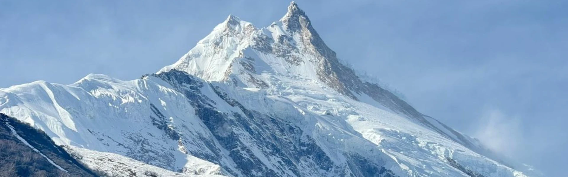
Standing at 8,163 metres above sea level, Mount Manaslu ranks as the eighth-highest peak in the world, a towering presence in the Mansiri Himal range of the west-central part of Nepal. Meanwhile, the mountain of the spirit, as its Sanskrit name translates, draws climbers and trekkers with a magnetic pull that combines raw natural grandeur, technical challenge, and profound cultural richness. Therefore, understanding Manaslu means looking beyond summit statistics to grasp its geology, history, environment, and the people who call its foothills home.
This guide serves adventure seekers, mountaineering enthusiasts, geographers, and cultural explorers who want depth rather than superficial travel inspiration. Furthermore, you'll find practical insights on Manaslu geography, climbing context, trekking routes, and environmental considerations that matter when you're planning meaningful engagement with this Himalayan peak. However, this isn't an expedition manual with permit logistics or step-by-step ascent protocols; it's a comprehensive resource for understanding the mountain itself.
Whether you're researching trekking in Nepal, comparing 8000-metre peaks, or simply curious about what makes Manaslu unique among the world's highest mountains, this guide from Nepal Everest Base Camp Trekking Company offers grounded knowledge from someone who knows these trails and valleys. Consequently, you'll walk away with clear awareness of what Manaslu represents geographically, historically, environmentally, and culturally.
2. Geography and Geology
2.1 Mount Manaslu Geographic Features of Manaslu
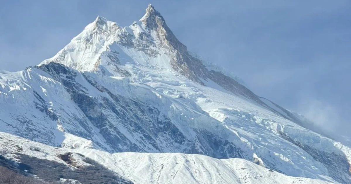
Manaslu mountain dominates the Gorkha district of Nepal, its summit rising sharply from deeply carved valleys that drain into the Budhi Gandaki river system. Moreover, the mountain forms the anchor point of the Mansiri Himal, a sub-range of the greater Himalayas that stretches roughly 50 kilometres east to west. Additionally, this mountain in Nepal stands as one of the most visually commanding peaks in the entire mountain range.
Key Geographic Features:
Summit elevation: 8,163 metres (26,781 feet)
Prominence: Approximately 3,092 metres, making it a standout peak even among giants
Glacial systems: North and northeast faces feed massive glaciers, including the Manaslu Glacier, which descends into alpine meadows
Ridge systems: Sharp arêtes connect satellite peaks, creating a complex topography of ice walls, hanging glaciers, and exposed rock
Valley context: The Budhi Gandaki valley curves around the mountain's western flank, offering trekking access through culturally rich villages
Additionally, the peak sits roughly 64 kilometres east of Mount Annapurna and 120 kilometres northwest of Mount Everest, positioning it within a densely packed zone of 8000-metre summits. Therefore, the region experiences intense weather patterns driven by monsoon systems and high-altitude jet streams. Furthermore, experienced mountain guides often note that Mt Manaslu offers unique challenges compared to other Himalayan giants.
2.2 Neighbouring Mountains and Landscape Context
Peak Name
Elevation (m)
Relationship to Manaslu
Himalchuli
7,893
Forms eastern boundary of Mansiri Himal, connected by technical ridge
Ngadi Chuli
7,871
Southwest satellite peak, also called Peak 29
Manaslu North
7,157
Northern subpeak, part of main massif
Naike Peak
6,211
Trekking peak visible from Manaslu Circuit route
Consequently, this clustering creates a dramatic skyline visible from villages like Samagaon and Samdo, where locals have lived for generations beneath these towering walls. However, Manaslu itself holds distinct visual dominance, its broad north face and steep summit pyramid unmistakable even from distances of 20 kilometres. Meanwhile, the Manaslu range provides spectacular views for anyone undertaking the Mount Manaslu trek through these culturally rich valleys.
2.3 Geological Structure and Formation
The Himalayas formed through continental collision, where the Indian tectonic plate continues driving northward into the Eurasian plate. Meanwhile, Manaslu represents crystalline rock thrust upward through this ongoing compression, primarily composed of metamorphic gneiss, schist, and granite intrusions. Thus, knowing this geological background makes it easier to comprehend why the 8th highest mountain is increasing by millimetres every year.
Geological Characteristics:
Rock types: Predominantly high-grade metamorphic rocks with igneous intrusions, shaped by extreme pressure and heat
Glaciation: Current glaciers cover roughly 45 square kilometres around the mountain, carving cirques, moraines, and U-shaped valleys
Tectonic activity: The region experiences seismic events; the 2015 Nepal earthquake triggered avalanches and altered glacier stability around Manaslu
Erosion patterns: Seasonal monsoons and glacial melt create dramatic erosion, particularly on south-facing slopes where water runoff intensifies weathering
Furthermore, ongoing uplift means the Himalayas continue rising by several millimetres annually, though erosion balances this growth. Therefore, the peak's current height represents a dynamic equilibrium between tectonic forces and weathering processes. Additionally, these geological forces make Manaslu one of the most fascinating subjects for anyone studying mountain climbing in the Himalayas.
2.4 Climate and Weather Patterns
Manaslu experiences typical Himalayan climate extremes, with conditions varying dramatically by season, altitude, and aspect. Moreover, weather patterns directly influence climbing windows, trekking safety, and ecosystem health across the Manaslu region. Consequently, any adventure in Nepal targeting this peak requires careful seasonal planning.
Season
Temperature (Base Camp)
Temperature (Summit)
Precipitation
Climbing Suitability
Winter (Dec–Feb)
-15°C to -5°C
-40°C to -25°C
Low snowfall
Extremely challenging, attempted by elite climbers only
Pre-monsoon (Mar–May)
0°C to 10°C
-30°C to -15°C
Moderate, increasing
Best climbing season, stable weather windows
Monsoon (Jun–Aug)
5°C to 15°C
-25°C to -10°C
Heavy rain/snow
Dangerous, avalanche risk high
Post-monsoon (Sep–Nov)
-5°C to 5°C
-35°C to -20°C
Low, stable
Second climbing season, colder but stable
Additionally, the mountain sits directly in the monsoon shadow zone, meaning it receives less precipitation than peaks further east like Everest. However, when storms do arrive, they intensify rapidly, particularly above 7,000 metres where jet stream winds can exceed 150 km/h. Therefore, planning a Manaslu climb requires understanding these weather patterns thoroughly.
3. Climbing History
3.1 First Ascents and Early Expeditions
The first successful ascent of Manaslu came on May 9, 1956, when Japanese climbers Toshio Imanishi and Gyalzen Norbu reached the summit. Nevertheless, this achievement followed years of diplomatic negotiation, as Nepal initially restricted access to many peaks following sacred mountain concerns and post-1950 political adjustments. Moreover, the spirits of the mountain held deep significance for local communities who initially resisted foreign expeditions.
Early Expedition Timeline:
1950:Nepal opens to foreign mountaineers, but Manaslu remains restricted
1952: Japanese team makes first reconnaissance, turned back by local opposition citing spiritual concerns
1953: Second Japanese attempt fails at approximately 7,750 metres due to weather and technical difficulties
1954: Third attempt reaches 7,900 metres before avalanche danger forces retreat
1956: Fourth Japanese expedition succeeds via northeast face route
Interestingly, the Japanese teams built strong relationships with local Gurung and Tibetan communities, establishing patterns of cultural respect that continue influencing Manaslu expeditions today. Therefore, the mountain'sclimbing history reflects not just technical achievement but evolving cross-cultural understanding. Furthermore, this history established Manaslu as a serious objective for international mountain climbing enthusiasts.
3.2 Notable Historic Climbs and Modern Records
Since 1956, Manaslu has seen steady climbing activity, though it remains less crowded than commercial giants like Everest. However, several ascents stand out for technical innovation, endurance, or historical significance. Meanwhile, the 8th tallest mountain continues attracting elite alpinists seeking to test their limits.
Significant Climbing Achievements:
1971: First women's ascent, though details remain disputed in historical records [Unverified specific names]
1983: First winter summit by Polish climbers Maciej Berbeka and Ryszard Gajewski, establishing Manaslu as a serious winter objective
1984: First solo ascent by Reinhold Messner, part of his quest to climb all fourteen 8000-metre peaks
2023: Speed ascent records continue falling as elite alpinists push human limits [Inference based on ongoing competitive climbing culture]
Moreover, Manaslu has become increasingly popular as a stepping stone for climbers preparing for Everest or other technical 8000-metre summits. Consequently, annual summit attempts have grown from fewer than 50 in the 1990s to over 200 in recent years. Additionally, climbing Mount Manaslu has become a recognised achievement in the international mountaineering community.
3.3 Mount Manaslu: Cultural and Symbolic Significance
Locally, Manaslu is known as "Kutang", though the Sanskrit name "Manaslu" (meaning mountain of the spirit) has gained international recognition. Meanwhile, the peak holds deep spiritual meaning for Buddhist and Bon communities in surrounding valleys, who traditionally view it as sacred territory inhabited by protective deities. Therefore, understanding that Manaslu is the eighth-highest peak in the world requires appreciating both its physical stature and cultural significance.
Cultural Names and Symbolism:
Mountain of the Spirit: Reflects Buddhist cosmology where high peaks serve as dwelling places for spiritual beings
"Killer Mountain in Nepal": Western mountaineers sometimes use this ominous nickname due to Manaslu deaths from avalanches and technical accidents
Kutang: Local Tibetan name, rarely used in international climbing literature
Furthermore, it is known as the Killer Mountain, and its reputation stems partly from objective hazards (particularly avalanche risk on standard routes) and partly from cultural misunderstanding of local spiritual warnings. However, when climbers approach the mountain with appropriate preparation and respect, fatality rates align with other 8000-metre peaks. Nevertheless, the 'killer mountain' in Nepal designation serves as a sobering reminder of the mountain's objective dangers, though it's not the killer mountain of the world as sometimes sensationalised in media.
4. Natural Environment of the Manaslu Conservation Area
4.1 Flora and Fauna
The Manaslu region supports remarkable biodiversity despite harsh high-altitude conditions. Additionally, elevation gradients from 1,400 metres in lower valleys to over 8,000 metres create distinct ecological zones, each with characteristic plant and animal communities. Moreover, this mountain of the world serves as a critical ecosystem corridor for countless species.
Nival zone (above 4,500m): Lichens, mosses, minimal vegetation
Notable Wildlife:
Species
Habitat
Conservation Status
Snow Leopard
Alpine/nival zones
Endangered
Himalayan Tahr
Rocky slopes, 3,000–5,000m
Near Threatened
Red Panda
Temperate forests
Endangered
Blue Sheep (Bharal)
Alpine meadows
Least Concern
Himalayan Monal (bird)
Forest edges
Least Concern
Moreover, the Manaslu Conservation Area provides critical habitat connectivity between protected areas, allowing species migration and genetic exchange. However, climate change and increasing human activity pose ongoing threats to ecosystem stability. Therefore, conservation efforts around this peak in Nepal remain essential for protecting biodiversity.
4.2 Manaslu Conservation Area
Established in 1998, the Manaslu Conservation Area covers 1,663 square kilometres, protecting ecosystems from subtropical forests to glacial environments. Furthermore, the Manaslu Conservation Area Project operates under community-based conservation principles, involving local villages in management decisions and benefit-sharing arrangements. Additionally, this conservation area plays a vital role in protecting the Manaslu mountain in Nepal and its surrounding ecosystems.
Key Conservation Features:
Protected status: Managed by National Trust for Nature Conservation (NTNC) rather than government department
Community involvement: Local committees participate in tourism management, wildlife monitoring, and resource allocation
Cultural preservation: Supports traditional practices like seasonal grazing while limiting environmental damage
Additionally, visitors require a Manaslu Conservation Area Permit alongside trekking permits, fees directly funding conservation programmes and community development. Therefore, responsible trekking contributes measurably to environmental protection and local livelihoods. Moreover, these conservation efforts ensure that the highest peak in the world among this sub-range remains protected for future generations.
4.3 Environmental Challenges
Despite conservation efforts, the Manaslu region faces mounting environmental pressures from climate change, tourism growth, and infrastructure development. Moreover, these challenges require coordinated responses involving local communities, Nepal government agencies, and international stakeholders. Consequently, sustainable practices become increasingly critical for preserving this mountain environment.
Waste management: Growing expedition and trek traffic generates solid waste, including oxygen bottles, fuel canisters, and human waste at high camps
Trail erosion: Heavy foot traffic degrades pathways, particularly during monsoon season
Fuelwood consumption: Lodge operations and local households create pressure on forest resources
Wildlife disturbance: Increased human presence disrupts animal behaviour and habitat use
Consequently, sustainable tourism initiatives focus on waste removal programs, alternative energy adoption (solar power for lodges), and trail maintenance systems. However, success depends on visitor compliance with Leave No Trace principles and willingness to support higher-cost sustainable operations. Therefore, anyone planning a Manaslu mountain expedition should prioritise environmental responsibility throughout their journey.
5. Climbing Routes and Challenges (Overview)
5.1 Mount Manaslu: Main and Secondary Routes
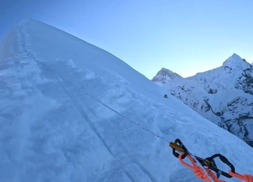
The standard route to climb Manaslu follows the northeast face, a moderately technical line that nevertheless demands respect for objective hazards and altitude challenges. Meanwhile, alternative routes exist for climbers seeking greater technical difficulty or aesthetic lines. Furthermore, understanding route options helps anyone considering a Manaslu climb make informed decisions about their approach.
Northeast Face (Standard Route):
Starting point:Manaslu Base Camp at approximately 4,800 metres
Route character: Snow and ice slopes, 40-50° maximum angle, crevasse navigation
Camp structure: Four camps established during ascent rotations
Summit day: Typically 12-16 hours from Camp 4 (7,400m) to summit and back
Alternative Routes:
Route Name
First Ascent
Technical Grade
Objective Hazards
Northwest Ridge
1983
TD+ (alpine grade)
Avalanche, rockfall, exposure
East Pinnacle
1996
ED (alpine grade)
Extreme technical difficulty, limited fixed ropes
South Face
Unclimbed
Projected ED+
Hanging glaciers, sustained vertical ice
Furthermore, most commercial expeditions stick to the standard northeast face, which offers reasonable safety margins when conditions align and teams maintain proper acclimatisation schedules. However, even this "normal route" demands mountaineering competence, high-altitude experience, and mental resilience. Additionally, Mount Manaslu is the eighth-highestpeak globally, yet it remains more accessible than ultra-technical 8000-metre summits like K2.
Mount Manaslu Range
5.2 Technical Challenges
Climbing Manaslu mountain presents a combination of physical, technical, and environmental challenges that distinguish it from lower peaks while remaining more accessible than ultra-technical objectives like K2. Moreover, understanding these challenges proves essential for anyone attempting this world's eighth-highest mountain. Therefore, proper preparation and realistic expectations become critical success factors.
Primary Hazards and Difficulties:
Crevasse fields: Particularly between Base Camp and Camp 1, requiring rope team travel and vigilance
Serac fall: Hanging glaciers on upper slopes of Manaslu occasionally release, creating objective danger zones
Altitude effects: Above 7,000 metres, cognitive function declines, decision-making suffers
Weather windows: Successful summit attempts depend on stable high-pressure systems, often lasting only 3-5 days
Additionally, the mountain sits in a geographic position that can receive weather systems from multiple directions, making forecasting more complex than for peaks in more sheltered positions. Therefore, expedition leaders must balance ambition with conservative weather assessment. Furthermore, working with experienced mountain guides significantly improves success rates and safety margins on the Manaslu peak.
5.3 High Camp System Overview
The camp structure on Manaslu follows standard Himalayan expedition practice, with progressively higher camps allowing acclimatisation and load carrying before summit attempts. Moreover, teams typically make multiple rotations to higher camps before committing to a summit push. Consequently, the full attempt to climb Manaslu spans several weeks, requiring patience and systematic preparation.
Camp System Details:
Base Camp (4,800m): Staging area, rest between rotations, medical support
Camp 1 (5,700m): First major acclimatisation point, typically 4-6 hours from Base Camp
Camp 2 (6,400m): Mid-mountain rest, critical for assessing weather and physical condition
Camp 3 (6,800m): Final acclimatisation rotation before summit attempt; some teams rest here
Camp 4 (7,400m): Final climb from camp to summit; most teams depart around midnight for dawn summit
Consequently, the full attempt to climb Manaslu spans several weeks, allowing the body to adapt to extreme altitude while minimising time spent in the "death zone" above 8,000 metres. Additionally, this camp system mirrors structures used on other 8000-metre peaks, though the specific locations vary based on terrain and route characteristics.
6. Trekking and Access
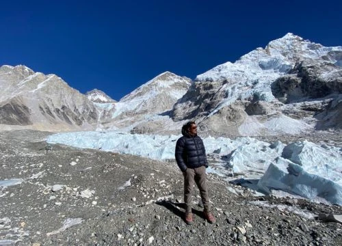
6.1 Trek to Manaslu Base Camp
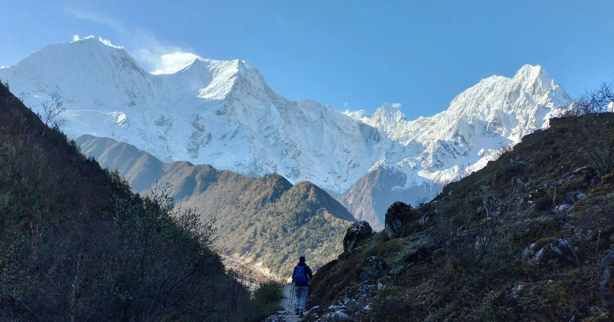
The approach to Manaslu Base Campwith Tsum valley trek ranks among Nepal's finest trekking routes, combining natural beauty, cultural immersion, and physical challenge. Furthermore, the trail follows the Budhi Gandaki valley, passing through villages that maintain traditional lifestyles largely unchanged by mass tourism. Moreover, this route offers experiences comparable to the famous Everest Base Camp trek but with fewer crowds and deeper cultural engagement.
Route Overview:
Starting point: Soti Khola or Machha Khola (depending on road access)
Total trekking distance: Approximately 60-70 kilometres one way
Duration: 8-10 days to Base Camp, 3-4 days return
Maximum elevation:Base Camp at 4,800 metres, though viewpoints may go higher
Difficulty: Moderate to challenging, sustained uphill sections, altitude considerations
Moreover, the trek requires both a Manaslu Restricted Area Permit and Manaslu Conservation Area Permit, reflecting the region's sensitivity regarding border security and conservation priorities. Therefore, independent trekking isn't permitted; visitors must travel with registered guides and organised groups. Additionally, this Mount Manaslu trek showcases the highest mountain in the world rankings from unique vantage points throughout the valley system.
6.2 Cultural Highlights Along the Trek
The trek in the Manaslu region offers extraordinary cultural depth, passing through villages where Gurung and Tibetan communities maintain traditional practices, including polyandry, seasonal migration, and Buddhist ritual calendars. Additionally, cultural interaction forms a core part of the trekking experience, often as memorable as landscape encounters. Therefore, this adventure in Nepal provides insights into mountain communities rarely experienced elsewhere.
Cultural Elements:
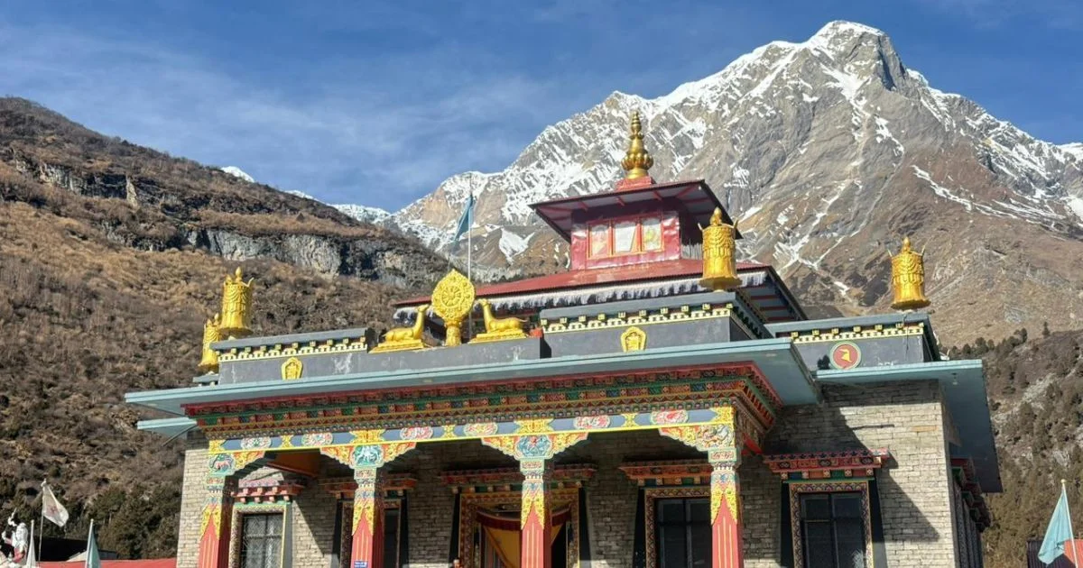
Monasteries: Pungyen Gompa, Ribung Gompa, and smaller shrines offer insight into Tibetan Buddhist practice
Mani walls: Carved stone prayer walls line trails, some extending hundreds of metres
Traditional architecture: Stone houses with wooden details and flat roofs designed for storage and drying crops
Local economy: Yak herding, potato cultivation, barley farming, increasingly supplemented by tourism income
Festivals: Lhosar (Tibetan New Year) celebrations if timing aligns, though most trekkers visit in autumn or spring
Furthermore, respectful cultural engagement enhances both visitor experience and community benefits, creating positive feedback loops when tourists demonstrate genuine interest and appropriate behaviour. However, photographers should always request permission, particularly inside monasteries or of individuals. Moreover, understanding local customs enriches the overall experience of approaching the summit of Manaslu region.
Buddhist Monasteries
6.3 Manaslu Circuit vs Direct Base Camp Access
The Manaslu Circuit Trek and direct Base Camp approach offer different experiences, though both showcase the mountain's magnificence and cultural context. Moreover, route choice depends on available time, physical conditioning, and personal priorities regarding scenery versus cultural immersion. Consequently, careful consideration of these options helps optimise your trekking experience.
Comparison:
Manaslu Circuit: Crosses Larkya La pass (5,160m), creates full loop returning via different valley, adds 3-5 days, showcases wider range of landscapes, including high alpine passes
Base Camp Direct: Retraces route back down Budhi Gandaki valley, focuses specifically on Manaslu itself, has a shorter overall duration, allows deeper engagement with fewer villages
Scenic Differences:
The circuit route provides 360-degree Himalayan panoramas from Larkya La, including views toward Annapurna range
The direct base camp route offers sustained proximity to Manaslu north face, which is better for photographers focusing on the mountain
Consequently, first-time visitors to the region of Nepal often choose the circuit for comprehensiveness, while those specifically interested in mountaineering context prefer the direct Base Camp approach with more time at higher elevations. Additionally, both routes provide exceptional opportunities to experience the landscape around Manaslu and its cultural richness.
7. Safety and Preparation (High-Level)
7.1 Altitude Considerations
Altitude sickness represents the primary health risk for anyone venturing into the Manaslu region, whether trekking to Base Camp or attempting the summit. Meanwhile, proper acclimatisation schedules and awareness of symptoms can prevent most serious incidents. Therefore, understanding altitude physiology becomes essential for safe travel in this high-elevation environment.
High Altitude Pulmonary Edema (HAPE): Fluid in lungs, life-threatening, requires immediate descent
High Altitude Cerebral Edema (HACE): Brain swelling, extremely dangerous, requires immediate descent and medical evacuation
Prevention Strategies:
Gradual ascent: No more than 500 metres of elevation gain per day above 3,000 metres
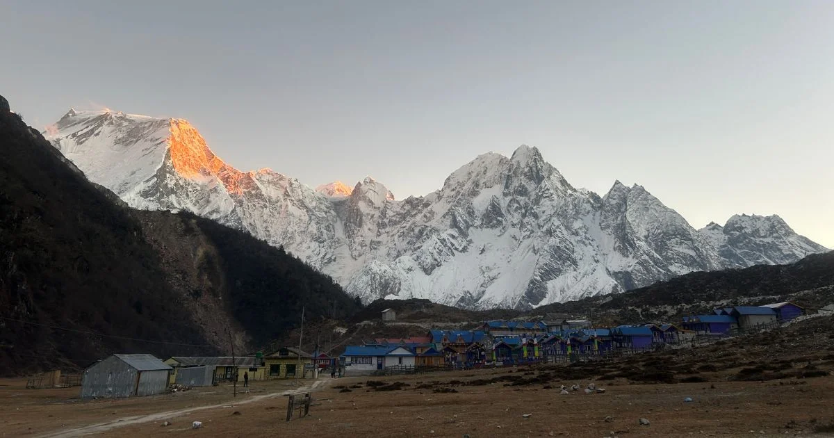
Acclimatisation days: Rest days at key elevations (Samagaon, Samdo)
Hydration: 3-4 litres water daily
Medication: Diamox (acetazolamide) under medical guidance
Monitoring: Daily symptom checks, oxygen saturation measurement if available
Furthermore, even experienced mountaineers must respect altitude; previous high-altitude success doesn't guarantee immunity on subsequent trips. Therefore, conservative ascent profiles and willingness to descend at early warning signs remain essential safety practices. Moreover, recognising that Manaslu sits among the highest peak ranks globally helps maintain appropriate caution regarding altitude effects.
7.2 Physical and Mental Preparation
Trekking to Manaslu Base Camp or attempting to climb the mountain demands comprehensive physical conditioning and mental resilience. Additionally, preparation & training should begin months before departure, building both cardiovascular fitness and specific strength. Therefore, systematic training programmes significantly improve success rates and overall experience quality.
Decision-making under stress: Recognising when to push versus when to retreat
Team dynamics: Patience, communication skills, flexibility with changing plans
Solitude comfort: Long days require mental self-sufficiency even in group settings
Moreover, the beauty of Manaslu and cultural richness provide motivational rewards, but success depends on foundations built during months of training, not inspiration alone. Consequently, anyone planning to climb this challenging peak should commit to systematic preparation well in advance of their departure date.
7.3 General Gear Essentials
Proper equipment significantly impacts safety, comfort, and success rates, whether trekking or climbing the mountain. Furthermore, gear choices should prioritise reliability and versatility over weight savings, particularly for items affecting survival in emergency situations. Additionally, coordinating with expedition operators ensures compatibility with group equipment and support systems.
Core Gear Categories:
Category
Essential Items
Notes
Clothing
Layering system, down jacket, waterproof shell, thermal base layers
First aid kit, water purification, emergency shelter
Customise for group size
Additionally, commercial expeditions typically provide group equipment (tents, ropes, cooking gear), but personal items remain an individual responsibility. Therefore, gear lists should be checked against expedition operator requirements and adjusted for specific route plans. Moreover, investing in quality equipment appropriate for the eighth-highest mountain in the world proves worthwhile for both safety and comfort throughout your journey.
8. Case Study: 2025 Autumn Season on Mount Manaslu
The 2025 autumn climbing season on Mount Manaslu attracted 378 climbers to Base Camp, making it one of the busiest years in the mountain's history. The season demonstrated both the achievements possible with proper preparation and the persistent risks on 8000-metre peaks.
Weather Windows and Summit Statistics
October 2025 brought stable conditions to the Mansiri Himal range. Three weather windows between October 15 and 31 produced remarkable results.
The second window (October 23-26) saw heaviest traffic with 156 attempts, creating 45-90 minute delays
Extended stable weather allowed climbers aged 19 to 68 to reach the summit
Speed ascent record: 9 hours 48 minutes Base Camp to summit
Safety and Environmental Impact
Commercial teams dominated with 75% participation, supported by 142 Sherpa and high-altitude workers. However, serious incidents occurred despite favourable conditions.
4 fatalities: 2 from altitude sickness, 2 from descent falls
7 helicopter evacuations for severe altitude illness and injuries
2.8 tonnes of waste removed from high camps, though 3 teams faced fines for violations
The 2019 season on the eighth-highest mountain in the world reinforced that improved forecasting and logistics have made Himalayan mountaineering more accessible, yet fundamental risks remain. Success requires conservative decision-making, proper acclimatisation, and willingness to retreat when conditions or physical state dictate.
9. Mount Manaslu: Final Insights
Mount Manaslu represents far more than statistics, elevation, technical difficulty, or climbing records. Instead, the mountain embodies complex intersections of geology, culture, environment, and human aspiration, a living landscape where natural forces and human communities have shaped each other for generations. Therefore, approaching Manaslu with genuine understanding means looking beyond the summit to grasp the entire system that makes this peak significant.
The eighth-highest peak in the world offers accessible yet serious mountaineering challenges, cultural immersion rarely found on more commercialised routes, and environmental lessons about climate change, conservation, and sustainable tourism. Moreover, whether you trek to Base Camp or attempt to climb Manaslu itself, the experience demands respect for altitude, weather, and the local communities whose knowledge and labour make safe passage possible. Consequently, responsible engagement with the mountain requires preparation, humility, and willingness to adjust plans when conditions dictate.
What makes Manaslu truly remarkable isn't one single quality but rather how geography, history, environment, and culture combine to create a Himalayan experience that feels both challenging and approachable, remote yet welcoming. The mountain stands as a testament to Earth's dynamic geology, human determination to explore vertical frontiers, and the resilience of communities living in extreme environments. All these elements converge on the slopes of Manaslu, offering lessons that extend far beyond mountaineering technique, and for anyone planning a Nepal Hiking Adventure, you can [Contact Us] to get expert guidance and start your journey into the heart of the Himalaya.
Mount Manaslu
10. Mount Manaslu: FAQs
How high is Mount Manaslu?
Mount Manaslu stands at 8,163 metres (26,781 feet) above sea level, making it the eighth-highest mountain in the world. Additionally, its prominence of approximately 3,092 metres ensures the peak stands out dramatically even among neighbouring Himalayan summits, creating the distinctive skyline visible from surrounding valleys.
Why is it called the "Killer Mountain"?
The nickname "killer mountain" stems from the mountain'savalanche history and objective hazards, particularly incidents involving multiple fatalities like the 2011 avalanche at Camp 3. However, this reputation reflects partly objective danger and partly inadequate preparation by some teams; Manaslu isn't statistically more dangerous than other 8000-metre peaks when climbed properly.
What makes Manaslu unique among 8000 m peaks?
Manaslu is the eighth-highest peak yet sees significantly fewer climbers than commercial giants like Everest, preserving a more authentic expedition atmosphere. Moreover, the mountain combines reasonable technical difficulty with genuine remoteness, cultural richness in approach valleys, and spectacular glacial scenery.
Can trekkers experience the mountain without climbing?
Absolutely, the trek to Manaslu Base Camp and Manaslu Circuit Trek provide extraordinary access to the mountain without requiring technical climbing skills. Furthermore, these routes pass through culturally rich Gurung and Tibetan villages, cross stunning high-altitude landscapes, and offer close-range views.
What is the best season to visit or climb?
The optimal seasons for trekking to Manaslu or climbing are pre-monsoon (late March through May) and post-monsoon (September through November). Meanwhile, pre-monsoon offers slightly warmer temperatures and spring wildflowers, but increasing afternoon clouds; post-monsoon provides clearer skies.
What wildlife and natural features can be seen?
The Manaslu Conservation Area supports remarkable biodiversity, including endangered snow leopards, red pandas, Himalayan tahr, and blue sheep across elevation zones from subtropical forests to alpine meadows. Additionally, the region showcases dramatic glacial features, including the Manaslu Glacier.
How many climbers reach the summit each year?
Annual summit numbers fluctuate based on weather conditions, permit availability, and global events, but recent years have seen approximately 150-250 climbersreach the summit during typical seasons [inference based on permit trends]. However, compared to Everest, which has more than 600 summit attempts per year, this is a much smaller number.
Blending digital strategy with mountain passion, I help adventurers find their way to the Himalayas online. With hands-on experience in Nepal’s trekking trails and a role at Nepal Everest Base Camp Trekking Co., Thamel, I combine SEO expertise with true trail insight.