The Himalayas hold secrets that few travellers witness. High above the teahouse trails and prayer flags, vast rivers of ice shape the landscape in ways most visitors never comprehend. Glaciers of Nepal cover approximately 5,300 km² across the nation's towering peaks, yet most trekkers pass beneath them without recognising their significance.
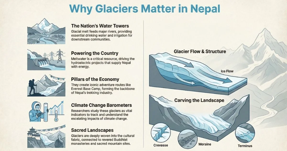
Meanwhile, glaciers in the Himalayas serve as the lifeblood of Nepal and beyond. When snowfall compresses into glacier ice, it flows downward and feeds rivers like the Dudh Kosi, Bhote Kosi, and Langtang Khola. Consequently, communities downstream depend entirely on glacier melt for drinking water, irrigation, and electricity generation.
In this comprehensive guide, I walk you through the hidden world of Himalayan glaciers in clear, systematic detail. You'll first learn how glacier ice forms and behaves across Himalayan valleys. Then, we'll move on to explore the major glaciers visible along popular trekking routes that draw adventurers from around the world.
At Nepal Everest Base Camp Co., we've witnessed these frozen landscapes firsthand, guiding hundreds of trekkers through glacier sections safely while documenting retreat patterns that reshape mountain ecosystems season after season. Finally, I'll explain the growing dangers posed by glacial lakes and the increasing risk of glacier lake outburst floods (GLOFs) that threaten the valleys and local communities below.
Understanding Himalayan Glaciers
How Glaciers Form and Move
Glacier formation begins with snow accumulation in high-altitude basins where temperatures remain permanently below freezing. Year after year, new snowfall compresses under its own weight, eventually transforming into dense, crystalline ice through a process that spans centuries. Subsequently, wind and gravity compress it, air pockets collapse, and ice crystals bond together. After hundreds of years of pressure, firn (intermediate ice) converts to hard glacier ice. Hence, every glacier you see today contains ice thousands of years old.
Why Glaciers Matter
Impact
Description
Water Supply
Feed major river basins across Nepal
Energy
Power hydroelectric projects nationwide
Trekking
Create iconic adventure routes (EBC, Langtang)
Science
Help researchers track climate change
Culture
Connect to Buddhist monasteries and spiritual sites
Glaciers aren't static formations; rather, they flow like extremely slow rivers driven by gravity and pressure. Therefore, the weight of accumulated ice above creates immense pressure, causing crystals to deform and flow downhill at rates ranging from meters to tens of meters per year. Glaciers also carve the valleys they move through, reshaping Himalayan terrain and influencing where new rivers emerge. This movement creates several dramatic features:
Feature
Description
Trek Visibility
Icefall
Cascading ice where glacier flows over steep terrain
Khumbu Icefall (EBC route)
Crevasse
Deep cracks in glacier surface from stress
Common on high-altitude glacier traverses
Serac
Unstable ice tower; hazard for climbers
Everest Southwest Face approach
Moraine
Rock debris carried by glacier
Ridge lines on glacier edges
Terminus
Where glacier ends and ice melts
Glacier lakes form here
Key Types of Glaciers Found in Nepal
The Himalayas host several distinct glacier types, each with unique characteristics shaped by elevation, terrain, and climate. Valley glaciers represent massive ice streams flowing downward through mountain valleys, carving distinctive U-shaped canyons over millennia. Examples include Khumbu Glacier, Langtang Glacier, and Ngozumpa Glacier. Consequently, valley glaciers represent the most accessible type for trekkers and researchers.
Additionally, debris covered glaciers hide beneath thick layers of rock and sediment. Examples include Imja Glacier and portions of Ngozumpa Glacier. The debris layer insulates the ice beneath, paradoxically slowing glacier melting compared to clean glacier surfaces. Therefore, debris covered glaciers often appear black or grey rather than pristine white, deceiving travellers who underestimate their glacial nature.
Factors Influencing Glacier Health
Glacier survival depends on a delicate balance between accumulation at high elevations and melting at lower elevations. Specifically, rising air temperature in Nepal during 1976–2015 increased at 0.045°C per year, directly destabilising glacier systems across the region of Nepal. Moreover, change in Nepal includes shifting precipitation patterns that reduce snowfall effectiveness, contributing to mass loss of glaciers nationwide.
Major List of Glaciers of Nepal
S.N.
Glacier Name
Connected Mountain / Region
Province
Approx. Size / Length
Notable Features
1
Ngozumpa Glacier
Cho Oyu, Everest region
Koshi
~79 sq km
Largest in Nepal; supraglacial lakes; debris-covered; retreating due to climate change
2
Langtang Glacier
Langtang Valley
Bagmati
~18 km long
Valley glacier; subject to retreat; Langtang National Park
Includes Khumbu Icefall; major Everest climbing route
4
Barun Glacier
Makalu, Baruntse
Koshi
~14 km long
Remote, pristine valley glacier; feeds Barun River
5
Hunku Glacier
Baruntse
Koshi
~7–8 km
Scenic trekking glacier; base for Baruntse climbs
6
Makalu Glacier
Makalu Peak
Koshi
~6–7 km
Feeds Barun River; remote high-altitude glacier
7
Imja Glacier
Island Peak, Lhotse Shar
Koshi
~5–6 km
Forms Imja Tsho; studied for glacial lake outburst floods (GLOFs)
8
Ambulapcha Glacier
Cho Polu, Solukhumbu
Koshi
~4–5 km
Part of Imja system; forms Ambulapcha Tsho
9
Lhotse Shar Glacier
Lhotse region
Koshi
~4 km
Part of Imja Glacier system; contributes to glacial lakes
10
Nuptse Glacier
Nuptse Peak
Koshi
~3–4 km
Connects to Khumbu Glacier system; important for climbers
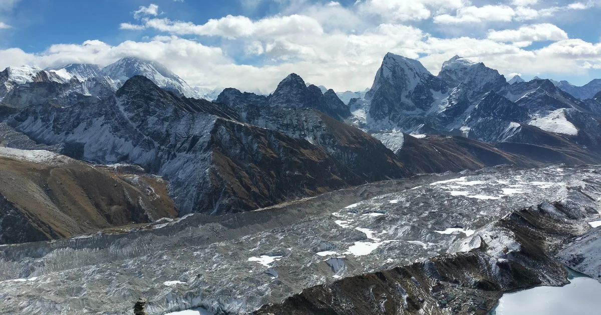
Langtang Lirung and Langtang Glacier view from Kyanjin ri
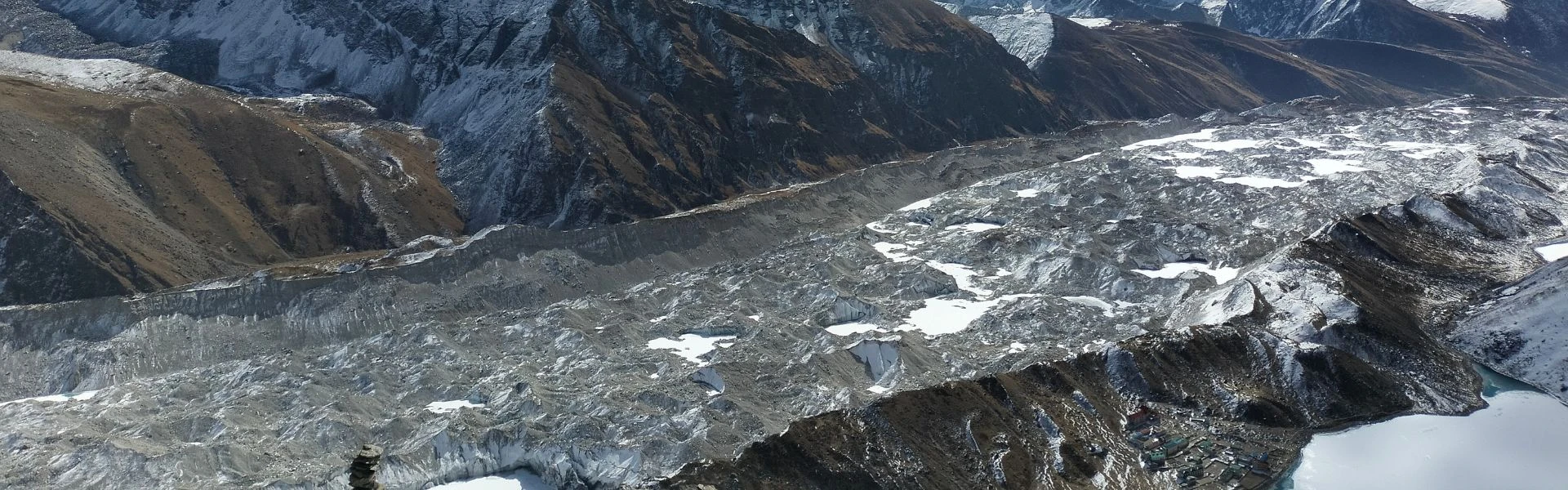
Ngozumpa Glacier – Nepal's Largest Ice Body
The largest glacier of Nepal and among the top 5 glaciers in the entire Himalayas, Ngozumpa Glacier sprawls across 28.2 km² in the Khumbu region. Furthermore, this mighty ice mass rises from approximately 5,000 metres to 6,000 metres in elevation, flowing majestically from the slopes of Cho Oyu and surrounding peaks. Consequently, Ngozumpa Glacier feeds the Dudh Kosi River, one of Nepal's most vital water sources, supporting millions downstream.
Key Characteristics:
Elevation Range: 5,000–6,000 meters
Length: ~20 km from source to terminus (though not the longest glacier in the Himalayas)
Width: Up to 1.5 km in places
Key Landmark:Gokyo Lakes in the Nepal Himalaya form at glacier terminus
Accessibility: Gokyo trek passes alongside
The glacier displays dramatic debris cover along lower sections, with Gokyo Lakes - a series of stunning glacier lakes (up to 5 lakes visible) - marking where the glacier retreats. Therefore, trekkers on the Gokyo trek witness firsthand how glacier retreat creates new glaciers and glacial lakes in the Nepal Himalayas. Moreover, the glacier's mass balance has deteriorated significantly; glacier area loss accelerates annually at alarming rates.
Field Observation: Ngozumpa Terminus (April 2024) Standing at the terminus of Ngozumpa Glacier, I witnessed the chain of Gokyo Lakes form where ice once dominated. The subtle cracking of ice and glacial meltwater flowing into turquoise lakes created a sense of both awe and fragility.
The temperature at 4,790 m registered -2°C at dawn, yet by afternoon the surface meltwater increased noticeably. Visibility extended across the entire lake chain, revealing how dramatically the glacier has retreated over recent decades. The quiet sound of trickling water beneath moraine deposits served as a constant reminder that these landscapes transform daily.
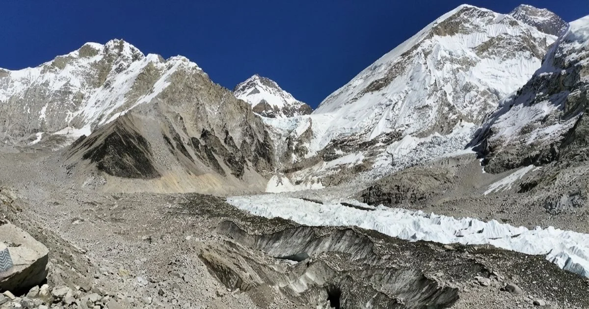
Khumbu Glacier and the Legendary Icefall
Khumbu Glacier feeds the famous Khumbu Icefall, one of mountaineering's most treacherous passages. This glacier descends from the Everest South Col region toward Everest Base Camp (EBC), creating what many consider the world's most challenging ice route. Additionally, Khumbu Glacier plays a critical role in mountaineering logistics; therefore, understanding its dynamics proves essential for expedition safety.
The Khumbu icefall forms where Khumbu glacier flows over steep terrain, dropping approximately 600 metres vertically. Subsequently, this icefall comprises unstable ice towers (seracs) and deep crevasses that shift constantly. Furthermore, glacier movement causes the icefall to shift several metres annually, requiring rope routes to be re-established each climbing season.
Scientific Significance:
Khumbu Glacier is the world's highest: glacier reaches elevations above 7,500 meters on Everest's slopes
Khumbu glacier is considered the world's most photographed glacier icefall
Glacier retreat here has exposed previously inaccessible archaeological sites
Personal Experience: Crossing Khumbu Glacier (October 2023) Crossing sections of Khumbu Glacier with our trekking group, I observed shifting seracs and deep crevasses underfoot. The sound of cracking ice echoes faintly, reminding trekkers of the glacier's raw, dynamic power. As guides with Nepal Everest Base Camp Co., we've escorted trekkers through glacier sections safely, emphasising acclimatisation, rope techniques, and real-time risk assessment.
One client experienced a near-miss on a slippery, melting ice patch that highlighted the importance of vigilance and proper gear. We always monitor unstable seracs or glacial lakes, particularly after warm days, and never underestimate the effects of meltwater on moraine stability.
Infographics: Glacier maters in Nepal
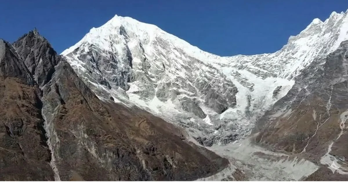
Langtang Valley: The Valley of Glaciers
Langtang Valley contains the valley of glaciers, a spectacular concentration of ice fields accessible via the popular Langtang trek. Specifically, this region showcases multiple fascinating glaciers within a compact geographic area, making it one of the most significant glaciers in the Langtang region. For trekkers, exploring the valley of glaciers means walking through one of Nepal's most visually dramatic glacier basins.
Langtang Glacier, the largest glacier in Langtang valley, spans approximately 14 km² and dominates the valley's western slopes with dramatic ice formations. Furthermore, Langtang Lirung (7,227 m peak) anchors this massive ice system. The glacier supplies the Langtang Khola River, supporting downstream communities throughout the year. Consequently, glacier retreat threatens water security for villages like Kyanjin Gompa and numerous settlements below. Moreover, impacts on glaciers and glacial systems here directly affect local livelihoods, agriculture, and traditional ways of life.
Case Study: Langtang Valley 2015 Floods The devastating avalanche and GLOF event triggered by the 2015 Gorkha earthquake demonstrated the vulnerability of communities living near glacial systems. Approximately 250 people perished when ice and debris cascaded through Langtang Valley, burying the village of Langtang beneath metres of rubble.
This tragedy underscored the importance of glacial lake monitoring and early warning systems. Today, reconstruction efforts incorporate GLOF risk assessments, and our treks include education about recognising hazard signs and evacuation routes.
Imja, Barun, and Eastern Systems
Imja Glacier stands as a prominent debris-covered glacier in the Khumbu region. Significantly, Imja Glacier has retreated dramatically since the 1960s, creating the rapidly expanding Imja Lake (one of the largest glacial lakes in the Nepal Himalayas). This glacier exemplifies how glacier retreat transforms landscapes and creates new hazards. Moreover, glacier mass loss here accelerated sharply since 2010, with surface lowering exceeding 100 metres in lower sections.
Located in the remote Everest area near the Barun Valley in eastern Nepal, Barun Glacier remains less visited yet geologically significant for researchers. The glacier feeds the Barun River, contributing substantially to the Koshi River basin water system. Additionally, this glacier demonstrates extreme glacier thinning patterns due to accelerating climate impacts. These glaciers in the Everest area provide critical insights into regional glacier change patterns.
Case Study: Imja Lake ExpansionImja Lake has expanded from a small pond measuring 0.12 km² in 1960 to 1.5 km² by 2023, representing a twelve-fold increase in surface area. The lake now holds approximately 78 million cubic metres of water behind an unstable moraine dam.
Risk assessments classify Imja Lake as one of Nepal's most dangerous glacial lakes, prompting the installation of early warning systems and dam reinforcement projects. During our treks to Island Peak base camp, we brief clients on evacuation procedures and monitor lake conditions as part of our safety protocols.
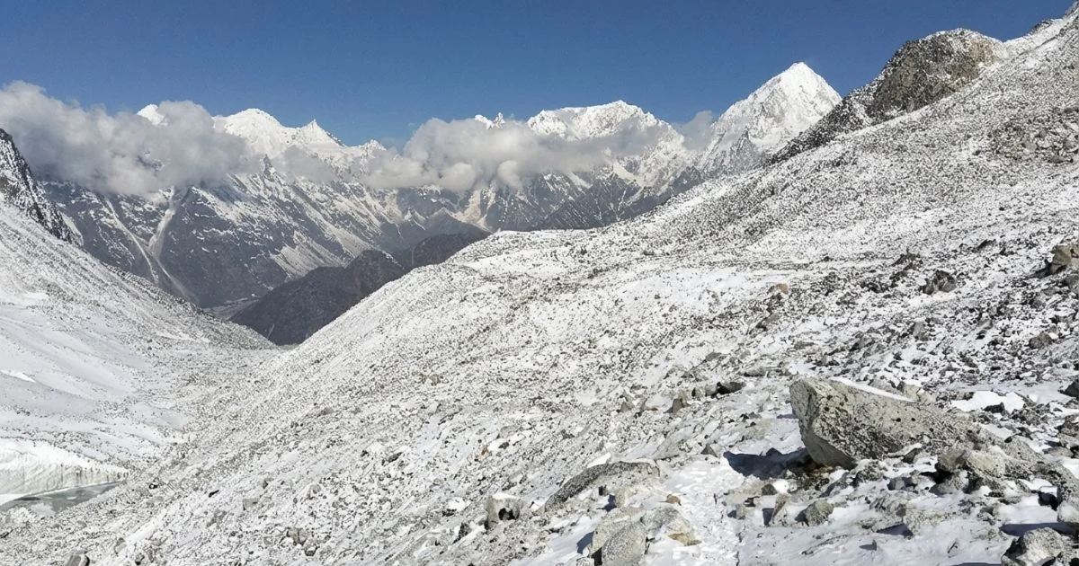
Rocky path and mountain view in glacier areas
Regional Distribution: Koshi to Gandaki
The Koshi region encompasses Nepal's most iconic glacier territory, hosting world-famous formations including Ngozumpa Glacier (28.2 km²), Khumbu Glacier (~6.5 km²), and Imja Glacier (~6.2 km²). The Dudh Kosi River emerges from Ngozumpa Glacier, subsequently flowing through the Khumbu region with tributaries joining downstream. Therefore, the Koshi river basin relies heavily on glacier melt during dry seasons when monsoon rains cease.
In contrast, the Gandaki region encompasses western Nepal's glacier systems, spreading ice melt across diverse tributaries. Major glaciers include Hunku Glacier, Makalu Glacier, Annapurna South Glacier, and the Dhaulagiri Glacier complex. Meanwhile, the Karnali River Basin in far western Nepal contains additional small glaciers that feed critical water systems. Nepal also maintains several national parks to glacier connections, protecting these critical ice reserves through conservation initiatives.
Other Notable List of Glaciers of Nepal (Smaller / Lesser-Known, Largest to Smallest)
S.N.
Glacier Name
Connected Mountain / Region
Province
Approx. Size / Length
Notable Features
11
Ngozumpa North Glacier
Cho Oyu region
Koshi
~3 km
Branch of Ngozumpa; high-altitude, less explored
12
Nangpai Gosum Glacier
Nangpai Gosum Peaks
Koshi
~2–3 km
Hidden glacier; hydrological importance; Nangpai Gosum glacier at least 2 km long along the borders of China and Nepal
13
Chamlang Glacier
Chamlang Peak
Koshi
~2–3 km
Remote, high-altitude glacier
14
Kangtega Glacier
Kangtega Peak
Koshi
~2–3 km
Scenic; contributes to Dudh Kosi river system
15
Mera Glacier
Mera Peak
Koshi
~2 km
Small glaciers; base for Mera Peak climb
16
Nupchu Glacier
Everest region
Koshi
~2 km
Less frequented high-altitude glacier; glacier lies close to major trekking routes
17
Pokalde Glacier
Pokalde Peak
Koshi
<2 km
Trekking glacier near Everest region; glacier is one of the most accessible
18
Pangboche Glacier
Pangboche village
Koshi
<2 km
Local hydrology; small valley glacier
19
Yamatari Glacier
Koshi Himalayas
Koshi
~1–2 km
Minor glacier; important for local rivers
20
Cho Polu Glacier
Cho Polu Peak
Koshi
~1–2 km
Feeds Ambulapcha system
Climate Change and Glacier Retreat
Signs and Data on Glacier Retreat
Glacier recession across Nepal represents one of Asia's most dramatic and measurable climate signals. Therefore, understanding retreat patterns illuminates the broader environmental crisis affecting mountain regions globally. Research on changes of glaciers revealed through monitoring programmes demonstrates the severity of ongoing glacier change.
Retreat Quantification:
1992–2015 Period: Nepal's glaciers lost approximately 24% of total glacier area
Annual Retreat Rate: Approximately 0.24 km² per year (rate accelerating)
Temperature Rise: Maximum air temperature in Nepal during 1976–2015 increased at 0.045°C per year
Mass Loss:Mass loss of glaciers now exceeds accumulation by significant margins across all regions
Glacier-Specific Retreats:
Ngozumpa Glacier: Lost approximately 18% of glacier area since 1992
Yala Glacier (near Langtang): Yala glacier lost approximately 40% of ice volume since 1990
Langtang Glacier: Showed 22% glacier area loss between 2000 and 2020
Research on Yala and Rikha Samba glaciers confirms these trends extend across northeastern Nepal and western regions alike. Furthermore, recent satellite data reveals that approximately 90% of Nepal's glaciers are retreating, making Nepal one of Asia's most severely affected glacier regions. Studies on mass balances of debris-free glaciers have provided important baseline data, while balances of debris-free glaciers observed through field measurements confirm accelerating trends.
Additionally, glaciers observed between the southern slopes and northern aspects show varying retreat rates. Research utilising satellite imagery shows glaciers revealed by multitemporal digital analysis demonstrate consistent negative mass balance. Recent studies tracking glacier mass balances from 2000 onwards reveal patterns consistent with global glacier mass loss trends documented worldwide.
Impact of Climate Change on Glacier Systems
The impact of climate change manifests through multiple interconnected drivers accelerating glacier demise across Nepal Himalaya. Rising degrees celsius on Asia's glaciers directly reflect greenhouse gas accumulation in the atmosphere. Additionally, warming is amplified at high elevations; hence, glacier zones experience temperature increases 2–3 times global averages.
Moreover, changing monsoon patterns disrupt traditional accumulation cycles. Historically predictable seasonal peaks now arrive erratically, reducing snowfall on glaciers and compromising the delicate balance between accumulation and ablation. The number of glaciers experiencing negative mass balance continues increasing annually, threatening long-term water security across South Asia.
Khumbu Glacier and gokyo lake view from Gokyo ri
Glacial Lakes and GLOF Threats
Formation and Expansion of Glacial Lakes
As glaciers retreat, they leave behind depressions filled with glacier melt, creating potentially hazardous water bodies. Consequently, glaciers and glacial lakes expand annually as temperatures continue rising. Understanding glacial lake formation proves essential for predicting hazards and protecting downstream communities.
Notable Glacial Lakes:
Gokyo Lakes (Chain of 5): Formed from Ngozumpa Glacier retreat (1960s–present)
Imja Lake: Rapid expansion from Imja Glacier since 1960s (High threat level)
Chame Lake: Recent formation from Langtang Glacier activity
Dudh Pokhari: Pre-existing lake, now expanding due to accelerated melt
Critical statistics reveal that glacial lakes in Nepal increased from 217 (1960s) to 2,500+ (2023). Furthermore, approximately 25 glacial lakes now pose immediate GLOF risks to communities downstream.
Field Observation: Ngozumpa Lake Chain Formation During our April 2024 expedition to the Gokyo Lakes, we documented five distinct lakes formed at the Ngozumpa terminus. Temperature readings showed significant diurnal fluctuation: -5°C at night rising to +8°C during midday sun exposure.
This thermal cycle accelerates melting, creating visible changes in lake levels even within a single trekking season. We observed fresh moraine deposits along lake edges, indicating ongoing glacier recession. The tranquil beauty of these turquoise waters belies the dramatic transformation occurring beneath the surface.
Understanding GLOF Events
A glacier lake outburst flood (GLOF) occurs when a moraine dam fails catastrophically, releasing devastating floods. Subsequently, billions of gallons of water rush downslope at speeds exceeding 50 km/hour, destroying everything in their path. Understanding GLOF events in Nepal proves crucial for community safety and infrastructure planning.
GLOF Mechanisms:
Moraine Dam Failure: Glacier-deposited moraines contain unstable sediment; rising lake levels or earthquakes trigger sudden collapse
Seepage Erosion: Water percolates through moraine, gradually weakening its structure until catastrophic breach occurs
Historical GLOF events in Nepal demonstrate the destructive potential of these disasters. Therefore, monitoring systems now track high-risk water bodies continuously to provide early warning to vulnerable communities.
Glaciers and Nepal's River Systems
Glacier melt serves as the lifeblood of Nepal's river systems, sustaining millions of people across South Asia. When temperatures rise seasonally or permanently, ice converts to water through complex processes. Subsequently, this meltwater carves channels through glacier surfaces and flows beneath ice, exiting at glacier termini in dramatic fashion.
Primary Rivers Fed by Glaciers:
Dudh Kosi River: Originates from Ngozumpa Glacier, flows through the Khumbu region
Langtang Khola River: Fed by Langtang Glacier, supports the valley of glaciers communities
Barun River: Sourced from Barun Glacier, contributes to Koshi river basin
During peak melt season (June–September), glacier-fed rivers account for 60–80% of total discharge. Therefore, understanding glacier area and volume changes proves essential for water resource planning. Local communities from high mountain villages to lowland agricultural zones depend critically on consistent glacier melt throughout dry seasons when monsoon rains cease.
Visiting Nepal's Glaciers Responsibly
Best Trekking Routes and Seasons
Seasonal patterns dramatically affect glacier visibility, safety, and overall trekking experience. Spring (March–May) offers clear skies and stable weather, creating ideal conditions for glacier viewing. Meanwhile, Autumn (September–November) provides the clearest skies of the year with excellent glacier visibility across all regions.
Popular Trekking Routes:
Gokyo Lakes Trek: Showcases Ngozumpa Glacier and glaciers and glacial lakes systems (10-12 days)
Everest Base Camp Trek: Views Khumbu Glacier and icefall from safe distance (12-14 days)
Langtang Valley Trek: Accesses the valley of glaciers and multiple ice fields (7-10 days)
Island Peak Climb: Involves traversing glacier systems with technical equipment (16-18 days)
Essential Safety and Permits
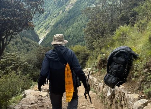
Glacier trekking demands specialised knowledge and proper equipment for safe exploration. Trekkers must obtain mandatory TIMS cards and national park permits before entering protected areas. Additionally, hiring certified guides with glacier experience remains essential for safety.
Required Permits:
TIMS Card: NPR 3,000
Sagarmatha National Park: NPR 3,000
Langtang National Park: NPR 3,000
Makalu-Barun National Park: NPR 3,000
Note: Permit fees may vary depending on the trekking region and recent updates from local authorities.
Critical Safety Measures:
Plan adequate acclimatization with rest days
Turn back immediately if storms approach
Always rope up when crossing glacier systems
Recognize altitude sickness symptoms and descend if needed
Avoid technical passages without professional mountaineering experience
Safety Lesson from the Field: The feeling near or above a glacier combines awe, reverence, and humility - a calm awareness of the centuries of ice beneath your feet, alongside a recognition of nature's scale and unpredictability.
As guides with Nepal Everest Base Camp Co., we've learnt to read subtle signs: unusual cracking sounds indicating serac instability, accelerated meltwater flow suggesting warm weather impacts, and fresh crevasse formations requiring route adjustments. These observations, accumulated over hundreds of successful expeditions, inform our safety protocols and distinguish experienced guides from casual operators.
Sustainable and Ethical Practices
Glacier visitors bear significant responsibility for environmental preservation and community support. Therefore, following Leave No Trace principles protects these fragile environments. Pack out all waste, avoid disturbing glacier surfaces, and use biodegradable products responsibly.
Furthermore, hiring local Nepal based guides and porters supports mountain economies directly. Stay in family-run lodges, purchase supplies from local vendors, and respect cultural traditions throughout your journey. By visiting glaciers, trekkers become ambassadors for climate action on a global scale.
Future Outlook and Preservation
Scientific models predict increasingly dire scenarios for glaciers in the Himalayas unless dramatic emissions reductions occur. By 2050, conservative estimates suggest 50–70% of glacier area across Nepal will disappear completely. Glaciers below 5,000 metres will largely vanish from the landscape, while highest glacier systems (above 6,500 m) will persist but become significantly diminished.
Research Initiatives:
High Mountain Asia Glacier Mass Balances tracking programs
Benchmark Glaciers Program with standardized monitoring networks
University of Tribhuvan collaborations on comprehensive monitoring
Annual field expeditions measuring glacier mass balance and surface velocity
Nepal must continue investing heavily in glacier research, comprehensive monitoring infrastructure, and community adaptation programmes to mitigate inevitable impacts. Meanwhile, travellers can advocate powerfully for climate policy, support renewable energy initiatives, and inspire others through compelling stories from glacier experiences. Your trek to Nepal's glaciers today becomes a pilgrimage to witness Earth's vulnerability and resilience simultaneously unfolding.
Nepal's Glaciers: Where Nature's Power Meets Human Destiny
Glaciers of Nepal represent frozen archives of Earth's climate history, storing centuries of atmospheric data within their ice. These massive glaciers and glacial lakes regulate water flow across the Koshi river basin, Bagmati basin, and Gandaki basin, sustaining millions downstream. Moreover, iconic formations like Ngozumpa Glacier and Langtang Glacier anchor the trekking routes that have shaped global adventure culture, making them essential for both ecological balance and economic survival.
Glacier recession accelerates at alarming rates, transforming glacier area and volume measurements year after year. Consequently, glaciers in the Himalayas now face unprecedented threats from atmospheric warming, with glacial lake outburst flood risks multiplying across vulnerable regions. Additionally, communities throughout northeastern Nepal watch helplessly as their ancient water sources diminish, threatening traditional livelihoods maintained for generations.
Visitors bear profound responsibility for these frozen landscapes, carrying stories that spark climate action worldwide. Furthermore, supporting national parks to glaciers conservation initiatives ensures adequate resources reach critical protection zones. Nepal Everest Base Camp Co. specialises in responsible glacier treks that combine adventure with environmental stewardship, guiding travellers through these remarkable landscapes while minimising ecological impact - contact us to plan your journey witnessing Earth's fragility and remarkable resilience firsthand.
Glacier of Nepal at EBC
Glaciers of Nepal: FAQs
Which Is the Largest Glacier in Nepal?
Ngozumpa Glacier, spanning 28.2 km² in the Khumbu region, stands as Nepal's largest glacier and ranks among the top five largest in the entire Himalayan range. This massive ice field feeds the vital Dudh Kosi River and anchors the iconic Gokyo Lakes trek. Consequently, it remains both scientifically significant for climate research and central to regional water systems supporting millions downstream.
How Many Glaciers Exist Across Nepal?
Nepal contains 3,808+ glaciers distributed across three major river basins: the Koshi river basin (1,140 glaciers, ~1,600 km²), the Bagmati basin (680 glaciers, ~900 km²), and the Gandaki basin (990 glaciers, ~1,300 km²). These glaciers in the Himalayas span from east Nepal to central Nepal to western regions, with highest concentrations near towering peaks. However, the number of glaciers continuously decreases due to climate warming.
Why Are Nepal's Glaciers Retreating So Rapidly?
Nepal's glaciers retreat due to rising temperatures (0.045°C per year during 1976–2015) combined with changing monsoon patterns that reduce critical snowfall accumulation. Specifically, degrees celsius on Asia's glaciers have increased 1.5°C above pre-industrial levels, causing dramatic mass loss of glaciers across Nepal's Himalayan systems. Consequently, approximately 90% of Nepal's glaciers now retreat annually at measurable rates, demonstrating the severe impact of climate change on Himalayan ice reserves.
What Risks Do Glacial Lakes Pose?
Glacier lake outburst floods (GLOF) occur when unstable moraine dams fail catastrophically, releasing billions of gallons of water downslope at devastating speeds exceeding 50 km/hour. For instance, Imja Lake, expanding dramatically from a small pond to 1.5 km² since 1960, poses high GLOF risks to downstream villages like Dingboche. Therefore, glacier and glacial lakes monitoring system now track 25+ high-risk water bodies across Nepal to prevent catastrophic disasters.
Can Trekkers Visit Glaciers Safely?
Yes, trekkers can safely visit many glaciers in Nepal by following proper safety protocols consistently. Hire certified guides with glacier experience, obtain mandatory TIMS and national park permits, and choose appropriate seasons (spring/autumn strongly preferred). Popular safe options include the Gokyo Lakes trek (Ngozumpa Glacier views), Langtang trek (the valley of glaciers approaches), and Everest Base Camp trek (safe viewpoint of Khumbu icefall from 5,486 m elevation). Additionally, avoid technical glacier traversals without professional mountaineering training and equipment.
Blending digital strategy with mountain passion, I help adventurers find their way to the Himalayas online. With hands-on experience in Nepal’s trekking trails and a role at Nepal Everest Base Camp Trekking Co., Thamel, I combine SEO expertise with true trail insight.