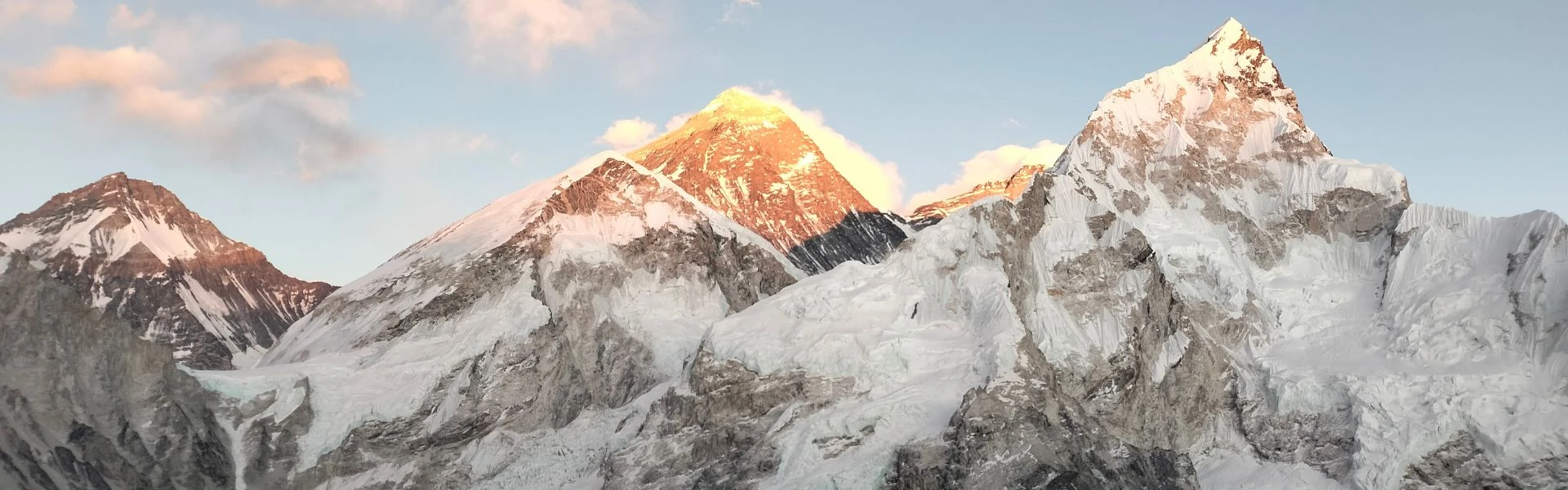
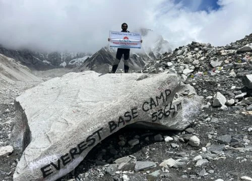
The Everest region sits in the north-east of Nepal, tucked into the greater Himalayas along the border where China and Nepal meet. These facts about the Everest region begin with its setting: the Khumbu District, a high-altitude area shaped by deep valleys, ancient glaciers, and peaks that rise well above 6,000 meters. Mount Everest stands at the centre of it all, pulling climbers, trekkers, and researchers from every corner of the world.
The landscape here is unlike anywhere else on earth. The mountain range presses close on all sides, with trails winding through rhododendron forests at lower elevations before giving way to bare rock and ice higher up. Villages cling to the hillsides, monasteries mark the ridgelines, and the air gets thinner with every upward step. For anyone planning a serious Himalayan journey, understanding the geography, history, and logistics of this area before setting out makes a real difference.
This guide covers the Everest region in a structured way, moving from Mount Everest itself through geography, access, culture, and cost with Nepal Everest Base Camp Co. It also explores some of the most mind-blowing aspects of the mountain that go well beyond the summit. Whether your goal is Everest Base Camp or something further afield, each section builds on the last to give you a clear picture of what this region involves, what it demands, and what makes it one of the most extraordinary places on the planet to visit.
2. Mount Everest: Essential Facts
2.1 Different Names of Mount Everest
Mount Everest carries four names, each rooted in a different tradition. In Nepal, it is called Sagarmatha, which translates roughly as "Goddess of the Sky". In Tibet, the mountain is known as Chomolungma, a name that means "Goddess Mother of the World." In the Limbu tradition, it is referred to as Deeudhunga, meaning "holy mountain". Before receiving its official Western name, British surveyors recorded it simply as Peak XV. All these names predate or accompanied the mountain's formal recognition by the outside world.
The English name honors Sir George Everest, who led the Great Trigonometric Survey of India during the nineteenth century. His successor, Andrew Waugh, proposed naming the tallest mountain after him in 1865, though Sir George Everest himself objected to the choice. The name stuck regardless.
Name
Language / Origin
Meaning
Sagarmatha
Nepali
Goddess of the Sky
Chomolungma
Tibetan
Goddess Mother of the World
Everest
English (survey origin)
Named after Sir George Everest
2.2 Height, Border, and Location
The official height of Mount Everest is 8,848.86 meters above sea level, confirmed by a joint survey conducted by China and Nepal in 2020. This figure updated the previous widely cited measurement of 8,848 meters and settled a long-running dispute over the elevation of Mount Everest. So, Mount Everest is the tallest landmass on earth when measured from sea level, making it both the world's highest mountain and the world's tallest mountain by that standard. It is also recognised as the highest mountain in the world by every major geographical authority.
Everest is on the border between Nepal and the Tibet Autonomous Region of China. The southern slopes of Mount Everest lie in Nepal, while its northern slopes extend into the Tibet Autonomous Region of China. This boundary shapes everything from climbingpermits to approach routes, and it explains why Mount Everest has two very different base camps on opposite sides of the mountain.
Coordinates: 27.9881° N, 86.9250° E
Country border: Nepal and Tibet (China)
Official height: 8,848.86 meters above sea level
Mountain range: Mahalangur Himal, part of the Himalayas
Nearest major city: Kathmandu, Nepal
2.3 First Ascent and Historical Milestones
Mount Everest was first summited on May 29, 1953, by Edmund Hillary of New Zealand and Tenzing Norgay, a Tibetan-born Sherpa from the Khumbu region. They reached the summit of Mount Everest as part of a British expedition led by Colonel John Hunt via the South-East Ridge.
Before 1953, multiple expeditions had attempted the summit without success. George Mallory and Andrew Irvine disappeared near the top of Mount Everest in 1924, and their fate remains one of the great unsolved questions in mountaineering. The history of Everest includes decades of attempts, setbacks, and hard-won lessons about altitude, weather, and the limits of the human body.
First ascent: 29 May 1953
Climbers: Edmund Hillary and Tenzing Norgay
Route: South-East Ridge (Nepal side)
Expedition leader: Colonel John Hunt
Nation: British expedition, Commonwealth climbers
Since 1953, more than 6,000 people have summited Mount Everest. Notable milestones include the first woman to summit Everest (Junko Tabei, 1975); the first ascent of Everest without supplemental oxygen (Reinhold Messner and Peter Habeler, 1978); and more recent records set on speed, age, and consecutive seasons.
3. Geography and Natural Features of the Khumbu
3.1 Khumbu Glacier: Structure and Movement
The Khumbu Glacier is among the highest and most iconic glaciers in the world, stretching from the slopes of Mount Everest through the heart of the Khumbu Valley. It begins near the south base camp at roughly 5,364 meters and extends downward for about 17 kilometres, ending near the village of Lobuche. The glacier sits in a high bowl between the peaks of Mount Everest, Lhotse, and Nuptse, fed by snowfall and ice accumulation at the upper elevations.
The glacier moves constantly, though slowly. It shifts at about one metre per day at its upper sections, compressing and fracturing the ice into the unstable terrain that defines the Khumbu Icefall above base camp. Himalayan researchers have found that the glacier is retreating due to rising temperatures, losing significant mass each year.
For trekkers heading to Everest Base Camp, the lower sections of the glacier are visible from the trail near Gorak Shep. The ice formations, meltwater ponds, and debris-covered surface give a strong impression of the glacial system that shapes the entire valley.
3.2 Khumbu Icefall: The Most Dangerous Passage
The Khumbu Icefall is the section of the Khumbu Glacier that tumbles down from the Western Cwm toward Everest Base Camp in Nepal. It sits between roughly 5,400 and 5,800 meters and is widely regarded as the most dangerous part of the standard climb on the Nepal side. Large towers called seracs can collapse without warning.
Each climbing season, a team of specialist Sherpas known as the Icefall Doctors prepares and maintains a route through the icefall using aluminium ladders and fixed ropes. Even with these preparations, the icefall has claimed more lives than any other section of the climb.
Carried out by the Icefall Doctors before each season
Season
Typically passable from late March to late May
3.3 The Everest Death Zone Explained
The Death Zone refers to altitudes above 8,000 meters above sea level, where the air contains too little oxygen to support human life for extended periods. On Mount Everest, this covers roughly the upper 848 meters of the climb, from the South Col to the summit of Everest. At this altitude, the body cannot acclimatise. It simply deteriorates.
In the Death Zone, oxygen concentration drops to about a third of what it is at sea level. Even with supplemental oxygen, climbers must move quickly and efficiently. Climbing Everest without supplemental oxygen is, therefore, considered one of the most demanding physical feats a person can attempt.
The effects include severe hypoxia, mental confusion, frostbite, and potentially fatal oedema in the lungs or brain. Most fatalities on Mount Everest occur in this zone, often during descent when climbers are already exhausted and weather can change rapidly.
3.4 Surrounding Peaks and Landscape
The Khumbu region is surrounded by some of the most impressive peaks on earth. Lhotse, at 8,516 meters, shares a saddle with Mount Everest and is the fourth-highest mountain in the world. Nuptse (7,861 m) forms the southern wall of the Khumbu Valley. Cho Oyu (8,188 m) to the north-west is considered one of the more accessible eight-thousanders for experienced climbers.
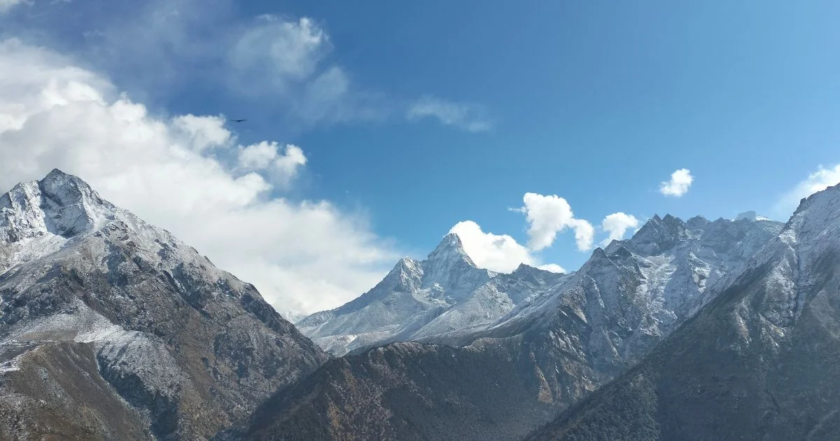
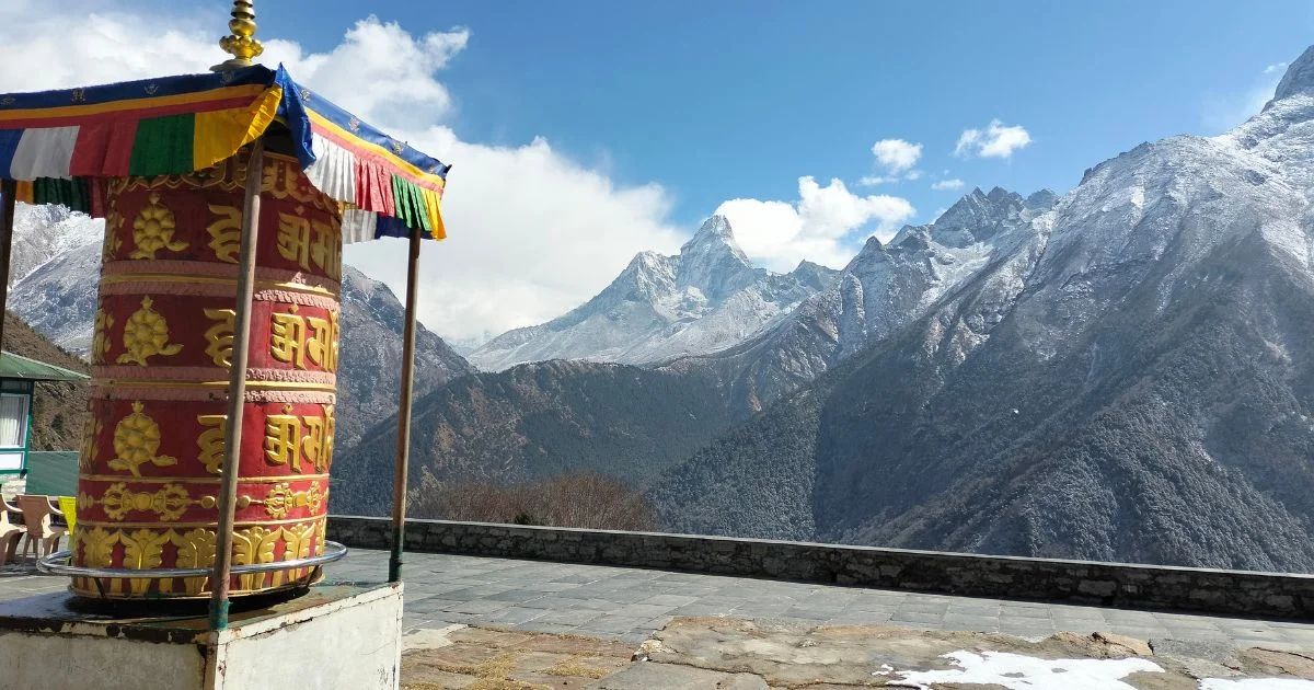
Further into the region, Ama Dablam (6,812 m) is perhaps the most photographed peak in the Khumbu. Its striking profile, visible from the trail between Namche Bazaar and Tengboche, has made it a symbol of Himalayan beauty. The landscape as a whole alternates between lush lower valleys, rocky moraine at mid-altitude, and stark ice-and-rock terrain above 5,000 meters.
4. Entry Points to the Everest Region
4.1 Lukla Airport: The Gateway to Everest
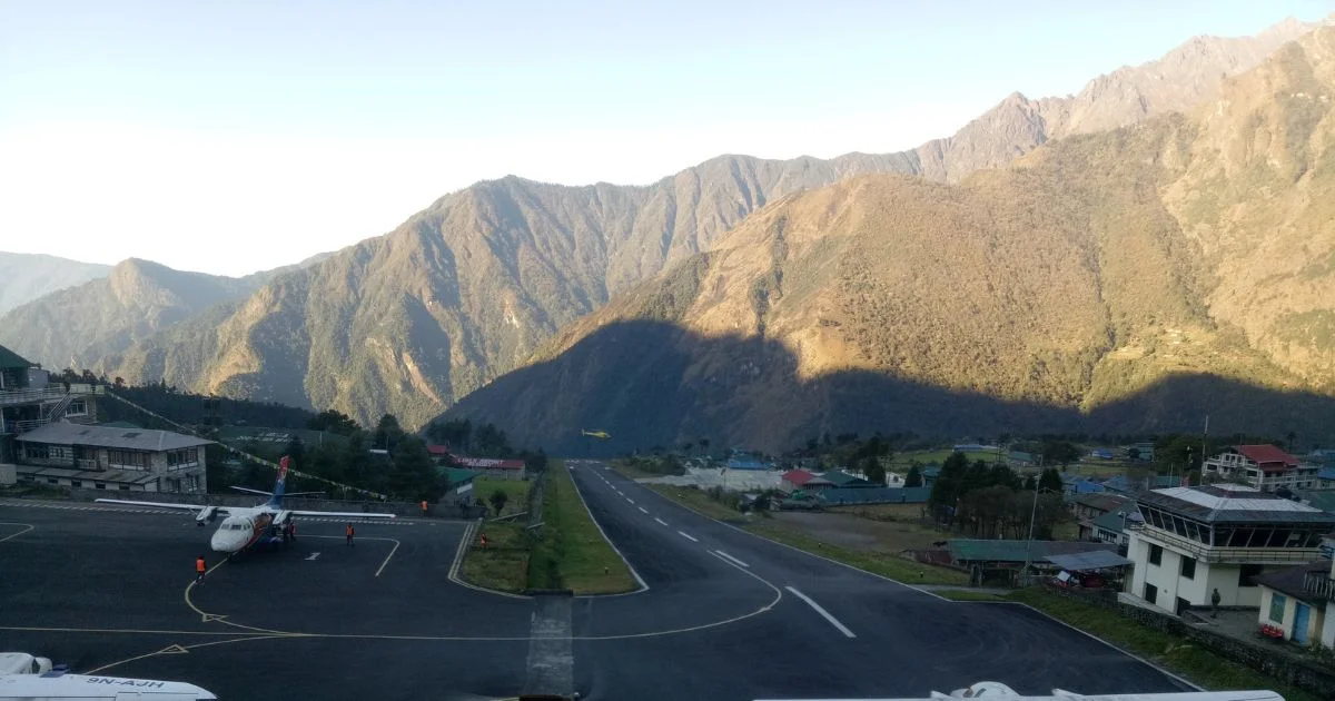
Tenzing-Hillary Airport in Lukla is the main entry point for anyone trekking to Everest Base Camp or elsewhere in the Khumbu. It sits at 2,845 meters above sea level and is widely listed among the most dangerous airports in the world. The runway is just 527 meters long, slopes upward at a 12 percent gradient, and ends abruptly at a mountain wall on one side and a steep drop on the other.
Flights to Lukla Airport depart from Kathmandu, taking about 35 minutes. But the schedule is highly weather-dependent. Fog, cloud, and wind can ground all flights for days at a time, so most trekkers build extra buffer days into their itinerary to account for delays.
Syangboche Airport sits above Namche Bazaar at approximately 3,780 meters above sea level and is one of the highest airstrips in the world. It was built to serve the Everest View Hotel, but it is no longer in operation. The airport has been closed to fixed-wing aircraft for over a decade due to its short, steep, and unpaved runway, which was deemed unsafe for commercial operations.
Status: Non-operational, closed to public air transport
Elevation: 3,780 meters above sea level
Reason for closure: Unsafe for commercial operations, short unpaved runway
Current use: Occasional cargo helicopter activity only
Note: Some mapping services still show the runway, but no commercial booking is available
Alternative: Tenzing-Hillary Airport in Lukla, approximately 13 km south of Namche Bazaar
4.3 Flight Risks and Weather Challenges
Weather in the Khumbu is unpredictable and changes fast. The pre-monsoon season (roughly April to May) and the post-monsoon season (October to November) are the primary trekking windows. Even within these periods, morning clarity can give way to afternoon cloud and strong wind within a few hours.
For flights into Lukla, the combination of a narrow mountain valley, poor visibility in cloud, and a technically demanding runway makes weather-related incidents a recurring concern. Pilots fly visually rather than by instrument, which means cloud cover at either end cancels the flight entirely. Trekkers should plan for at least one to two buffer days around Lukla in either direction.
5. Key Places in the Everest Region
5.1 Namche Bazaar: The Heart of the Khumbu
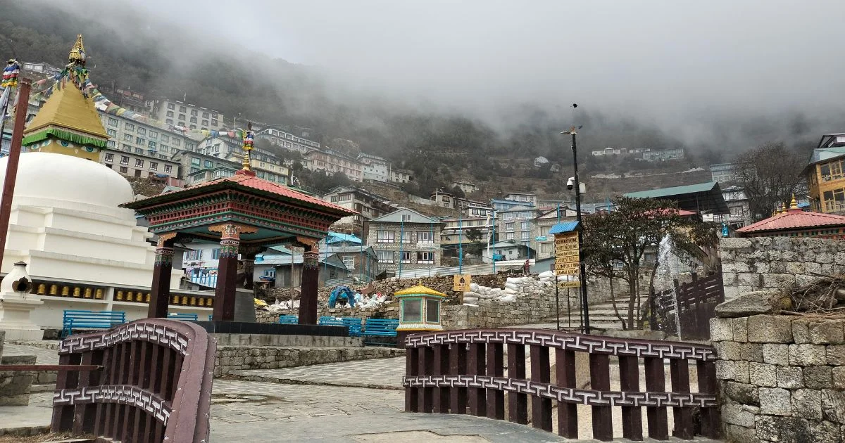
Namche Bazaar sits at 3,440 meters and serves as the commercial, cultural, and logistical centre of the Khumbu. Most trekkers arrive here on day two or three from Lukla and spend at least two nights to acclimatise. The town is built into a natural amphitheatre in the hillside, with lodges, bakeries, gear shops, and even a small supermarket clustered along steep lanes.
For acclimatisation, the standard advice is to spend two nights in Namche before ascending. A day hike up to the Everest View Hotel at Syangboche, which offers some of the finest views of Mount Everest visible from any building, gives the body time to adjust without staying idle. The hotel sits at about 3,962 meters.
Namche is also home to the Sherpa Culture Museum, a Saturday market that draws traders from across the region, and the headquarters of Sagarmatha National Park. For visiting Everest and the broader Khumbu, Namche is the hub everything passes through.
Namche Bazzar
5.2 Everest View Hotel: The Highest Luxury Stay
The Everest ViewHotel near Syangboche holds the Guinness World Record as the highest-altitude hotel in the world with a proper road and air connection. It sits at approximately 3,962 meters, and its panoramic windows frame some of the most direct views of Everest, Lhotse, Ama Dablam, and Thamserku available from any building. From here, trekkers get a clear look at the upper parts of the Everest massif that are otherwise only visible from the high trail.
The hotel opened in 1971 and originally attracted guests by small aircraft to Syangboche. Today, it is accessible by helicopter and by foot from Namche Bazaar. The walk up from Namche takes about 90 minutes and is a popular acclimatisation day hike. Trekkers often stop for tea or lunch even if they are not staying overnight.
5.3 Tengboche and Cultural Landmarks
Tengboche Monastery sits at 3,867 meters on a ridge above the confluence of the Imja Khola and Dudh Koshi rivers. It is the largest monastery in the Khumbu and the spiritual centre of the Sherpa community. First built in 1916, destroyed by earthquake in 1934, destroyed again by fire in 1989, and rebuilt each time, it remains a living place of worship.
The monastery is a standard stop on the Everest Base Camp trek and most other trek routes through the Khumbu. The views of Mount Everest, Lhotse, Nuptse, and Ama Dablam from the ridge at Tengboche are among the finest on the trail. The Mani Rimdu festival, held here each autumn, draws large crowds of local worshippers and trekkers alike.
Further along the trail, Dingboche, Lobuche, and Gorak Shep each serve as acclimatisation and rest stops on the approach to base camp. Each village has its own character, from the sheltered warmth of Dingboche to the stark, wind-exposed position of Gorak Shep.
5.4 Remote Villages and Trail Life
Beyond the main corridor, the Khumbu contains smaller villages that most trekkers never visit. Thame, to the north-west of Namche, is notable as the home village of many famous Sherpas, including Apa Sherpa, who summited Mount Everest a record number of times. Phortse, perched on a ridge above the main valley, offers quieter teahouse stays and strong traditional village life.
Trail life in the Khumbu is built around the teahouse system. Teahouses are small family-run guesthouses that provide accommodation, meals, and social spaces along the route. As altitude increases, menus narrow and prices rise, reflecting the real cost of carrying supplies up by foot or yak. Porter and yak trains share the paths with trekkers, and understanding trail etiquette is a practical necessity.
Everest View Hotel, Syangboche
6. Everest Base Camp Facts
6.1 Two Everest Base Camps (Nepal and Tibetan Sides)
Everest has two distinct base camps, one on the Nepal side and one in Tibet. Mount Everest has two separate approach routes, and each requires its own base camp as the starting point for climbers. Both serve the same purpose but differ in access, elevation, and experience.
The South Base Camp in Nepal sits at 5,364 metres and is reached on foot from Lukla via the classic Everest Base Camp trek. For decades, climbers and trekkers gathered at the original site on the Khumbu Glacier, but persistent glacial movement and deteriorating surface conditions prompted authorities to designate a new location.
The current Everest Base Camp is positioned slightly away from the old site, on more stable ground near the edge of the glacier. The North Base Camp in Tibet is accessible by road through Lhasa and then by jeep to the Rongbuk Monastery area. Each camp draws different types of climbers and presents different logistical challenges.
Feature
Old Everest Base Camp
Current Everest Base Camp
Elevation
5,364 metres
Approximately 5,300 metres
Location
On the Khumbu Glacier surface
Stable ground near the edge of the Khumbu Glacier
Access
On foot via Lukla and the Khumbu trail through Sagarmatha National Park
On foot via Lukla and the Khumbu trail through Sagarmatha National Park
Permit Authority
Nepal government
Nepal government (managed through Sagarmatha National Park entry permits)
Trekker Access
Previously open to trekkers on the Everest Base Camp trek
Yes, open to trekkers on the Everest Base Camp trek
Climbing Route
South-East Ridge route, passing the Khumbu Icefall
South-East Ridge route, passing the Khumbu Icefall
Season
April to May, October
April to May, October
Reason for Change
Glacial movement and deteriorating surface conditions on the Khumbu Glacier
Designated for safer, more stable ground by Nepal authorities
6.2 Elevation, Location, and Layout
Everest Base Camp on the Nepal side sits at 5,364 meters above sea level on the lateral moraine beside the Khumbu Glacier. It is not a permanent settlement. During the Everest expedition season, typically April and May, it becomes a sprawling temporary city of tents, mess tents, communication equipment, and support structures. At peak times, several hundred climbers and many more support staff occupy the camp.
Each expedition team claims a section of ground and sets up its own area. There are no buildings, no running water, and no sanitation infrastructure beyond what teams bring themselves. Waste management at base camp has become a serious concern, which Sagarmatha Next and the park authorities have worked to address.
6.3 What Trekkers Actually Experience at EBC
Trekking to Everest Base Camp from Lukla takes most people 12 to 14 days round trip. The trail gains altitude steadily, passing through Namche, Tengboche, Dingboche, Lobuche, and Gorak Shep before reaching base camp. The final section from Gorak Shep takes about 2 to 3 hours each way across moraine and rough terrain.
At base camp itself, trekkers can walk among the expedition tents during the climbing season. Outside of the main season, the site is quiet and marked mainly by prayer flags and stone cairns. The views of Everest looking up toward the Khumbu Icefall and the faces of Nuptse and Lho La are genuinely impressive.
The most common physical challenges on the Everest Base Camp trek include altitude sickness above Namche and Dingboche, exhaustion from daily elevation gains, and cold nights. Proper preparation, including acclimatisation days, reduces the risk considerably.
7. Trekking Facts in the Everest Region
7.1 Everest Base Camp Trek Distance and Duration
The Everest Base Camp trek covers roughly 130 kilometres round trip from Lukla to base camp and back. Most trekkers complete it in 12–16 days, depending on the pace they set and the number of acclimatisation days they take. The standard itinerary builds in rest days at Namche Bazaar and Dingboche, both of which are important for reducing altitude sickness risk.
Daily walking time ranges from 4 to 7 hours depending on the section. The trail is not technically difficult, but altitude is the defining challenge. Above 4,000 meters, even fit and experienced walkers will feel the effects of thin air, and pushing too fast is one of the most common mistakes trekkers make.
Total distance: Approximately 130 km round trip
Duration: 12 to 16 days standard itinerary
Daily walking: 4 to 7 hours
Maximum altitude: 5,364 meters at base camp (5,644 m at Kala Patthar)
Best seasons: March to May, October to November
Starting point: Lukla (2,845 m), reached by flight from Kathmandu
7.2 Popular Routes Including the Three Passes Trek
The Three Passes Trek is a longer and more demanding circuit through the Khumbu that crosses three high mountain passes: Kongma La (5,535 m), Cho La (5,420 m), and Renjo La (5,360 m). The full route covers roughly 160 kilometres and takes 18 to 21 days. It is considered one of the finest high-altitude treks in Nepal for those who want more than the standard Everest Base Camp trek.
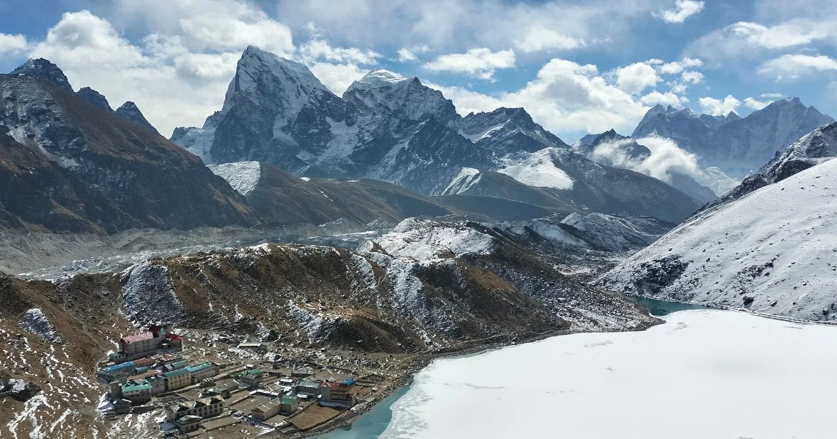
The Three Passes Trek includes Everest Base Camp as a highlight along the route, but it also loops through the Gokyo Valley with its turquoise glacial lakes and offers panoramic views of Mount Everest and other mountain from Gokyo Ri (5,357 m). Renjo La, in particular, is widely regarded as one of the best viewpoints in the Khumbu for unobstructed views of Everest.
7.3 Sagarmatha Next: Waste and Sustainability Efforts
Sagarmatha Next is a waste management and environmental programme operating in the Khumbu, focused on reducing the accumulation of rubbish on the trails and at Everest Base Camp. The project was established by the Khumbu Climbing Center and works with local organisations, the Nepal government, and trekking operators to promote responsible practices across the Everest region.
Each Everest expedition brings tonnes of equipment, food, and materials into a remote area with no formal waste infrastructure. Over decades, this activity has led to a serious accumulation of rubbish on the mountain itself and along the approach trails. Sagarmatha Next collects, sorts, and processes waste from base camp level and aims to reduce single-use plastics across the trekking corridor.
For trekkers, the practical implications are straightforward. Carrying out your own rubbish, using refillable water bottles, and choosing operators who follow responsible waste practices all contribute. The programme has made visible progress, but the scale of the issue means the work is ongoing.
7.4 Sagarmatha National Park: Entry, Permits, and Protection
Sagarmatha National Park covers 1,148 square kilometres of the Khumbu and was established in 1976. It was designated a UNESCO World Heritage Site in 1979, in recognition of its outstanding natural and cultural value. The park protects the entire Everest region within Nepal, including the Khumbu Glacier, surrounding peaks, forests, and the villages within its boundaries.
Every trekker entering the park must pay an entry fee, currently around NPR 3,000 for foreign nationals. The permit is checked at the park gate above Monjo, typically on day two or three of the trek from Lukla. Combined with the TIMS card, this forms the basic permit requirement for independent trekkers.
Park area: 1,148 square kilometres
Established: 1976
UNESCO status: World Heritage Site (1979)
Entry fee: Approximately NPR 3,000 for foreign nationals
Wildlife: Snow leopard, Himalayan tahr, red panda, musk deer, over 150 bird species
Protected glaciers: Khumbu, Ngozumpa, Imja, and others
8. Climbing Everest: Costs and Realities
8.1 Royalty Fee Per Climber
The royalty fee to climb Mount Everest from the Nepal side is USD 11,000 per climber as of the most recent update, though the Nepal government has discussed raising it to as much as USD 15,000 per climber in proposed reforms. The fee covers the right to attempt the summit and is paid directly to the Nepal government. It does not include any other expedition costs.
This fee applies to the standard spring season. The permit is issued per person, and each climber must hold one regardless of whether they reach the summit or turn back before the top of Everest. Tibet issues its own permits for the north side through the China Tibet Mountaineering Association.
8.2 Total Cost of an Everest Expedition
The royalty fee is only a fraction of what a full Everest expedition costs. When all elements are included, the total typically ranges from USD 30,000 to over USD 100,000 per climber, depending on the level of support and the operator chosen.
Cost Element
Approximate Cost (USD)
Permit / royalty fee
11,000
Guided expedition package
25,000 to 65,000
Flights (international and Lukla)
2,000 to 4,000
Gear and equipment
5,000 to 10,000
Insurance (rescue and evacuation)
1,500 to 3,000
Additional personal expenses
2,000 to 5,000
Total (guided, mid-range)
40,000 to 85,000
Budget operators offer lower prices but typically provide less Sherpa support, older equipment, and smaller safety margins. So, climbing Everest on the cheap is a genuine risk rather than just a cost decision.
8.3 Why the Death Zone Is So Dangerous
Above 8,000 meters, the human body is in a state of steady physical decline. The oxygen available is roughly one-third of what it is at sea level, and no amount of acclimatisation makes this safe for extended stays. Most climbers try to spend as little time as possible above this line, moving through the Death Zone in a single continuous push toward the summit of Mount Everest and back.
The effects of prolonged exposure include high-altitude cerebral oedema, where fluid builds in the brain, and high-altitude pulmonary oedema, where fluid fills the lungs. Both can be fatal within hours if not treated. Even without oedema, thin air causes significant cognitive impairment and slowed movement, both of which compound the risk during descent.
Most deaths on Mount Everest occur during descent rather than the ascent itself. The peak of Everest is reached by a relatively small number of those who attempt it, and every season brings reminders of how serious the undertaking is.
8.4 Summit Windows and Climber Traffic
The main summit window on Mount Everest falls in late May, typically between 15 and 25 May. This brief period of relative calm in the jet stream allows climbers to attempt the Everest summit push with manageable wind speeds. The actual summit days are often concentrated into just two or three days per season.
The concentration of climbers on the same narrow window has led to visible congestion in recent years. Images of long queues near the peak of Mount Everest, particularly at the Hillary Step just below the top of the world, have drawn attention to capacity challenges Nepal faces. In a busy year, more than 300 climbers may summit Everest within a few days of each other.
The jet stream typically lifts off the summit in May, reducing wind speeds temporarily
Most successful summit days happen between 15 and 25 May
October offers a shorter secondary window but sees far fewer attempts
Weather forecasting services now provide detailed summit predictions to expedition teams
Some interesting facts about this window: in a record year, the Nepal government has issued over 400 permits for a single spring, making summit-day congestion a genuine safety concern as well as a logistical one.
9. Culture and Life in the Everest Region
9.1 Sherpa Community and Traditions
The Sherpa people are the indigenous inhabitants of the Khumbu region and the wider Solu-Khumbu area in northeastern Nepal. They originally migrated from eastern Tibet roughly five centuries ago and settled in the high valleys of what is now north-eastern Nepal. The word "Sherpa" represents "people of the east" in the Tibetan language.
Sherpas are widely known for their high-altitude capability, which stems from a combination of genetic adaptation and generations of life at altitude. Research has shown that Sherpas use oxygen more efficiently and adapt better to low-oxygen environments than most people living at sea level. But this biological advantage is only part of the story.
The Sherpa community has an economy now deeply shaped by trekking and Mount Everest climbing expeditions. Many families own teahouses or lodges, work as high-altitude guides, or manage logistics for climbing expeditions. The industry has raised living standards significantly over the past forty years, but it has also brought pressure on local culture, infrastructure, and the environment.
9.2 Religion and Monasteries
Tibetan Buddhism shapes every aspect of life in the Khumbu. The Sherpa people follow the Nyingma tradition, one of the oldest schools of Tibetan Buddhism, and their deep spiritual heritage is reflected throughout the landscape. Prayer flags stretch between ridges, mani stones line the trails, and monks conduct ceremonies at monasteries that have stood for centuries.
The most important monastery in the region is Tengboche, but others, including Thame, Pangboche, and Khumjung, each play a role in the religious and cultural life of the Khumbu. Khumbu and Pangboche Monastery, one of the oldest in the region, sits at 3,985 meters and still has resident monks.
For travelers, these monasteries are not just tourist stops. They are active religious sites, and visitors are expected to behave accordingly. Removing footwear before entering, walking clockwise around chortens and mani walls, and asking permission before photographing monks or ceremonies are all standard expectations on the trail.
9.3 Daily Life at High Altitude
Life at high altitude in the Khumbu is shaped by physical constraints that most visitors only experience briefly. Cooking takes longer because water boils at lower temperatures. Cold affects everything from how building materials perform to how quickly food spoils. The growing season is brief, and at higher elevations, most food and essential supplies must be transported by porters, pack animals, or helicopter.
Yaks are essential to life in the region. They carry supplies, produce milk for butter and cheese, and provide fuel in the form of dried dung. The yak is adapted to high altitude with a larger lung capacity and richer blood than lowland cattle. Crossbreeds called 'dzopkyos' and 'dzums' are common at mid-altitudes and carry loads at elevations below the yak's comfort zone.
Electricity in the Khumbu comes mainly from micro-hydro projects on local rivers, supplemented by solar panels. Most teahouses in the main corridor have electric lighting and phone charging. Wi-Fi is available at most lodges from Namche upward, though speeds and reliability decrease as altitude increases.
10. Lesser-Known Facts About the Everest Region
10.1 Connectivity and Internet at High Altitude
The Khumbu has better mobile connectivity than many trekkers expect. Nepal Telecom's network covers most of the main trail, and 4G data is available in Namche and several other villages. At higher elevations, connectivity drops to 3G or weaker signals. Gorak Shep and Everest Base Camp have basic coverage, though reliability varies by season and weather.
Wi-Fi at teahouses is standard from Namche upward, typically charged per hour or per day. Trekkers who want reliable communication for emergencies generally carry a satellite communicator as a backup. This level of connectivity at altitude is one of the more surprising fun facts for first-time visitors, as it means images and updates from base camp appear in real time during the climbing season.
10.2 Food, Supplies, and Logistics
All food and supplies in the Khumbu above Lukla arrive by foot, yak, and helicopter. There are no roads connecting the region to Kathmandu or any other lowland area. This makes every item more expensive as altitude increases, reflecting the genuine cost of the supply chain.
A teahouse's menu in Namche might charge NPR 800-1200 for a main meal. The same meal at Lobuche or Gorak Shep can cost NPR 1000-1500 or more. Trekkers on a budget should account for this altitude pricing effect when planning expenses. The logistics of visiting Everest during the climbing season are complex, with hundreds of tonnes of expedition gear flown or carried into the region each spring.
10.3 Records, Extremes, and Unique Stories
Some of the most compelling facts about Everest involve records that go well beyond standard mountaineering narratives. For anyone who has followed the mind-blowing facts about Mount Everest that circulate online, many of the real figures are even more striking in context. Kami RitaSherpa holds the record for the most Mount Everest summit ascents, with over 29 successful trips to the top of Mount Everest as of recent seasons. His record is a reminder of the extraordinary physical capability that elite Sherpas bring to the tallest mountain on the planet.
The oldest person to summit Everest was Yuichiro Miura of Japan, who did so at age 80 in 2013. The youngest was Jordan Romero of the United States, who reached the summit of Mount Everest at age 13 in 2010, though Nepal has since set minimum age requirements of 16 years for permit applicants.
Climbing Everest without supplemental oxygen remains one of the rarest achievements in mountaineering. Since Reinhold Messner and Peter Habeler first did it in 1978, only a small number of climbers have repeated the feat. The physiological demand is so severe that most Everest climbers, even highly experienced ones, rely on bottled oxygen above 7,000 meters.
Other notable facts include the following:
Mount Everest grows by about 4 millimetres per year due to tectonic plate movement
The roof of the world sees temperatures drop to minus 60 degrees Celsius in winter
Fly-over Mount Everest tours from Kathmandu operate regularly and offer views of Everest without setting foot on a trail
The first woman to summit Mount Everest was Junko Tabei of Japan on 16 May 1975
More than 300 people have died on Mount Everest, with many bodies still on the tallest mountain on earth
Mount Everest is the highest point on earth measured from sea level, but Mauna Kea in Hawaii is technically taller from its oceanic base
As the world's tallest mountain by sea level measure, Mount Everest also holds the distinction of being the highest peak in the world and the tallest mountain in the world by the same standard
11. Facts About the Everest Region: Final Verdict
‘The Everest region is one of the most studied, documented, and visited mountain environments on earth, but it still holds the capacity to surprise. From the layered geology of the Himalayas to the quiet rhythms of Sherpa village life, the Khumbu rewards both careful preparation and genuine curiosity. Facts about the Everest Region and its surroundings are not just figures on a page. They are the framework for a real journey that changes most people who make it.
For those planning a trek, the practical knowledge in this guide matters as much as the historical and geographical context. Understanding why Lukla is challenging, why acclimatisation days at Namche are non-negotiable, and what the Death Zone actually does to the body all shapes how you prepare and what you expect. Everest is the highest peak on earth by sea level measure, but what makes the region extraordinary is everything that surrounds and supports that fact.
Visiting Everest in any form, whether as a trekker reaching Everest Base Camp, a climber attempting the summit, or a day tripper on a scenic flight, is a significant undertaking. The tallest mountain on earth does not bend to schedules or optimism. But for those who go in with clear information, realistic expectations, and genuine respect for the altitude and the culture, the Khumbu offers an experience without equal anywhere else on the planet. For personalised planning, permits, and guided support, contact us at Nepal Everest Base Camp Co.
Everest region treks
12. Facts About the Everest Region: FAQs
What is the difficulty of trekking to Everest Base Camp?
The Everest Base Camp trek difficulty is rated moderate to challenging for most trekkers. The main difficulty is altitude rather than technical terrain, and the risk of altitude sickness is real above 3,500 metres, which is why acclimatisation days at Namche Bazaar and Dingboche are essential.
Why is Lukla Airport considered dangerous?
Lukla is considered one of the most dangerous airports in the world because of its short 527-metre runway, steep mountain approach, and full weather dependency. Pilots fly visually with no instrument landing system, and the runway ends at a mountain wall on one side and a cliff drop on the other.
What is the death zone on Everest?
The Death Zone refers to altitudes above 8,000 meters above sea level, where oxygen levels are too low for the human body to function safely over time. On Mount Everest, this covers the final 848 meters to the summit, and it is where most fatalities on the mountain occur.
How much does it cost to climb to the top of Mt. Everest?
The government royalty fee to climb Mount Everest from Nepal is approximately USD 11,000 per climber, with proposed increases under discussion. A full guided Everest expedition including logistics, Sherpa support, gear, and flights typically costs between USD 40,000 and USD 85,000 in total.
Are there really two Everest Base Camps?
Yes. Everest has two base camps on opposite sides of the mountain. The South Base Camp in Nepal sits at 5,364 meters and is the one reached by the standard Everest Base Camp trek. The north base camp in Tibet sits at approximately 5,150 meters and is accessed by road through the Tibet Autonomous Region.
What is the Three Passes Trek?
The Three Passes Trek is an extended circuit through the Khumbu that crosses three high mountain passes: Kongma La, Cho La, and Renjo La. It covers roughly 160 kilometers, takes 18 to 21 days to complete, and includes Everest Base Camp as one of its highlights. It is considered one of the finest high-altitude treks in Nepal for experienced walkers.
Blending digital strategy with mountain passion, I help adventurers find their way to the Himalayas online. With hands-on experience in Nepal’s trekking trails and a role at Nepal Everest Base Camp Trekking Co., Thamel, I combine SEO expertise with true trail insight.