Larkya La Pass, at 5,106 metres, is the highest and most demanding section of the Manaslu Circuit trek in Nepal. The crossing takes 8 to 11 hours and requires good fitness, proper altitude acclimatisation, and suitable cold-weather gear. April and October offer favourable conditions, while a licensed guide, necessary permits, and careful weather planning are essential for a safe crossing.
Exploring Larkya La Pass
Larkya La Pass sits in the Mansiri Himal range of the Nepalese Himalayas, on the northwestern edge of the Manaslu Conservation Area in Gorkha District, separating the Budhi Gandaki Valley to the east from the Bimthang Valley to the west. At 5,106 metres, it is the highest point of the Manaslu Circuit trek and the single moment the entire route builds toward. The trail crosses moraine and snowfields in the early hours before dawn, and the cold and altitude make it the most demanding day on the circuit. It is the reason serious trekkers come to the Manaslu region of Nepal in the first place.
This guide covers everything about Larkya La Pass that matters before you leave Kathmandu. From altitude risk and trail conditions to permits, gear, and the best time to cross Larkya La, each section gives you real information rather than general encouragement. Whether you are comparing it with Thorong La on the Annapurna Circuit or trying to understand exactly what the ascent involves, you will find clear, grounded answers here.
If you are planning to trek to Larkya La Pass, read this carefully before finalising your Manaslu Circuit trek itinerary. The pass rewards preparation and punishes overconfidence in equal measure. What follows is a straightforward breakdown of what to expect, what to carry, and how to give yourself the best chance of crossing the Larkya La Pass with proper altitude acclimatisation, awareness of weather conditions, and smart route planning, safely and on your own terms. For support and logistics, Nepal Everest Base Camp Pvt Ltd can assist with guided arrangements.
Larkya La Pass Overview
Altitude, Distance, and Key Facts
Larkya La Pass sits at an elevation of 5,106 metres above sea level. It is the highest point of the Manaslu Circuit and one of the most demanding pass trekking objectives in Nepal. The crossing day covers roughly 24 kilometres from Larkya Phedi (also known as Dharamsala) to Bimthang, with a total ascent of around 1,000 metres.
Detail
Information
Larkya La Pass elevation
5,106 m (16,752 ft)
Starting point
Larkya Phedi / Dharamsala (4,460 m)
End point
Bimthang (3,590 m)
Distance (crossing day)
~24 km
Total ascent
~1,000 m
Typical crossing time
8 to 11 hours
Trek difficulty
Strenuous
The pass sits on the border between the Manaslu and Annapurna massifs.
It is classified as a high-altitude pass requiring prior acclimatisation.
Larkya La Pass is one of the most technically demanding non-technical crossings in Nepal.
The majority of hikers leave between three and five in the morning to avoid afternoon wind and deteriorating snow conditions.
Exact Position on the Manaslu Circuit Route
The Larke-La Pass in Manaslu sits near the northern curve of the circuit, positioned between Dharamsala and Bimthang. Trekkers heading clockwise, which is the standard direction, approach the pass on the Manaslu Circuit from Larkya Phedi (Dharamsala) after spending a night there at around 4,460 metres. With Larkya La Pass located just northeast of Mount Manaslu itself, views from the summit include the peak at a very close range.
The Larkya La Pass Manaslu crossing connects the upper Budhi Gandaki valley to the Dudh Khola valley.
Bimthang marks the first proper settlement on the descent side.
Clockwise trekking is strongly recommended because it allows better acclimatisation before reaching the pass.
What Makes This Pass Different from Others
The Larkya La Pass in Manaslu stands apart from most other Himalayan crossings because of its length, its remoteness, and the altitude sustained throughout the crossing day. Unlike shorter passes, this one keeps you above 5,000 metres for several hours.
Pass provides panoramic views of Manaslu, Cheo Himal, Himlung Himal, and Annapurna II.
There are no teahouses between Larkya Phedi and Bimthang on crossing day.
A restricted area permit is required, and evacuation procedures are more complex than in other trekking regions.
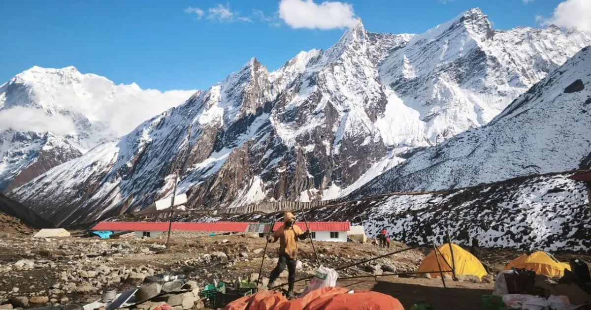
Dharamsala Camp, Last stop before larkela pass
What It Is Like to Cross Larkya La Pass
Starting Point and Early Ascent
The trek to Larkya La Pass begins before dawn from Larkya Phedi. Most guides wake their groups between 3:00 and 4:30 a.m. The temperature at that elevation sits well below freezing, often between minus 10 and minus 15 degrees Celsius overnight, depending on the weather season. Headlamps are essential, and the first hour of walking crosses rocky moraine in the dark.
The initial ascent gains altitude steadily across loose rocky ground.
By the time light appears, trekkers are usually above 4,800 metres.
Early starts are not optional. The ascent to the pass must be completed before winds intensify around midday.
Trail Conditions and Terrain Changes
As the trail climbs, the surface changes from rock and earth to compacted snow and, in late season, hard ice. The gradient steepens noticeably above 5,000 metres. In spring, there is often a well-worn trail through the snow. In autumn, the surface can be firmer and more slippery.
Fixed ropes are usually needed only in the low season, especially during winter.
Trekking Larkya La Pass after fresh snowfall significantly increases the time and energy required.
Crampon use depends on conditions. Your guide will advise on the day.
Summit Conditions and Views
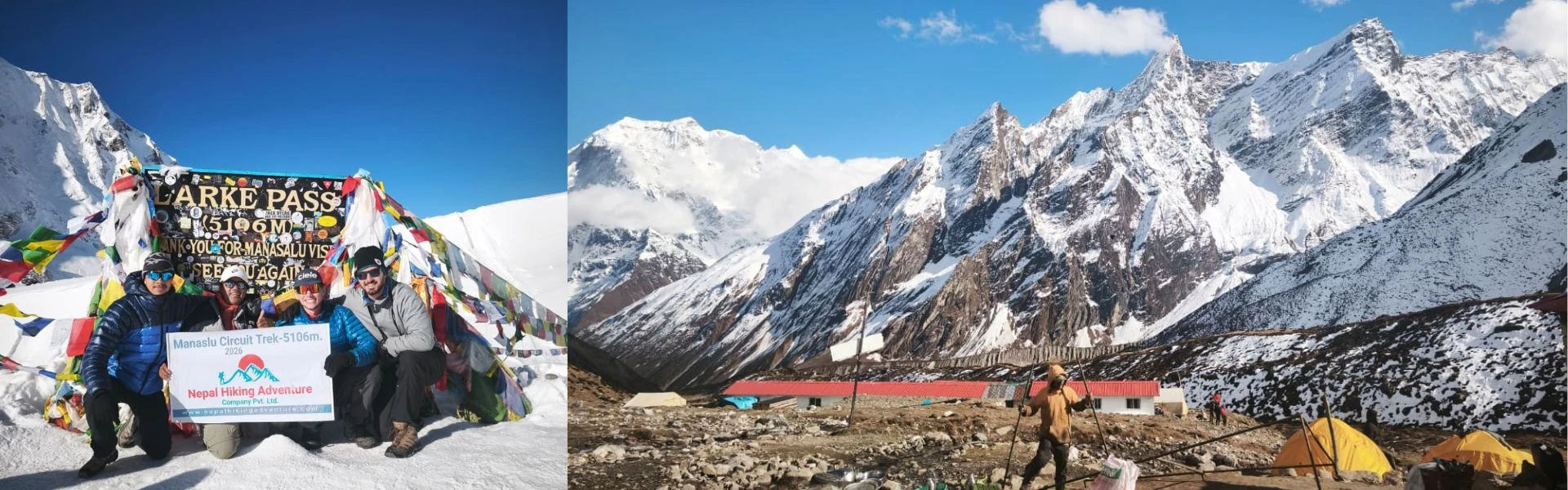
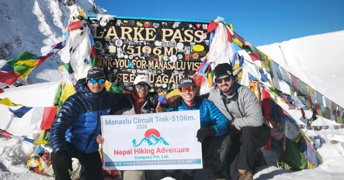
The top of the pass is marked by prayer flags and a small stone cairn. At 5,106 metres, exposure to wind is extreme. Consequently, most trekkers spend only a few minutes at the summit before descending. The view of Manaslu from here is exceptional, with the north face visible at close range.
Temperatures at the summit can drop below minus 20 degrees Celsius with wind chill.
Visibility is frequently excellent in the early hours, often deteriorating by late morning.
Standing still at the top of Larkya la cools the body very quickly. Move promptly.
Descent and Final Stretch
The descent to Bimthang is long and forms the final part of the trek on crossing day. From the summit, trekkers drop over 1,500 metres across a mix of snowfields, glacial moraine, and eventually grassy slopes. The trail is not technically difficult on the way down, but the cumulative distance and the tired legs from the ascent make the final hours demanding.
The descent takes between 4 and 6 hours depending on pace and conditions.
Bimthang sits at 3,590 metres, which feels merciful after the summit.
Afternoon clouds typically roll in during autumn, so the lower section is often walked in mist.
Total Time and Effort Required
The trek usually takes 8 to 11 hours for the full crossing from Larkya Phedi to Bimthang. Fit trekkers with good acclimatisation complete it closer to 8 hours. Those moving cautiously, or dealing with symptoms may take closer to 11 or 12.
Segment
Approximate Time
Larkya Phedi to base of steep section
3.0 to 4.0 hrs
Steep section to summit
1.5 to 2.5 hrs
Summit to Bimthang
4.0 to 5.5 hrs
Total
8 to 11+ hrs
Difficulty Level of Larkya La Pass
Physical Demands
Larkya La Pass difficulty is rated strenuous. The crossing day is the longest and highest of the Manaslu Circuit trek, and it comes late in the itinerary when fatigue has already accumulated. Furthermore, the sustained altitude means the body is working harder than normal for the full crossing.
Aerobic fitness is the primary requirement. Prior trekking experience at altitude is strongly advised.
Carrying a pack above 7 to 8 kilograms significantly increases effort at this altitude.
Trekkers with cardiovascular conditions should consult a doctor before attempting the pass.
Trail Difficulty and Conditions
The trail itself is not technical. There is no climbing equipment needed in normal conditions. However, the combination of altitude, cold, snow, and distance makes this a genuine endurance challenge.
Loose scree on the approach becomes harder to navigate when iced over.
The fixed rope section near the summit is short but steep.
Post-monsoon rock debris can make the lower trail approach uneven.
Mental Challenge and Endurance
Starting in the dark, moving slowly in cold air, and knowing you have a full day ahead takes a particular kind of mental steadiness. Many trekkers describe the pre-dawn hour as the hardest part, before the rhythm of movement sets in.
Pacing is more important than speed. Moving slowly and consistently beats bursts followed by rest stops.
Throughout the trek, and especially on crossing day, mental discipline carries physical effort further than fitness alone.
Turning back is always an option, and experienced guides know when to call it.
Who Should Attempt This Pass
The pass is among the more demanding pass trekking crossings in Nepal, but it is achievable for well-prepared trekkers without technical mountaineering experience.
Prior multi-day trekking experience at altitude (above 4,000 m) is strongly recommended.
Completing Everest Base Camp or the Annapurna Circuit beforehand gives useful reference.
Age is less of a factor than fitness and acclimatisation history.
Altitude and Acclimatisation
Key Risk Zones Before the Pass
Altitude becomes a genuine concern above 3,500 metres, and the Manaslu Circuit trek spends several days above that threshold before reaching the pass. The highest camp before the summit is Larkya Phedi at 4,460 metres, and sleeping there is already demanding.
Location
Altitude
Risk Level
Samagaon
3,530 m
Moderate
Samdo
3,860 m
Moderate to High
Dharamsala / Larkya Phedi
4,460 m
High
Larkya La Pass summit
5,106 m
High
Most trekkers take a rest day at Samagaon before continuing.
Moving from Samdo to Larkya Phedi on the same day as departure is not advisable.
Common Altitude Symptoms
Understanding altitude sickness symptoms is not optional on this trek. The risk of altitude sickness increases above 4,000 metres and peaks at the summit.
Headache, nausea, fatigue, and disturbed sleep are the most common early signs.
Confusion, loss of coordination, or a persistent dry cough requires immediate descent.
Altitude sickness can develop even in trekkers who felt fine the previous day.
Proper Acclimatisation Strategy
Acclimatisation is the single most important preparation for crossing the Larkya La Pass. The standard circuit trek itinerary builds rest days into the route, but cutting corners here costs trekkers dearly.
Follow the rule of climbing no more than 300 to 500 metres of sleeping altitude per day above 3,000 metres.
Rest days at Samagaon (3,530 m) and, ideally, at Samdo (3,860 m) are strongly recommended.
Hydration, mild activity on rest days, and avoiding alcohol all support better acclimatisation.
When to Stop or Turn Back
Knowing when to descend is as important as knowing how to ascend. Guides are trained to recognise danger signs, and their judgement should be followed without argument.
Persistent vomiting, severe headache unrelieved by medication, or visible confusion are clear stop signs.
If a trekker cannot walk a straight line or seems disoriented near the pass, immediate descent is the only safe option.
Descent by as little as 300 to 500 metres often produces rapid improvement in symptoms.
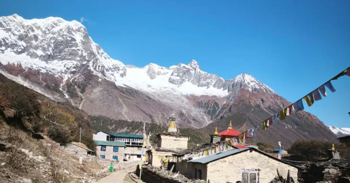
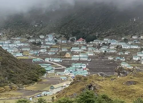
Samagaun Village
Best Time to Cross Larkya La Pass
Spring Season Conditions
The best time to cross Larkya La Pass is widely considered to be spring, specifically late March through May. Snow conditions are stable, days are long, and temperatures, while cold at altitude, are manageable.
Larkya La Pass has spring conditions at their most reliable: consolidated snow, clear morning skies, and predictable weather windows.
April is the peak month for pass trekking on the Manaslu Circuit.
Wildflowers on the lower sections of the approach add to the experience without affecting summit conditions.
Autumn Season Conditions
October and November offer the second strong window. Skies are clear after the monsoon, and visibility from the summit is exceptional.
Temperatures drop faster in November, and early winter conditions can arrive by late November.
October is generally the preferred autumn month for trekking Larkya La pass.
Trail surfaces are drier in early October, making the descent more manageable.
Winter Challenges
December through February is when the high pass becomes genuinely dangerous and frequently impassable.
Heavy snowfall can block the trail entirely for days at a time.
Wind speeds at the summit regularly exceed 60 kilometres per hour.
Only very experienced trekkers with proper winter equipment should consider attempting the pass in these months.
Monsoon Limitations
June through August brings the monsoon, and most trekking companies suspend operations on this route.
Rain, low visibility, and unstable slopes make the pass trekking route hazardous.
Leeches, flooded river crossings, and slick rock surfaces make even the lower trail unpleasant.
The Manaslu region receives heavy rainfall, and the path to the pass becomes genuinely treacherous.
Weather and Trail Conditions
Temperature Range
Temperature at Larkya La Pass varies significantly by season and by time of day.
Season
Summit Temp (Day)
Night at Larkya Phedi
Spring (Apr–May)
-5°C to -15°C
-10°C to -20°C
Autumn (Oct–Nov)
-8°C to -18°C
-12°C to -25°C
Winter (Dec–Feb)
-15°C to -30°C
-20°C to -35°C
Wind Exposure
The pass sits directly in the path of high-altitude westerly winds. Even on clear days, wind at the summit can be intense and disorienting.
Wind typically picks up between 9:00 and 11:00 a.m., which is why early starts are critical.
Wind chill at the summit can make an apparent minus 10 degrees feel like minus 25 degrees.
Trekkers who reach the summit after 10:00 a.m. frequently report significantly harder conditions.
Snow and Ice Conditions
Snow and ice are present on the high-altitude sections of the trail for most of the year. In spring, the snow is usually firm and safe to walk on. In late autumn, refreezing overnight creates icy patches that are harder to navigate without traction devices.
Microspikes or crampons are recommended for autumn crossings.
In spring, trekking poles with rubber tips are typically sufficient.
Ice axes are carried by guides but are rarely needed by trekkers in normal seasonal conditions.
Visibility and Weather Changes
Clear mornings can deteriorate into cloud and light snow within hours at this high altitude. Weather changes faster in the mountains than most trekkers expect.
Afternoon thunderstorms are more common in the weeks just after the monsoon.
If cloud cover drops suddenly on the ascent, maintaining the planned pace becomes even more important.
Guides familiar with local weather patterns are invaluable in reading morning conditions.
Larkya La Pass Compared to Other Passes
Larkya La vs Thorong La
Thorong La on the Annapurna Circuit sits at 5,416 metres, making it higher than Larkya La Pass. However, a direct altitude comparison does not tell the full story.
Feature
Larkya La Pass
Thorong La (Annapurna)
Altitude
5,106 m
5,416 m
Crossing distance
~24 km
~17 km
Technical difficulty
Moderate
Moderate
Remoteness
Very High
Moderate
Rescue access
Difficult
Easier
Teahouse at the summit
No
Yes
Trekker volume
Low
High
Larkya La vs Cho La
Cho La Pass trek on the Everest circuit sits at 5,420 metres and involves a short glaciated section that is genuinely technical in icy conditions.
Feature
Larkya La Pass
Cho La (Everest)
Altitude
5,106 m
5,420 m
Technical element
Low
Moderate (glacier)
Crossing time
8 to 11 hrs
5 to 7 hrs
Remoteness
Extremely remote
Moderate
Which Pass Is More Difficult
The question of which pass is more difficult depends on the metric used. Thorong La is higher, but it is shorter and far better serviced. The Larke La pass is located lower but is longer, more remote, and demands more from a trekker across the full day. As a result, the Larkya La Pass difficulty in terms of sustained effort over distance is arguably greater than either Thorong La or Cho La.
Route Context Within the Manaslu Circuit
Key Stops Before the Pass
The Manaslu circuit Larkya La pass section of the route follows several important villages and rest points. The sequence on the standard clockwise itinerary runs as follows:
Arughat (460 m) - starting point for most groups
Jagat (1,340 m) - first permit checkpoint
Deng (1,860 m)
Namrung (2,630 m)
Lho (3,180 m) – excellent views of Manaslu
Samagaon (3,530 m) – key acclimatisation stop
Samdo (3,860 m)
Larkya Phedi / Dharamsala (4,460 m) - village before the pass
Larkya La Pass (5,106 m)
Bimthang (3,590 m)
Beshishahar (760 m)
Elevation Gain and Route Profile
The full Manaslu circuit gains and loses altitude repeatedly before the final push. This natural profile supports acclimatisation, but it also means accumulated fatigue by the time the pass arrives.
Total circuit distance is approximately 177 kilometres.
The distance of the Manaslu circuit varies by route variant but averages 14 to 18 days.
The pass is the highest point on the entire route, reached typically on days 11 to 14.
Where the Pass Fits in the Itinerary
In a standard circuit trek itinerary, the crossing of Larkya La Pass falls after the longest sustained high-altitude section of the route. Most operators plan a rest day at Larkya Phedi before the crossing, rather than combining it with the Samdo to Larkya Phedi walk.
The point of the Manaslu circuit where the pass sits marks the geographic and physical climax of the trek.
After Bimthang, the route descends steadily toward Dharapani and the Annapurna region.
Allowing an extra buffer day near the pass accounts for weather delays without disrupting flights.
Permits and Entry Requirements
Restricted Area Permit
The Manaslu Circuit falls within a restricted zone requiring a dedicated Manaslu Restricted Area Permit. This permit is not available to solo trekkers. You must be in a group of at least two and travel with a licensed guide.
Permit
Cost (approx.)
Required for
Manaslu Restricted Area Permit
USD 100 (Sep–Nov) / USD 75 (other months)
All trekkers
Manaslu Conservation Area permit
NPR 3,000
All trekkers
Annapurna Conservation Area Permit (ACAP)
NPR 3,000
All trekkers
TIMS card
NPR 2,000
All trekkers
Permits are arranged in Kathmandu through a registered trekking agency.
Carry originals at all times. Checkpoints verify them at multiple points on the route.
Conservation Area Permits
The Manaslu Conservation Area encompasses the full circuit route. The Manaslu Conservation Area Project manages the permit and reinvests fees into local conservation and infrastructure.
The Manaslu Conservation Area Permit (MCAP) and Annapurna Conservation Area Permit (ACAP) are separate from the restricted area permit and must be obtained independently.
Both are available through registered agencies in Kathmandu.
Guide Requirement Rules
It is not only advised to trek with a guide on this path. It is a legal requirement under the restricted area permit rules.
Solo trekking in the Manaslu circuit without a guide is not permitted.
Guides must hold a valid government-issued licence for restricted area trekking.
Attempting to make the trek without a guide invalidates your permit and risks serious complications.
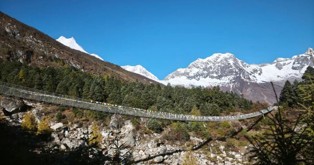
Suspension bridge on the way to Samagaun
Guide and Porter Support
Do You Need a Guide
Yes. Beyond the legal requirement, the terrain, altitude, and remoteness of the Manaslu Pass trek make a competent guide genuinely essential. This is not the route to attempt independently, even if regulations allowed it.
Guides know trail conditions day to day and can adjust plans based on weather and health.
Communication in remote villages requires Nepali language ability.
In an emergency, a guide's network and local knowledge are irreplaceable.
Benefits of Hiring a Guide
Navigation on the pass trekking route above the snowline is not always straightforward.
Guides monitor altitude symptoms and make experienced calls on pacing.
Trek to Manaslu with a knowledgeable guide, and the safety margin improves significantly.
Cultural interpretation of villages, monasteries, and local customs enriches the experience.
Porter Support and Load Management
Porters carry loads of up to 25 to 30 kilograms on the Manaslu Larke pass section of the route. Hiring a porter means trekkers carry only a daypack, which makes a considerable difference on a crossing day.
A lighter pack reduces fatigue and lowers altitude sickness risk by allowing better breathing.
Standard porter rates run between USD 25 and USD 35 per day.
Porter welfare matters. Ensure your agency provides porters with adequate gear and insurance.
Packing List for Larkya La Pass
Essential Gear for Crossing Day
Item
Notes
Headlamp with spare batteries
A pre-dawn start is standard
Trekking poles
Critical for descent stability
Microspikes or crampons
Condition-dependent; guide advises
Daypack (20–25 L)
Carry only essentials on crossing day
Clothing for Cold and Wind
Down jacket (rated to at least minus 15 degrees Celsius)
Windproof outer shell
Thermal base layers (top and bottom)
Fleece mid-layer
Insulated gloves and a spare pair of liner gloves
Balaclava or neck gaiter
Warm hat and sun hat (both needed on crossing day)
Footwear and Grip Support
Double-layered or insulated waterproof trekking boots rated to minus 10 degrees Celsius or below
Thick wool or synthetic trekking socks (at least two pairs per crossing day)
Gaiters to keep snow out of boots during the high snow section
Safety and Backup Items
A personal first aid kit including Diamox (consult a doctor before use), blister care, and basic wound supplies
Emergency space blanket
Snacks for 12 hours (energy gels, nuts, chocolate, dried fruit)
2 litres of water in insulated bottles to prevent freezing
Whistle and personal locator beacon if trekking without agency support
Safety Tips for Crossing the Pass
Start Time and Pacing
Depart no later than 5:00 a.m. from Larkya Phedi. Moving steadily and conserving energy in the first two hours is more important than speed.
Keep a pace at which you can hold a short conversation. If you cannot, slow down.
Rest stops should be brief. Stopping for too long in cold air lowers core temperature quickly.
Food, Water, and Energy Use
The body burns significantly more calories at altitude during sustained effort. Eating before departure, even if appetite is low, is therefore important.
Eat small amounts regularly rather than large meals at infrequent stops.
Drink water consistently. Dehydration accelerates altitude sickness symptoms.
Hot tea at Larkya Phedi before departure provides warmth and fluids in one.
Recognising Unsafe Conditions
Fresh overnight snow exceeding 30 centimetres changes the nature of the crossing significantly. Wind speeds above 60 kilometres per hour at the summit make the crossing dangerous regardless of snow conditions.
If your guide assesses conditions as unsafe, the pass will wait. The Larkya La Pass crossing can be delayed by one day.
Guides should not be pressured to continue in precarious situations. Their judgement is based on experience, not caution.
Emergency Situations
There are no rescue stations between Larkya Phedi and Bimthang. Helicopter rescue is possible but depends on weather windows and can take hours to arrange.
In the event of a serious medical emergency, immediate descent is always the first action.
All trekking agencies operating in the Manaslu region are required to carry basic emergency equipment.
Travel insurance with helicopter evacuation cover is not optional on this route.
Common Mistakes to Avoid
Underestimating the Pass
The most common error is treating the Larke pass as simply a long walk. It is not. The cumulative demands of altitude, distance, cold, and early start combine to make crossing day genuinely hard.
Trekkers who arrive undertrained or underslept at Larkya Phedi frequently struggle significantly.
Overconfidence based on previous lower-altitude trekking experience is a recurring issue.
Poor Acclimatisation Planning
Cutting rest days to save time is the primary reason trekkers turn back or fall seriously ill near the pass.
Rushing the Manaslu Circuit trek to complete it in fewer than 14 days is risky above 3,500 metres.
Symptoms that seem minor in the evening can deteriorate overnight at high altitude.
Inadequate Gear
Under-layering for the cold is a consistent problem among trekkers who underestimate overnight temperatures at Larkya Phedi.
Down sleeping bags rated to minus 15 degrees Celsius are recommended for the upper section.
Cotton clothing is inappropriate at altitude. It retains moisture and loses insulating properties when damp.
Renting gear in Kathmandu is a practical option for trekkers not bringing their own equipment.
Choosing the Wrong Season
Planning to trek the Manaslu circuit without checking seasonal conditions carefully is an avoidable mistake.
The best time to visit is spring (April to May) or autumn (October to November).
Booking in December through February without confirming pass status with a local agency creates real risk.
Even within open seasons, a week of unusual snowfall can close the pass temporarily.
Cost Overview
Permit Costs
Permit
Fee
Manaslu Restricted Area Permit (peak season)
USD 100 per person per week.
Manaslu Conservation Area permit
NPR 3,000 (~USD 22)
ACAP Permit (Annapurna Conservation Area Permit)
NPR 3,000 (~USD 22)
TIMS card
NPR 2,000 (~USD 15)
Guide and Porter Costs
Service
Daily Rate (approx.)
Licensed trekking guide
USD 35 to USD 50 per day
Porter
USD 25 to USD 35 per day
Guide and porter package (agency)
Varies by operator
A standard 14-day Manaslu Larkya La pass trek with a guide and porter runs between USD 1,200 and USD 2,000, depending on group size and agency.
Equipment Costs
Gear rental in Kathmandu (sleeping bag, down jacket, trekking poles) costs approximately USD 2 to USD 5 per day per item.
Buying quality gear before departure is more cost-effective for trekkers planning multiple Himalayan treks.
Budget an additional USD 150 to USD 300 for equipment if renting in Kathmandu for a 14-day trek.
Larkya La Pass: Final Verdict
Larkya La Pass is the highest point and the hardest day on the Manaslu Circuit trek, and it earns that reputation honestly. The crossing demands fitness, acclimatisation, the right gear, and a clear head. Trekkers who prepare properly and follow their guide's judgement find it one of the most rewarding pass trekking experiences in Nepal. Those who cut corners on rest days or underestimate the cold tend to struggle in ways that are difficult to recover from at that altitude.
What makes the La Pass on the Manaslu worth the effort goes well beyond the summit views. The route leading to it passes through some of the most remote and culturally intact villages in the Himalaya. On this Larkya Pass trek, you'll pass through landscapes that see a fraction of the traffic on more popular circuits like the Everest Base Camp trek. That remoteness is the point. This is pass trekking for people who want a genuine Himalayan experience, not a managed one.
If you are planning to trek the Manaslu Circuit and visit Larkya La Pass, start your preparation early and treat the logistics seriously. Sort your permits, hire a licensed guide, build rest days into your itinerary, and invest in proper cold-weather gear. To reach Larkya La Pass safely and on schedule, everything from acclimatisation, permit management, and packing strategy must be handled with care. The Larkya La Pass, Nepal, crossing is not something to improvise on. Done well, it is the kind of day that stays with a trekker for a long time. For planning support and guided options, Nepal Everest Base Camp Pvt. Ltd is available. Contact us for details and bookings.
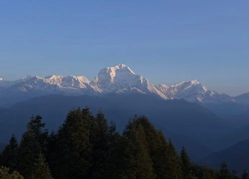
Larke la pass, top view
Larkya La Pass: FAQs
How Difficult Is Larkya La Pass?
Larkya La Pass difficulty is rated strenuous, making it one of the more challenging high passes in Nepal for non-technical trekkers. The combination of sustained altitude above 5,000 metres, a long crossing day of 8 to 11 hours, pre-dawn cold, and total remoteness puts it firmly in the demanding category. Prior trekking experience at altitude is strongly recommended before attempting the pass.
How Long Does It Take to Cross?
The time to cross Larkya La from Larkya Phedi to Bimthang is typically 8 to 11 hours, depending on fitness, conditions, and pace. Most guided groups depart between 3:00 and 5:00 a.m. to complete the ascent before winds intensify, and the descent to Bimthang takes another 4 to 6 hours from the summit.
Is It Suitable for Beginners?
The Larkya La Pass trek is not recommended for first-time trekkers with no prior altitude experience. Trekkers who have completed multi-day routes such as Everest Base Camp or the Annapurna Circuit at comparable altitudes are far better positioned to complete the trek safely and confidently.
Do You Need Special Equipment?
Insulated waterproof boots; a quality down jacket; trekking poles; and microspikes or crampons, depending on conditions, are essential for crossing the Larke La Pass. A sleeping bag rated to minus 15 degrees Celsius is also necessary for nights at Larkya Phedi. Standard trekking gear from lower altitude trails is generally insufficient for this high-altitude pass.
What Is the Highest Altitude?
The Larkya La Pass elevation reaches 5,106 metres (16,752 feet) at the summit, making it the highest point of the Manaslu circuit and the highest pass on the standard route. Trekkers remain above 4,800 metres for approximately two to three hours during the crossing, which is the sustained altitude period that makes acclimatisation so critical.
When Is the Best Time to Cross Larkya La Pass?
The best time to cross is during spring (late March to May) and autumn (October to November). Spring offers stable snow conditions and long daylight hours, while October provides clear post-monsoon skies and excellent summit visibility. The best time to visit for most international trekkers is April or October, when weather windows are most reliable and teahouses along the Larkya La Pass, Nepal, route are fully operational.
Blending digital strategy with mountain passion, I help adventurers find their way to the Himalayas online. With hands-on experience in Nepal’s trekking trails and a role at Nepal Everest Base Camp Trekking Co., Thamel, I combine SEO expertise with true trail insight.