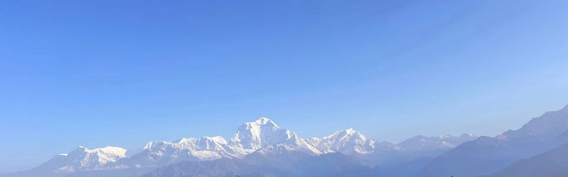
Summary: Mount Dhaulagiri, Nepal's seventh-highest peak at 8,167m, sits in Myagdi District beside the Kali Gandaki Gorge, once believed the world's tallest before Everest's survey. First summited in 1960 via the northeast ridge by a Swiss-Austrian team led by Max Eiselin, it remains one of the most dangerous eight-thousanders due to avalanche risk and remote logistics. Its name, meaning "white mountain", reflects year-round snow cover visible from Pokhara.
Inside the World of Mount Dhaulagiri
Most people who come to Nepal expecting big mountains are prepared for scale. What they are not always prepared for is Mount Dhaulagiri in the Annapurna region. At 8,167 metres, it is the seventh-highest mountain in the world, but the number does not quite capture what the mountain actually looks like when you are standing in the lower valleys of the Kali Gandaki and looking west. It rises almost without preamble. No long build-up of foothills, no gradual approach. The terrain goes from river valley to permanent ice in a vertical gain that very few Himalayan giants can match.
Dhaulagiri was, for a period in the early nineteenth century, believed to be the highest mountain in the world. That belief held for several decades before better surveys established Mount Everest as the true world's highest mountain. The story of that misidentification says something real about how overwhelming Dhaulagiri looks from the plains below. It is, in short, the kind of mountain that makes a strong impression before you know anything about it.
This guide covers the mountain in full. You will find sections on its precise location in Nepal, its geographic prominence, the meaning of its name, the structure of the Dhaulagiri massif, and the landscape that surrounds it. There is also detailed coverage of its geological formation, climate patterns, flora and fauna, and the ecosystems in its shadow. The history section covers the early surveys, the long period when Dhaulagiri was thought to be the highest mountain in the world, and the story of the 1960expedition that finally reached the summit. Whether you are planning a trek in the this region with Nepal Everest Base Camp, researching the mountain, or simply curious about one of the great alpine mountains of Nepal, this guide gives you the full picture.
Where Is Mount Dhaulagiri?
Mount Dhaulagiri sits in west-central Nepal, within Myagdi District, Gandaki Province. It lies roughly 65 kilometres northeast of Pokhara and approximately 260 kilometres west of Kathmandu. The mountain is part of the Dhaulagiri Himal, a sub-range of the broader central Himalayan mountain range running east to west across northern Nepal.
Distance from Kathmandu: Approximately 260 km west
Nearest major town: Beni, Myagdi District
One of the most striking geographic facts about Dhaulagiri is its relationship with the Kali Gandaki Gorge. The Kali Gandaki valley cuts between Dhaulagiri to the west and the Annapurna massif to the east of Dhaulagiri, forming what many geographers consider the deepest gorge in the world by certain measurements. The Gandaki River flows through this corridor at roughly 2,500 metres. The vertical difference between the river and the summit of Dhaulagiri exceeds 5,500 metres within a horizontal distance of under 40 kilometres. That compression of relief is difficult to imagine until you are actually standing in the gorge looking up.
Nearby mountains and features:
Mountain or Feature
Approx. Distance
Notes
Annapurna I
~34 km east
Separated by the Kali Gandaki gorge
Nilgiri North
~28 km east
Part of the Annapurna massif
Tukuche Peak
~15 km northeast
Within the Dhaulagiri Himal
Mustang District
~30 km north
High desert plateau, trans-Himalayan zone
Myagdi District
Immediate south
Primary access region for base camp approaches
Height, Ranking, and Prominence
Mount Dhaulagiri stands at 8,167 metres (26,795 feet) above sea level. This figure has been confirmed across multiple surveys by the Survey of India and later GPS-based measurements. Among the fourteen eight-thousanders, Dhaulagiri is the seventh-highest mountain in the world, sitting just four metres above Manaslu in the global ranking. That margin was, historically, a subject of survey dispute.
Dhaulagiri consistently looks larger than its rank suggests. Its topographic prominence of roughly 3,357 metres places it among the most dramatically rising mountains on earth. The face of Dhaulagiri on its south side rises nearly 4,000 metres from the valley floor in an almost unbroken wall of ice and rock. Very few mountains anywhere can show that kind of vertical gain from a single viewpoint. As a recognised peak in the world of this scale, its combination of height and isolation is what sets it apart from other eight-thousanders of comparable elevation.
Key structural facts:
The northeast ridge is the most commonly attempted line of ascent
The southeast ridge offers an alternative approach with greater technical demands
The mountain has five major faces: north, south, east, west, and southwest
Ice cliff systems on the south face make it one of the most avalanche-prone walls in the range
Meaning and Origin of the Name
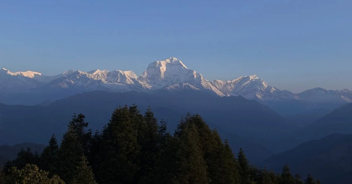
The name 'Dhaulagiri' comes from two Sanskrit words: 'dhawala', meaning 'white' or 'dazzling', and 'giri', meaning 'mountain'. The combined meaning is the "white mountain", which the mountain earns through its year-round snow cover across almost every visible face. Even in the dry post-monsoon season, when many other Himalayan faces show bare rock, the upper ridges of Dhaulagiri stay covered. As a result, the views of Dhaulagiri from the Kali Gandaki trail and from viewpoints near Pokhara consistently show a white mass rising above everything around it.
The Dhaulagiri Massif
The Dhaulagiri massif is the collective name for the entire mountain group centred on Dhaulagiri I. The massif covers a large area of Myagdi District and contains multiple distinct peaks, each with its own character and climbing history. The Dhaulagiri Himal as a whole spans roughly 120 kilometres through western Nepal and forms one of the most concentrated collections of high-altitude terrain in the country.
Major peaks in the Dhaulagiri range:
Peak
Elevation
Notes
Dhaulagiri I
8,167 m
The main summit, the seventh highest mountain in the world
Dhaulagiri II
7,751 m
Northwest of the main peak
Dhaulagiri III
7,715 m
Challenging, rarely attempted
Dhaulagiri IV
7,661 m
Part of the Western Massif group
Dhaulagiri V
7,618 m
Southern extension of the range
Tukuche Peak
6,920 m
Common reference point for trek approaches
When people refer to wanting to climb Dhaulagiri, they almost always mean Dhaulagiri I. The other peaks of the Dhaulagiri Himal are significant in their own right but sit, in most accounts, in the shadow of the main summit.
Mount Dhaulagiri Range
Geography and Landscape
The terrain surrounding Mt Dhaulagiri is steep, varied, and in places severe. To the south, deep river valleys cut down from the massif toward the lower hills of Myagdi. To the north, meanwhile, the land transitions toward the dry, high-altitude plateau of Mustang.
Key terrain features:
Deep glacial valleys on the eastern and northern flanks of the mountain ranges.
High passes connecting the Dhaulagiri region to neighbouring valleys
Dense rhododendron and pine forest in the lower approach zones below 3,500 metres
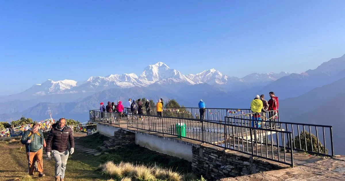
The glacier systems feeding off Dhaulagiri include the Chonbardan Glacier on the northeastern flank, which supplies the upper Myagdi Khola and serves as an important water source for communities further downstream. Base camp for the northeast ridge route sits near the terminus of this glacier at around 4,750 metres. The Gandaki River and its tributaries drain the eastern and southern flanks of the massif. The Kali Gandaki flows south through the gorge between Dhaulagiri and Annapurna, and the Myagdi Khola joins the Gandaki River near Beni. Together, these river systems define the approach routes for any trek toward Dhaulagiri base camp. On a clear morning, the mountain is visible from Phewa Lake in Pokhara, and the views of Dhaulagiri from the Annapurna trekking circuit near Ghasa, and poon hill route are among the most striking mountain panoramas in Nepal.
Geological Formation of Mount Dhaulagiri
The Himalayan mountain range, including Dhaulagiri, formed through the collision of the Indian and Eurasian tectonic plates beginning around 50 million years ago. As the Indian plate pushed northward, the crust buckled and thickened, pushing rock upward over millions of years to create the highest mountain range on earth. That process is still active today.
Dhaulagiri is built primarily from metamorphic and sedimentary rocks that were once part of the ancient Tethys Sea floor. The upper layers contain limestone and other sedimentary material, which is evidence of the marine origins of rock now sitting above 8,000 metres. Key geological features include:
A metamorphic core complex at the heart of the massif
Thrust faults cutting through the lower flanks
Glacial erosion shaping the cirques and ridgelines
Active uplift still adding small increments of elevation each year
The Dhaulagiri region sits in one of the most seismically active zones on earth. The Indian plate continues its northward movement at roughly 45 millimetres per year, and Nepal experiences regular earthquakes as a result. The terrain around the massif shows clear evidence of past mass movements and ongoing slope instability, which every mountaineer and trekker in the area should be aware of.
Climate and Weather Conditions
Dhaulagiri's climate follows two major seasonal cycles: the South Asian monsoon from June to September and the dry, cold winter from December to February. The transition seasons bring the most unpredictable weather on the mountain, and the summit zone sits above most weather systems for much of the year.
Seasonal overview:
Season
Months
Conditions
Pre-monsoon
March to May
Best window for expedition attempts
Monsoon
June to September
Heavy snowfall, high avalanche risk
Post-monsoon
October to November
Second viable window, colder nights
Winter
December to February
Extreme cold, very high winds at summit
At high altitude, wind speeds above 8,000 metres regularly exceed 100 km/h during winter and early spring. The summit zone accumulates fresh snow rapidly after storms, which increases the load on the upper faces and raises avalanche risk on the main routes to Dhaulagiri. Temperature varies sharply with elevation:
Valley floor near Beni (800 m): 15°C to 30°C in summer
Base camp (4,750 m): -5°C to 10°C in spring
Camp 2 (~6,700 m): -15°C to -25°C in spring
Summit (8,167 m): -30°C to -50°C in winter conditions
October and November offer the clearest views of Dhaulagiri from lower elevations. March and April also provide good visibility. The monsoon between June and September, however, produces consistent cloud cover that hides the summit from valley viewpoints, and frequent flight disruptions to Lukla affect expedition arrivals through Kathmandu during this period.
Flora and Fauna Around Dhaulagiri
The altitude gradient around Dhaulagiri creates one of the most compressed ecological transitions on earth. Within a horizontal distance of around 40 kilometres, you move from subtropical riverine habitat to permanent glacial ice. This gradient supports high biodiversity in the lower and mid zones, giving way to sparse but well-adapted life higher up.
Vegetation zones by altitude:
800 to 2,000 m: Subtropical broadleaf forest, terraced farmland, bamboo
2,000 to 3,000 m: Temperate mixed forest, rhododendron, oak, and maple
3,000 to 4,000 m: Subalpine fir and birch, with dense rhododendron thickets
4,000 to 5,000 m: Alpine meadows, dwarf shrubs, and sparse grasses
Above 5,000 m: Rock, ice, and permanent snow
Wildlife commonly encountered on trek approaches toward Dhaulagiri base camp:
Himalayan tahr, a large ungulate common on steep rocky terrain
Blue sheep (bharal), frequently seen above 4,000 metres
Snow leopard, rarely seen but with tracks reported on high ridges
Red panda in the lower forest zones
Griffon vultures and Himalayan snowcock at high-altitude terrain.
History of Mount Dhaulagiri
Early Exploration and the Survey Years
Dhaulagiri embark Western geographic records in the early nineteenth century through the Survey of India, which operated across Nepal from distant observation. The mountain's mass made it visible from far away, and early estimates consistently placed it at the top of known elevations. For several decades, Dhaulagiri was thought to be the highest mountain in the world. That belief persisted until better survey data from the Karakoram and the systematic triangulation work of the Great Trigonometrical Survey of India identified Mount Everest as the definitive world's highest mountain. Dhaulagiri settled into its current rank as the seventh highest peak, but the historical context gives the mountain a weight that elevation figures alone cannot provide.
Systematic mapping of Dhaulagiri and the surrounding region continued through the mid-nineteenth and into the twentieth century. By the early twentieth century, the elevation of Dhaulagiri was well established, and the Dhaulagiri mountain had been identified as a major target for future expeditions. Multiple national teams attempted the ascent of Dhaulagiri before the 1960 breakthrough, each finding the routes to Dhaulagiri more demanding than early surveys had suggested from a distance.
The First Successful Ascent in 1960
Dhaulagiri was first climbed on May 13, 1960, by a Swiss-Austrian team led by Max Eiselin. The team led by Max Eiselin had spent years preparing for the climb Dhaulagiri objective, and the 1960 expedition was their breakthrough after a series of failed national attempts. The first successful summit push used the northeast ridge as the primary line, which subsequently became the normal route on the mountain. The Swiss-Austrian team used a Pilatus Porter aircraft to ferry supplies to a high camp, an innovative logistics approach for its era.
The summit team who reached the summit on May 13 included:
Climber
Nationality
Kurt Diemberger
Austrian
Albin Schelbert
Swiss
Ernst Forrer
Swiss
Peter Diener
German
Nawang Dorje
Sherpa
Nima Dorje
Sherpa
Kurt Diemberger went on to become one of the most respected mountaineers of the twentieth century. He is one of only two climbers ever to make the first ascent of two eight-thousanders without supplemental oxygen.The Swiss climbers, including Albin Schelbert and Ernst Forrer, made up the core technical team, while Sherpa members Nawang Dorje and Nima Dorje played key roles in the successful ascent. The role of Nawang and the wider Sherpa support team across the full expedition is well documented in accounts of the climb the mountain effort. Months of base camp preparation and multiple ascent attempts preceded the day they finally summit Dhaulagiri.
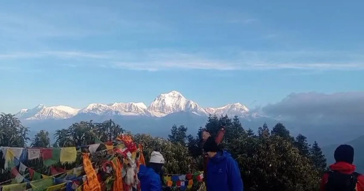
Exploring mountain view of Dhaularigi range from Poon hill
Why Mount Dhaulagiri Is Considered Dangerous
Dhaulagiri is not a mountain that rewards casual preparation. The routes to Dhaulagiri are technically demanding from the start, and the conditions change fast. The northeast ridge, which serves as the normal route, involves sustained sections of steep snow and ice. The southeast ridge, meanwhile, is considered even more committing, with fewer natural shelters and greater exposure to wind.
Key technical hazards on Dhaulagiri:
Icefalls and seracs on the upper glacier approaches
Exposed ridge sections above camp 2 where wind can stop a summit push entirely
Rock bands on the southeast ridge requiring mixed climbing at high altitude
Corniced ridgelines on the northeast ridge that can collapse without warning
The face of Dhaulagiri on its southern side funnels enormous amounts of snow onto the lower slopes during monsoon and winter loading periods. Avalanche paths on this face are well-documented across expedition records. Several teams have, in fact, suffered losses on the approaches and lower flanks as a direct result. The unpredictable weather systems that develop around the massif can produce whiteout conditions within hours, cutting off descent routes from Camp 2 and above.
Among the eight-thousanders, Dhaulagiri has a fatality rate that places it consistently in the more dangerous half of the group. The remoteness of the base camp approach adds a logistical layer that the busier trails do not have. Rescue options above base camp are extremely limited. Most climbers who have attempted to summit Dhaulagiri describe weather window management as the decisive factor, far more than technical skill alone.
Cultural and Religious Importance
Mount Dhaulagiri in Nepali Culture
For communities living in Myagdi District and the surrounding Gandaki Province, Dhaulagiri is not an abstraction. It shapes the local climate, feeds the rivers that sustain agriculture, and forms the permanent backdrop of the inhabited valleys below. The Magar and Gurung communities of the mid-hills south of Dhaulagiri have lived with the mountain as a constant presence for centuries. In local tradition, high mountains are not simply terrain. They are inhabited by spirits and are deserving of respect.
Before any major undertaking, including expeditions to the upper mountain, local Sherpa and high-altitude workers traditionally conduct puja ceremonies at base camp to seek permission and protection. This practice has been consistent across expeditions from the 1960 first ascent to the present day and is taken seriously regardless of the nationalities of the climbers involved.
Spiritual Importance in Himalayan Traditions
Across the broader Himalayan tradition, mountains of this scale occupy a space between the physical and the sacred. In Nepali, himal is not just about a mountain itself, but the wider world and presence that surrounds it. Sherpa communities bring this tradition to base camp on every expedition. Puja ceremonies include offerings to the mountain, prayers for a safe journey, and a moment of respect for the powerful natural world the group is about to enter.
Communities Living Around the Dhaulagiri Region
Magar communities dominate the middle hills of Myagdi District
Gurung communities are present further east toward the Kali Gandaki corridor
Thakali traders historically moved goods through the Kali Gandaki valley between Nepal and Tibet
Small Sherpa populations from Solu-Khumbu work seasonally on Dhaulagiriexpeditions
The town of Beni serves as the main logistics hub for trekkers and expedition teams approaching the mountain
Mount Dhaulagiri Compared to Other Himalayan Peaks
Dhaulagiri vs Mount Everest
Feature
Dhaulagiri
Mount Everest
Height
8,167 m
8,849 m
Global Rank
7th highest mountain
1st
Topographic Prominence
~3,357 m
~8,849 m
First Ascent
1960
1953
Annual Expeditions
20 to 40
300 to 500+
Base Camp Access
Remote, serious trek
Well-developed trail
Dhaulagiri and Mount Everest are different kinds of challenges. Everest is higher, far more commercialised, and considerably more accessible from Kathmandu via established infrastructure. Dhaulagiri, on the other hand, is quieter, more isolated, and carries a reputation among serious mountaineers for demanding greater self-sufficiency from its climbers.
Dhaulagiri vs Annapurna
Annapurna I sits around 34 kilometres east of Dhaulagiri, separated by the Kali Gandaki Gorge. Mount Annapurna stands at 8,091 metres, making it slightly lower than Dhaulagiri. Despite being the seventh-highest mountain versus Annapurna's tenth, Annapurna carries a higher historical fatality rate and is widely considered the more dangerous of the two. The Annapurna region benefits from one of the most popular trek circuits in Nepal, bringing far more visitors to the surrounding area than the Dhaulagiri approaches attract. Both mountains are visible from Pokhara on clear days.
Dhaulagiri vs Manaslu and Other Eight-Thousanders
Mount Manaslu (8,163 m) sits just four metres below Dhaulagiri in the global ranking
Manaslu has a well-established trekking circuit that has grown significantly in popularity
Dhaulagiri remains considerably less visited, with fewer commercial expeditions operators running guided ascent packages
The 7th highest peak status means Dhaulagiri sits above Annapurna, Manaslu, and all remaining eight-thousanders in the ranking, yet receives a fraction of their media attention
Feature
Dhaulagiri
Annapurna I
Manaslu
Height
8,167 m
8,091 m
8,163 m
Global Rank
7th
10th
8th
First Ascent
1960
1950
1956
Trek Popularity
Lower
Very high
High
Interesting Facts About Mount Dhaulagiri
Lesser-Known Facts and Records
Dhaulagiri was thought to be the highest mountain in the world for several decades in the early nineteenth century, before modern survey methods resolved the question
One of the earliest applications of aviation logistics in Himalayan mountaineering was the 1960 expedition, which employed a light aeroplane to transport supplies to a high base camp
The Kali Gandaki gorge between Dhaulagiri and Annapurna is deeper than the Grand Canyon when measured from peak to river floor
Dhaulagiri has been attempted via at least seven distinct routes, though only two or three have seen a successful ascent
Kurt Diemberger of the 1960 team also made the first ascent of Broad Peak in 1957, becoming one of only two people to make first ascents of two eight-thousanders
Despite being the 7th highest mountain in the world, Dhaulagiri receives a fraction of the media coverage and commercial expedition traffic of several lower-ranked peaks
The Mount Dhaulagiri massif contains five distinct named peaks above 7,500 metres, making it one of the most concentrated high-altitude areas in Nepal
Environmental Changes and Conservation
The glacier systems feeding off Dhaulagiri have shown measurable retreat over the past several decades. The Chonbardan Glacier, like many others in Nepal, is gradually losing its size and length as rising temperatures accelerate ice melt.
Key environmental challenges in the Dhaulagiri region:
The risk of glacial lake outburst floods (GLOFs) is rising as meltwater builds up behind shaky moraine dams
Vegetation zones are shifting upward as temperatures rise, altering the alpine ecosystems that support wildlife in the region
Expedition waste management remains a challenge at base camp and on the upper mountain routes
Increased trekker traffic on approach routes has added pressure to trail infrastructure and local resources in Myagdi District
The broader conservation area framework in Nepal covers parts of the Dhaulagiri Himal through the Dhorpatan Hunting Reserve and adjacent protected zones. Efforts by government agencies and local community groups focus on wildlife corridor protection for snow leopard and Himalayan tahr populations, waste management for trekking and expedition teams, and monitoring of glacier systems by research institutions working in western Nepal. The conservation area network does not yet fully cover the Dhaulagiri massif to the same degree as the Annapurna conservation area to the east. As a result, there is ongoing discussion about extending protections further west into the Dhaulagiri Himal zone.
Mount Dhaulagiri: A Mountain Worth Understanding
Mount Dhaulagiri is one of the great natural facts of Nepal. It is older than any record of it, more complex than any survey has fully captured, and more significant to the people who live beneath it than any ranking system can reflect. The mountain has shaped rivers, sustained ecosystems, and defined the skyline of an entire region for as long as anything about this part of the world has been recorded. Understanding Dhaulagiri means understanding something real about how the Himalayan mountain range was made and why the terrain around the Kali Gandaki gorge looks the way it does. Dhaulagiri rising above the Kali Gandaki Gorge creates one of the most breathtaking landscapes in the Himalayas. The vertical gain from river to summit is extraordinary, and it is easy to see why early European surveyors believed this was the highest thing on earth. Among climbers, the mountain's reputation rests on more than height. The routes to Dhaulagiri are demanding, the weather moves fast, and the isolation of Dhaulagiri base camp means that decisions made high on the mountain carry real consequences.
Dhaulagiri is not trying to be accessible. It sits at a remove from the main trekking circuits, requires a genuine approach, and rewards effort with a level of solitude and mountain presence that the more visited corners of Nepal can rarely offer. For trekkers willing to commit to the longer approach, the circuit around the Dhaulagiri massif offers terrain and views of Dhaulagiri that are genuinely different from anything on the Annapurna or Everest trails. The white mountain of Nepal has been known by that name for a long time. The interest it generates does not appear to be fading. Nepal Hiking Adventure can help you plan your Dhaulagiri trek with the right route, permits, logistics, and local support. Contact us to discuss your trekking plans and prepare for the journey.
Mt Dhaulagiri
Mount Dhaulagiri: FAQs
How High Is Mount Dhaulagiri and What Is Its Global Ranking?
Mount Dhaulagiri stands at 8,167 metres (26,795 feet) above sea level. Dhaulagiri is the seventh-highest mountain in the world among the fourteen recognised eight-thousanders, sitting just four metres above Manaslu in the global ranking.
Where Is Mount Dhaulagiri Located in Nepal?
Dhaulagiri is located in west-central Nepal, within Myagdi District, Gandaki Province. It sits roughly 65 kilometres northeast of Pokhara and approximately 260 kilometres west of Kathmandu, within the Dhaulagiri Himal sub-range.
Who First Climbed Mount Dhaulagiri and When?
Dhaulagiri was first successfully climbed on May 13, 1960, by a Swiss-Austrian expedition led by Max Eiselin. The summit team included Kurt Diemberger, Albin Schelbert, Ernst Forrer, Peter Diener, Nawang Dorje, and Nima Dorje. They used the northeast ridge as their line of ascent.
Is Dhaulagiri More Dangerous Than Annapurna?
Dhaulagiri has a significant fatality rate among the eight-thousanders, though Annapurna I is generally considered the more dangerous of the two by historical summit-to-death ratios. Both mountains carry serious avalanche and weather risks, and both demand careful preparation from any climber attempting to climb the mountain.
Blending digital strategy with mountain passion, I help adventurers find their way to the Himalayas online. With hands-on experience in Nepal’s trekking trails and a role at Nepal Everest Base Camp Trekking Co., Thamel, I combine SEO expertise with true trail insight.