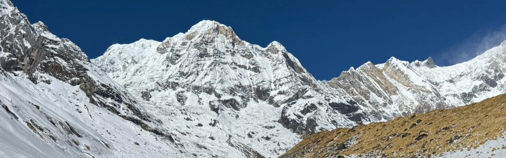
Mount Annapurna stands at 8,091 metres, making it the 10th highest mountain in the world. However, it's known less for its rank and more for its reputation. Consequently, the fatality rate on Annapurna has historically been among the highest of any Himalayan peak, which draws serious climbers and careful planners alike. Meanwhile, for trekkers, the Annapurna region offers some of the most accessible and varied trails in Nepal, ranging from villages to alpine zones.
Annapurna sits in north-central Nepal, part of the broader Himalayas. Furthermore, the Annapurna massif contains several peaks, including Annapurna South, Annapurna II, Annapurna III, and Annapurna IV. Notably, it was the first 8,000-metre peak to be summited, by Maurice Herzog and Louis Lachenal in 1950. Indeed, that achievement marked a turning point in high-altitude mountaineering, proving such summits were possible.
This guide, prepared by Nepal Everest Base Camp Co., explains the geography, history, and practical realities of visiting the Annapurna region. Additionally, it covers trekking routes, including the Annapurna Circuit and Annapurna Base Camp trek, permit requirements, seasonal conditions, and cultural context. The content is written for travellers planning a trek in Nepal within the coming months, who value accuracy and local insight over promotional language.
Overview of Mount Annapurna
Height, Rank, and Global Significance
Attribute
Detail
Elevation
8,091 metres (26,545 feet) above sea level
Global Rank
10th highest mountain in the world
Coordinates
28.5958° N, 83.8203° E
Mountain Range
Annapurna Himal, part of the Himalayas
Location
Gandaki Province, north-central Nepal
First Ascent
3 June 1950 by Maurice Herzog and Louis Lachenal
Notable Feature
One of the most dangerous 8,000-metre peaks for climbers
Known Risk Factor
Extremely high historical fatality rate compared to other 8,000-metre peaks
Nearest Major Settlement
Pokhara, approximately 40 km south
Mount Annapurna is not the tallest in the Himalayas, yet it holds significant weight in mountaineering history. Specifically, Annapurna was the first 8,000-metre summit ever reached, setting a precedent for expeditions to Mount Everest and other giants. Moreover, the south face of Annapurna is particularly notorious for its steepness and avalanche risk, making it a technical challenge even for experienced climbers.
Exact Location and Regional Setting in Nepal
Mount Annapurna lies in the Annapurna mountain range of Gandaki Province, roughly 200 kilometres northwest of Kathmandu. The Annapurna massif stretches east to west, bordered by the Kali Gandaki gorge to the west and the Marsyangdi River valley to the east.
Key geographic features include:
Pokhara serves as the gateway city, about 50 kilometres south
The massif forms a natural barrier between agricultural zones and high Himalayan plateaus
Villages such as Ghandruk, Manang, and Chhomrong sit in the foothills of Annapurna
Beyond settlements, the landscape shifts into glacial terrain, moraines, and ice
The Annapurna region spans from subtropical valleys at 1,000 metres to glacial zones above 4,000 metres. Consequently, this creates diverse ecosystems but also complicates route planning for trekkers and climbers.
The Annapurna Massif Explained
What the Annapurna Massif Is
The Annapurna massif is a compact mountain range containing multiple peaks above 7,000 metres. Furthermore, it spans roughly 55 kilometres and includes several distinct summits, all part of the same geological formation. The term 'massif' refers to a group of connected mountain peaks that share a common base, rather than a single standalone mountain.
The Annapurna Himal is the local name for this section of the Himalayas. Additionally, it's bounded by deep river valleys, which gives the range its dramatic relief. The Kali Gandaki gorge, one of the deepest in the world, runs along the western edge, separating Annapurna and Dhaulagiri.
Major Peaks Within the Annapurna Range
Peak
Elevation (metres)
First Ascent Year
Annapurna I
8,091
1950
Annapurna II
7,937
1960
Annapurna III
7,555
1961
Annapurna IV
7,525
1955
Annapurna South (Annapurna Dakshin)
7,219
1964
Gangapurna
7,455
1965
Machhapuchare (Fishtail Mountain)
6,993
Unclimbed (sacred)
Annapurna I, also called Annapurna One, is the highest and most technically demanding. Meanwhile, Annapurna South is visible from many trekking routes, including the Annapurna Base Camp trek. Machhapuchare, though lower, is culturally significant and remains closed to climbers out of respect for local beliefs.
Geological and Landscape Characteristics
Annapurna is composed of sedimentary and metamorphic rock, uplifted by the collision of the Indian and Eurasian tectonic plates. Key features include:
Steep ridges and hanging glaciers
Unstable slopes prone to avalanches
Snow and ice covering upper sections year-round
Lower zones transitioning into rhododendron forests and alpine meadows
Rapid terrain changes from subtropical valleys to glacial zones
Consequently, the combination of high relief and heavy monsoon precipitation makes the Annapurna prone to avalanches and rockfall. This variation creates diverse ecosystems but also complicates route planning for climbers and trekkers.
History of Mount Annapurna
Early Exploration and First Ascents
Before 1950, no 8,000-metre peak had been successfully climbed. Nepal opened its borders to foreign expeditions in 1949, and subsequently, the Annapurna massif became an early target. The French Alpine Club received permission for an Annapurna expedition in 1950, led by Maurice Herzog.
The team explored multiple approaches before committing to a route on the north face. The ascent of Annapurna was not well-documented compared to later Himalayan expeditions, partly because the team faced severe frostbite and had limited time before monsoon weather set in. Nevertheless, the success proved that humans could survive and function above 8,000 metres, which influenced planning for Mount Everest and other giants.
The First Ascent of Annapurna I
On 3 June 1950, Maurice Herzog and Louis Lachenal reached the summit of Annapurna, becoming the first people to stand on an 8,000-metre peak. However, the descent was catastrophic. Both men suffered severe frostbite, and Herzog lost his gloves near the summit, leading to amputations.
Key facts about Mount Annapurna include:
First successful climb of an 8,000-metre peak
Both summiteers suffered severe injuries during descent
The team navigated through storms and crevasses
Despite physical cost, the summit proved such climbs were possible
The route they used, the north face, remains a standard approach, though it's still considered dangerous due to avalanche risk and unstable snow conditions.
Annapurna's Influence on Himalayan Mountaineering
The 1950 Annapurna expedition influenced high-altitude climbing strategy. It showed that speed and acclimatisation were crucial and that even successful climbs carried significant risk. Later expeditions to Mount Everest and other peaks built on lessons learnt from Annapurna, including the importance of oxygen systems, weather forecasting, and descent planning.
The south face of Annapurna was first climbed in 1970 by a British team led by Chris Bonington, using a different and even more technical route. This climb is still regarded as one of the hardest achievements in Himalayan mountaineering. The face has seen few successful ascents since, and many climbers consider it more difficult than Mount Everest.
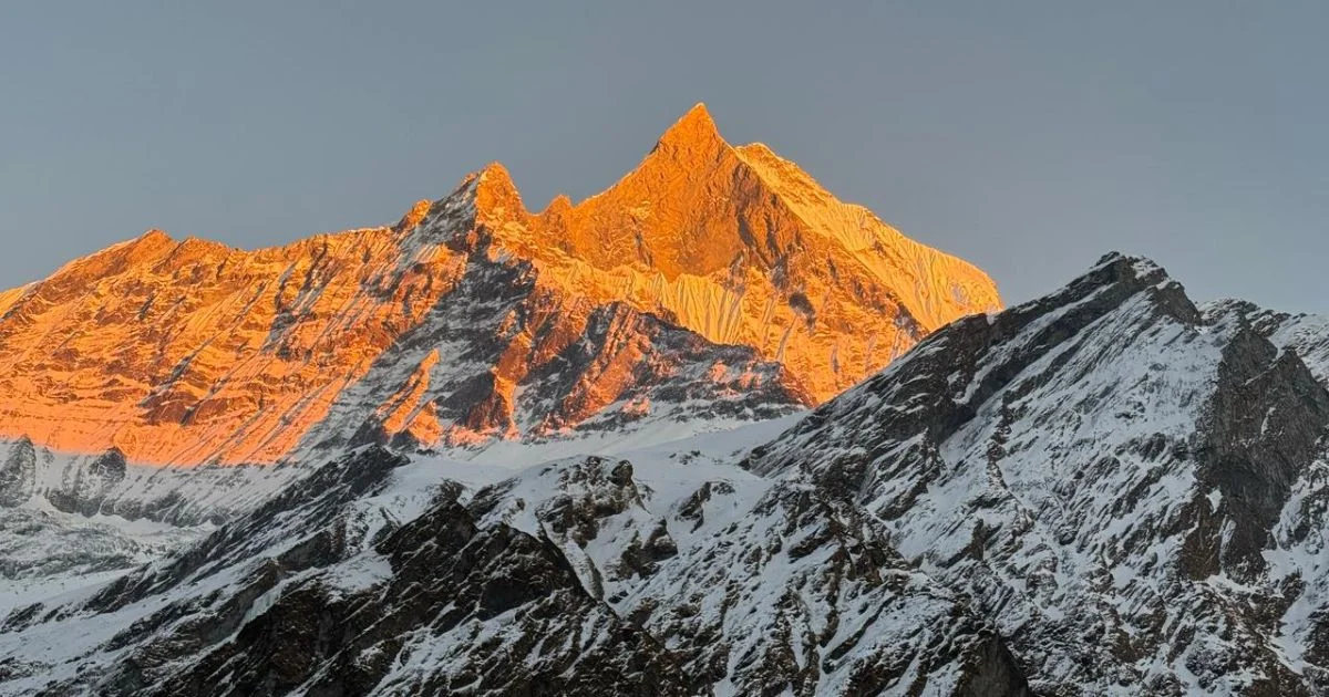
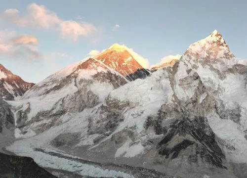
Machhapuchhre Seen from Machhapuchhre Base Camp
Origin and Meaning of the Name Annapurna
Sanskrit Meaning and Religious Context
"Annapurna" means "goddess of nutrition" or "full of food" in Sanskrit. It derives from anna, meaning food or grain, and pūrṇa, meaning full or complete. In Hindu tradition, Annapurna is a deity associated with abundance, sustenance, and the provision of food.
The Hindu deity Annapurna is often depicted:
Holding a cooking pot and ladle
Symbolising the provision of nourishment
Worshipped primarily in Varanasi, India
Her name extending across the Himalayas
The connection between the mountain and the goddess reflects the importance of the landscape in sustaining local communities through water, agriculture, and spiritual significance.
Cultural Importance in Nepal
For the Gurung, Magar, and other communities living around Annapurna, the mountain is sacred. Local beliefs discourage climbing Machhapuchare (Fishtail Mountain) because it's considered the home of Shiva. While Annapurna I is open to expeditions, the broader massif is treated with respect.
The Annapurna region is home to Buddhist monasteries and Hindu temples, particularly in areas such as Manang and Muktinath. Muktinath is a pilgrimage site for both Hindus and Buddhists, situated in the Annapurna mountain range on the Annapurna Circuit at 3,800 metres. The blend of religious traditions across the region makes cultural sensitivity important for visitors.
Climate, Weather, and Seasonal Conditions
Year-Round Weather Patterns
The Annapurna region experiences distinct seasonal patterns influenced by monsoon systems and altitude. Lower valleys remain relatively warm year-round, while higher elevations face extreme cold and wind.
Heavy rainfall in lower zones, snow at altitude, landslide risk, leeches common
Post-monsoon (Autumn)
September–November
Clear skies, stable weather, cold at night, peak trekking season
Winter
December–February
Cold temperatures, heavy snow above 3,500m, fewer trekkers, clear views
Temperatures vary dramatically by altitude. At 1,500 metres, daytime highs reach 20–25°C in autumn, while at 4,000 metres, temperatures drop to 5–10°C during the day and below freezing at night. Above 5,000 metres, temperatures rarely rise above freezing, even in summer.
Best Time to Visit the Annapurna Region
Autumn (September to November) and spring (March to May) are the most reliable seasons for trekking in the Annapurna region of Nepal. Autumn offers:
Stable weather patterns after monsoon clears
Clear mountain visibility
Comfortable temperatures at most elevations
Busy trails but well-stocked teahouses
Spring brings warmer conditions and blooming rhododendrons, particularly at mid-elevations. However, clouds often build in the afternoons, reducing visibility. Winter treks are possible but require preparation for snow and cold, especially on high passes such as Thorong La on the Annapurna Circuit.
Weather-Related Risks
Monsoon season (June–August) brings significant challenges:
Heavy rainfall causing landslides and trail damage
Reduced visibility obscuring mountain views
Leeches in forested areas below 2,500 metres
Flooding in river valleys
Winter conditions create different risks. Snow accumulation can close high passes, and cold temperatures increase the risk of hypothermia and frostbite. Shorter daylight hours also limit trekking time. Still, winter offers solitude and crystal-clear skies for those prepared for the conditions.
Annapurna Conservation Area
Overview and Size
The Annapurna Conservation Area (ACA) is the largest conservation area in Nepal, covering 7,629 square kilometres. Established in 1986, it protects the Annapurna mountain range and surrounding ecosystems. The Annapurna Conservation Area Project manages the zone, balancing environmental protection with local community needs.
The conservation area includes:
The entire Annapurna massif
Parts of the Annapurna and Dhaulagiri ranges
Multiple climate zones from subtropical to alpine
Over 100 villages and settlements
Major trekking routes, including the Annapurna Circuit and Annapurna Sanctuary
Unlike national parks, the ACA allows local communities to remain and participate in conservation efforts. Consequently, this model has helped preserve both natural and cultural resources while supporting sustainable tourism.
Flora, Fauna, and Biodiversity
Elevation Zone
Flora
Fauna
1,000–2,000 m
Sal forests, bamboo, subtropical vegetation
Langur monkeys, leopards, wild boar
2,000–3,000 m
Rhododendron, oak, pine forests
Red pandas, Himalayan tahr, musk deer
3,000–4,500 m
Juniper, alpine shrubs, grasslands
Blue sheep, snow leopards, Himalayan monal
Above 4,500 m
Sparse vegetation, lichens, moss
Lammergeiers, Himalayan griffons, pikas
The Annapurna region supports over 1,200 plant species, 100 mammal species, and 470 bird species. Rhododendrons bloom across mid-elevation forests between March and May, creating vibrant displays. Snow leopards inhabit the higher zones, though sightings are rare. Bird diversity is particularly high during spring and autumn migrations.
Conservation Rules and Responsible Travel
The Annapurna Conservation Area requires all visitors to obtain an ACAP permit. Entry fees support conservation programmes, trail maintenance, and community development. Rules within the conservation area include:
No plastic bags or non-biodegradable items
No hunting or collection of plants and animals
Stay on marked trails to prevent erosion
Use designated camping areas only
Respect local customs and sacred sites
Firewood collection prohibited; use kerosene or gas
Teahouses and lodges follow environmental guidelines, including waste management systems and solar power where possible. However, litter remains an issue on popular routes, so trekkers should carry out all waste and avoid single-use plastics.
People, Culture, and Life Around Annapurna
Indigenous Communities
The Annapurna region is one of the most culturally diverse areas in Nepal, home to several ethnic groups, each with distinct languages, customs, and livelihoods. Primary communities include:
Gurung: Dominant in lower southern villages such as Ghandruk and Landruk
Magar: Present in western areas and lower valleys
Thakali: Concentrated along the Kali Gandaki valley, known for hospitality
Manangba: Inhabit Manang valley, with Tibetan Buddhist culture
Bhotia: Live in high northern areas near the Tibetan border
Over ages, these communities have adapted to living in the mountains. Agriculture, animal husbandry, and trade formed traditional economies, though tourism now provides significant income. Many young people from villages work in teahouses, guiding, and porter services.
Local Traditions and Beliefs
Buddhist and Hindu traditions coexist throughout the Annapurna area. Lower villages tend toward Hindu practices, while higher settlements follow Tibetan Buddhism. Prayer flags, chortens (stupas), and mani walls mark the landscape, particularly along trekking routes.
Cultural practices to be aware of:
Remove shoes before entering temples and monasteries
Walk clockwise around religious structures
Ask permission before photographing people or ceremonies
Dress modestly, especially in villages
Avoid public displays of affection
Local festivals occur throughout the year, often tied to agricultural cycles or religious calendars. Dashain and Tihar are major Hindu festivals, while Losar (Tibetan New Year) is celebrated in northern areas. Visitors during these periods may see traditional dances, rituals, and community gatherings.
Cultural Sites and Practices
Key cultural landmarks within the Annapurna region:
Site
Location
Significance
Muktinath Temple
3,800 m, Mustang
Sacred Hindu and Buddhist pilgrimage site
Braga Monastery
3,450 m, Manang
Ancient Tibetan Buddhist monastery
Ghyaru Village
3,670 m, Manang
Traditional Tibetan-style settlement
Marpha Village
2,670 m, Kali Gandaki
Thakali cultural centre, apple orchards
Muktinath attracts pilgrims year-round, with 108 water spouts and an eternal flame fed by natural gas. The temple complex sits on the Annapurna Circuit, making it accessible to trekkers. Monasteries in Manang and surrounding areas preserve Tibetan art, texts, and practices.
Trekking in the Annapurna Region
Overview of Trekking Opportunities
The Annapurna region offers the most diverse trekking opportunities in Nepal. Routes range from short village walks to multi-week circuits crossing high passes. Infrastructure is well-developed, with teahouses at regular intervals on popular trails. This makes popular trekking routes accessible without camping equipment.
The Annapurna Sanctuary and Annapurna Circuit are the two primary treks, but numerous side valleys and alternative routes exist. Ghorepani Poon Hill, Khopra Ridge, and Tilicho Lake can be combined or done separately. Most treks start and end in Pokhara, which is easily reached from Kathmandu by road or air.
Annapurna Circuit Trek
The Annapurna Circuit trek circles the Annapurna massif, crossing from subtropical valleys to high alpine zones. The full circuit traditionally took 15–21 days, though road construction has shortened some sections. The route crosses Thorong La pass at 5,416 metres, the highest point on the trek.
Annapurna Circuit key details:
Aspect
Detail
Duration
12–21 days depending on route and pace
Maximum altitude
5,416 m (Thorong La pass)
Starting point
Besisahar or Chame (depending on transport)
Ending point
Jomsom or Nayapul
Difficulty
Moderate to challenging due to altitude and distance
Best seasons
March–May, September–November
The circuit showcases dramatic landscape changes. The eastern approach follows the Marsyangdi valley through rice terraces, forests, and eventually into the rain-shadow desert of Manang. After crossing Thorong La, the route descends through the Kali Gandaki gorge, passing Muktinath and Thakali villages.
Road access now reaches Manang and Jomsom, giving trekkers flexibility to shorten sections or arrange vehicle transport. However, this has also increased vehicle traffic on formerly quiet trails. Many trekkers now start at Chame or Dharapani to avoid the lower roadside sections.
Annapurna Base Camp Trek
The Annapurna Base Camp trek (ABC), also called the Annapurna Sanctuary trek, enters the heart of the Annapurna massif through a narrow glacial valley. The Annapurna Sanctuary is a natural amphitheatre surrounded by peaks, including Annapurna I, Annapurna South, Hiunchuli, and Machapuchare.
Annapurna Base Camp key details:
Duration: 7–12 days
Maximum altitude: 4,130m (base camp)
Starting/ending point: Nayapul or Phedi
Difficulty: Moderate, with steep ascents and descents
Best seasons: March–May, September–November
The trek typically follows the Modi Khola valley, passing through Gurung villages such as Ghandruk and Chhomrong. The upper section enters rhododendron and bamboo forests before emerging into alpine meadows. The final approach to base camp crosses glacial moraines with views of Annapurna peaks rising directly above.
The Annapurna Base Camp trek is shorter than the circuit but includes significant elevation gain. The route from Bamboo to base camp gains 1,700 metres over two days, requiring proper acclimatisation. Weather changes rapidly in the sanctuary, and snow can close the upper section even in shoulder seasons.
Other Notable Treks
Several alternative routes beyond the Annapurna Circuit and Annapurna Sanctuary exist:
These shorter treks share infrastructure with the main routes but offer different perspectives and experiences. Khopra Ridge, for example, stays in community-run lodges, supporting direct local income.
Permits can be obtained in Kathmandu at the Nepal Tourism Board office or in Pokhara at the TIMS counter. Most trekking agencies include permit fees in package costs and handle the paperwork. Independent trekkers need to provide passport photos and fill out registration forms.
TIMS cards come in two colours. Green cards are for independent trekkers, while blue cards are for those trekking with agencies. The permit system helps track trekker numbers and provides emergency contact information. Checkpoints along trekking routes record permit details at entry and exit points.
Fitness Expectations
The Annapurna Circuit and Annapurna Base Camp treks require good general fitness but not technical climbing skills. Daily walking ranges from 4 to 7 hours, with significant elevation gains and losses. Terrain includes stone steps, dirt trails, suspension bridges, and occasional rocky sections.
Fitness preparation should include:
Regular walking or hiking with a loaded pack (5–8kg)
Cardiovascular exercise 3–4 times weekly
Leg strength training, especially for descents
Practice on uneven terrain and stairs if possible
Build endurance progressively over 2–3 months
Age is less important than fitness level and acclimatisation awareness. Trekkers from teenagers to those in their 70s complete these routes successfully. However, pre-existing heart, lung, or joint conditions should be assessed by a doctor before trekking at altitude.
Packing and Gear
Essential for trekking: These items are crucial to stay safe, comfortable, and prepared on Himalayan treks.
Category
Essential Items
Clothing
Base layers, fleece, down jacket, waterproof shell, trekking trousers, thermal underwear
In order to adjust to temperature changes during the day, layering is essential. Mornings start cold, warm up by midday, then cool rapidly after sunset. Down jackets are essential above 3,000 metres, even in autumn and spring. Most teahouses provide blankets, but sleeping bags ensure comfort and hygiene.
Trekking poles reduce knee strain on descents and improve stability on loose terrain. Water purification tablets or filters are necessary, as bottled water creates plastic waste. Most teahouses offer boiled water for a small fee, which is both cheaper and more environmentally responsible.
Risks, Challenges, and Safety
Why Annapurna Has a Dangerous Reputation
Annapurna has one of the highest fatality rates among 8,000-metre peaks, historically around 32 percent. This reputation comes from several factors:
Steep, exposed faces prone to avalanches
Unstable snow and ice conditions
Technical climbing difficulty
Unpredictable weather systems
High objective hazards (rockfall, crevasses)
For climbers attempting to climb Annapurna and reach the top, the south face and the main summit routes present extreme technical and physical challenges. Even experienced Himalayan climbers treat Annapurna with caution. The mountain sees far fewer summit attempts than Mount Everest, partly due to its reputation.
For trekkers exploring deep into the Annapurna valleys, the risks are different and significantly lower. Altitude-related illness, weather exposure, and trail accidents are the primary concerns, all of which can be managed with proper preparation and awareness.
Afternoon storms common, especially in monsoon and spring
Snow and ice on high passes can close routes
Temperature drops rapidly at sunset
Wind chill increases cold exposure above 4,000 m
Trail Hazards
Landslides during monsoon
Rockfall in steep sections
Snow and ice making paths slippery
Stream crossings can be dangerous during heavy rain
The Annapurna Circuit crosses Thorong La pass, where altitude sickness is most common. Proper acclimatisation involves spending at least two nights in Manang (3,540 m) and ascending no more than 500 metres per day above 3,000 metres. The Annapurna Base Camp trek reaches 4,130 metres, which also requires careful pacing.
Safety Practices
Essential safety measures for trekking in the Annapurna region:
Trek with a partner or group, never alone
Hire a guide if unfamiliar with altitude or navigation
Carry a charged mobile phone (reception exists in most villages.)
Register at checkpoints and inform others of your plans
Carry basic first aid supplies and know how to use them
Be prepared to descend if weather worsens or symptoms develop
Guides and porters provide local knowledge, weather awareness, and support in emergencies. While treks can be done independently, first-time Himalayan trekkers benefit from experienced companions. Communication has improved with mobile coverage reaching most of the Annapurna Circuit and Annapurna Sanctuary routes.
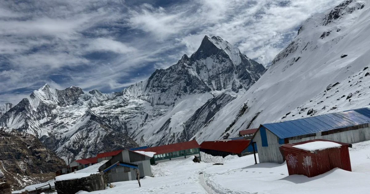
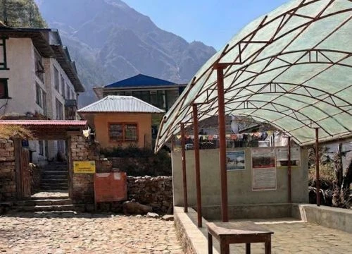
Teahouse Accommodation at the Annapurna base camp
Accommodation, Food, and Trail Facilities
Teahouses and Lodges
The Annapurna region has the most developed teahouse network in Nepal. Teahouses are family-run lodges offering simple rooms and meals. Facilities vary by altitude and location:
Altitude Range
Typical Facilities
Below 2,500 m
Private or shared rooms, hot showers, varied menu, wifi often available
2,500–3,500 m
Basic rooms, hot showers (sometimes solar), limited menu, intermittent wifi
Above 3,500 m
Simple dormitory-style or twin rooms, cold or bucket showers, basic menu, limited power
Room rates are low (NPR 500-1500), but lodges earn income from food and drinks. Heating, hot water, and charging devices cost extra. Most teahouses use solar power or generators, with electricity limited to certain hours. Blankets and mattresses are provided, but trekkers should carry sleeping bags for warmth and hygiene.
Advance booking isn't necessary outside peak season, but arriving by early afternoon ensures better room selection. During October and November, popular stops such as Manang, Thorong Phedi, and Annapurna Base Camp fill quickly.
Meals and Water
Teahouse menus feature a mix of Nepali, Tibetan, Indian, and Western dishes. Standard offerings include:
Dal bhat (rice, lentils, vegetables, curry)
Momos (dumplings)
Noodle soup, fried noodles
Fried rice, pasta
Porridge, pancakes, bread for breakfast
Tea, coffee, hot lemon
Dal bhat is the most filling and economical option, often with free refills. Higher altitudes offer less variety and higher prices due to transport costs. Fresh vegetables become scarce above 3,500 metres, and menus simplify to rice, noodles, and canned goods.
Water is available as:
Boiled water from teahouses (NPR 50–150 per litre)
Filtered water stations in some villages
Natural springs and streams (requires treatment)
Bottled water (expensive and environmentally harmful)
Carrying purification tablets or a filter reduces plastic waste and cost. Hydration is crucial for altitude acclimatization, so trekkers should drink 3–4 litres daily.
Comfort and Connectivity
Trail facilities have improved significantly:
Mobile coverage from Ncell and Nepal Telecom on most routes
Wifi available in many teahouses (NPR 200–500 per day)
Charging stations (NPR 100–300 per device)
Squat and Western-style toilets; cleanliness varies
Hot showers where solar or gas systems exist
Internet speeds are slow and unreliable, particularly above 3,000 metres. Power is limited, so carrying backup battery packs helps. Toilet paper should be carried, and waste management follows "pack it in, pack it out" principles in remote areas.
Scenic Highlights and Viewpoints
Major Viewpoints
The Annapurna region offers some of the most accessible mountain panoramas in the Himalayas, rivalling those of high mountains like Annapurna or Dhaulagiri Mountain:
Poon Hill (3,210m)
Sunrise viewpoint overlooking Annapurna and Dhaulagiri ranges
A short 45-minute climb from Ghorepani
Views of Annapurna South, Hiunchuli, Machhapuchare, Dhaulagiri
Crowded but spectacular
Annapurna Base Camp (4,130m)
360-degree views of Annapurna peaks
Surrounded by Annapurna I, Annapurna South, Hiunchuli, Gangapurna
Stunning close-up views of Machhapuchare, Hiunchuli, Annapurna South
Gradual trek from Pokhara valley, passing through rhododendron forests and small villages
Less crowded than Poon Hill or ABC
Best light during early morning and late afternoon
Offers both lower forested perspectives and high alpine panoramas
Each viewpoint offers different perspectives on the massif. Lower viewpoints such as Poon Hill and Ghorepani showcase the southern faces, while Thorong La and Manang provide northern perspectives. Weather determines visibility, so clear autumn mornings offer the best conditions.
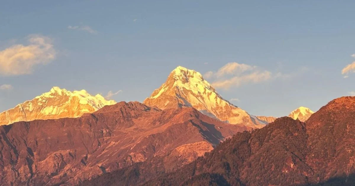
The Annapurna range seen from Poon Hill.
Photography Considerations
Mountain photography in the Annapurna region benefits from:
Early morning light, before clouds build
Golden hour at sunrise and sunset for warm tones
Polarising filters to reduce haze and enhance sky contrast
Wide-angle lenses for panoramas of Annapurna
Telephoto lenses to isolate peaks and details
Cold temperatures drain camera batteries quickly. Carrying spares and keeping batteries warm in inner pockets helps. Memory cards should have ample capacity, as cloud patterns and light change throughout the day.
Cultural sensitivity matters when photographing people. Always ask permission, especially in villages and religious sites. Some monasteries prohibit interior photography. Offering to send photos via email builds goodwill, though internet limitations may delay delivery.
Access and Transportation
How to Reach the Annapurna Region
Pokhara is the primary gateway to the Annapurna region. From Kathmandu, options include:
Transport (Starting Point)
Duration
Cost Range
Notes
Tourist bus from Kathmandu to Pokhara
6–7 hours
NPR 1200-2200
Comfortable, regular departures
Local bus from Kathmandu to Pokhara
7–8 hours
NPR 800–1500
Cheaper, more basic, frequent stops
Private vehicle from Kathmandu to Pokhara
5–6 hours
NPR 15000–30000
Flexible timing, door-to-door
Domestic flight from Kathmandu to Pokhara
25 minutes
USD 107
Weather-dependent, scenic, fast
Road conditions affect journey times, particularly during monsoon when landslides cause delays. Flights offer stunning Himalayan views on clear days but may be cancelled due to weather. Pokhara has multiple airlines serving the Kathmandu route, with several flights daily.
The Pokhara Valley serves as an ideal starting point, offering stunning views of the Annapurna range and easy access to major trailheads. Moreover, the city provides last-minute gear shopping, permits, and comfortable accommodation before heading into the mountains.
Trailheads and Starting Points
Different treks begin from different locations:
Annapurna Circuit
Traditional start: Besisahar (760m)
Common start now: Chame (2,670m) or Dharapani (1,860m) due to road access
Reached by jeep from Pokhara (6–8 hours) and from Kathmandu (6–8 hours).
Ending points: Jomsom (flight to Pokhara) or Nayapul (3–4 hour drive)
Annapurna Base Camp
Start: Nayapul (1,070m) or kyumi (1,130m)
1.5-hour drive from Pokhara
Most trekkers return via the same route
Total driving time: 1.5–2 hours from Pokhara
Jeeps and local buses connect Pokhara to these trailheads. Shared jeeps are cheaper (NPR 1000-5000), but you have to wait until they are full. Private jeeps offer flexibility and comfort but cost significantly more (NPR 5,000–10,000 depending on destination). Road conditions worsen during monsoon, increasing journey times and discomfort.
Cost Considerations and Budget Planning
Typical Costs
Trekking in the Annapurna region can be budget-friendly compared to other Himalayan destinations. Daily costs depend on services, season, and route.
Category
Budget Trekker
Mid-Range Trekker
Accommodation
NPR 200–500/night
NPR 500–1,000/night (better rooms, private bathrooms where available)
Food
NPR 2500–5000/day
NPR 3,500–7,000/day
Hot shower
NPR 100-500
NPR 100-500
Battery charging
NPR 100–300/device
Same
Wi-Fi
NPR 200–500/day
Same
Guide
NPR 3000–5000/day
NPR 4,000–7,000/day
Porter
NPR 2500–4500/day
NPR 2,500 – 45,00/day
Budget trekkers staying in basic rooms and eating dal bhat twice daily can manage on USD 20–30 per day. Mid-range trekkers preferring variety and comfort should budget USD 40–60 daily. These estimates exclude transport, permits, insurance, and gear.
Total trek costs for popular routes:
Annapurna Circuit: USD 900 – 1,500+ (12–18 days)
Annapurna Base Camp: USD 450–1100+ (5–14 days)
Ghorepani Poon Hill: USD 280–850+ (2-10 days)
What Influences Price
Several factors affect overall trekking costs:
Altitude and remoteness: Higher villages charge more due to porter transport costs. Prices increase 20–30 percent above 3,500 metres.
Season: Peak season (October–November, March–April) sees higher demand but better availability. Off-season may offer lower prices but reduced services.
Group size: Solo trekkers pay the same for accommodation and food. Groups sharing guides and porters reduce per-person costs.
Services: Hiring guides (USD 30 - 50/day) and porters (USD 20 - 35/day) adds cost but improves experience and supports local employment. Porters carry 20–25 kg and typically work for two trekkers.
Insurance: Comprehensive travel insurance with helicopter evacuation coverage costs USD 100–200 for two weeks. This is essential and non-negotiable.
Gear: Renting equipment in Pokhara (sleeping bags, down jackets, trekking poles) costs NPR 200–500 per item per day. Buying in Kathmandu or Pokhara is cheaper than in Western countries.
Contingency: Comprehensive travel insurance with helicopter evacuation coverage typically costs USD 100–200 for two weeks. The final price can vary by insurance company, policy limits, age, and trekking altitude. Even so, this cover is essential and non-negotiable for trekking and climbing in Nepal.
Mount Annapurna: Final Thoughts
Mount Annapurna is defined not by height alone but by its combination of danger, beauty, and accessibility. The 10th highest mountain in the world set the standard for 8,000-metre peaks when Maurice Herzog and Louis Lachenal reached the summit in 1950. Its steep faces, unstable conditions, and high fatality rate make it one of the most respected mountains among climbers. For trekkers, the Annapurna region offers unmatched variety, from subtropical valleys to glacial amphitheatres, all supported by established trails and teahouses.
The peaks of Annapurna are for experienced mountaineers only, but the trekking routes welcome anyone with moderate fitness and altitude awareness. While Khopra Ridge or Tilicho Lake provide serenity for seasoned trekkers, the Annapurna Circuit and Annapurna Base Camp hikes are ideal for first-time Himalayan tourists. The region rewards those who trek slowly, respect local culture, and prioritise acclimatisation over speed. Nepal's Annapurna landscape suits photographers, cultural enthusiasts, and anyone seeking immersion in mountain environments without technical climbing.
Nepal Everest Base Camp Co. presents the Annapurna region, a destination that rewards those who approach it with preparation and respect. Less commercialised than Mount Everest, it offers equally powerful experiences through the Annapurna massif, the Annapurna Conservation Area, and the communities living around Annapurna, where natural grandeur meets cultural richness. Whether trekking the Annapurna Circuit, standing at Annapurna Base Camp, crossing Thorong La, or watching the sunrise from Poon Hill, the region balances challenge and accessibility. For accurate, local guidance and to plan your trek, contact us today.
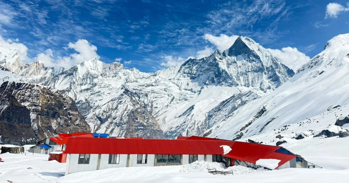
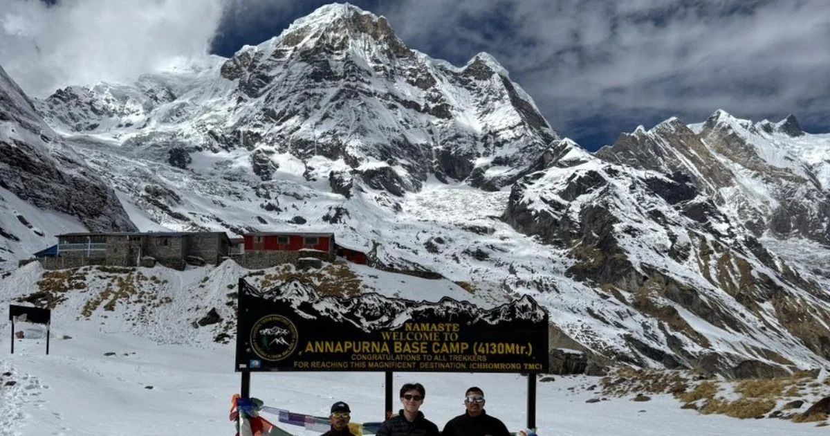
Mt. Annapurna seen from ABC
FAQs About Mount Annapurna
Is Mount Annapurna harder or more dangerous than other Himalayan peaks?
Annapurna has the highest fatality rate among 8,000-metre peaks, historically around 32 percent, making it more dangerous than Mount Everest for climbers. The mountain's steep faces, unpredictable weather, and avalanche risk contribute to this reputation, though trekking routes in the region carry significantly lower risks.
Can beginners trek in the Annapurna region?
Yes, the Annapurna Base Camp trek and Ghorepani Poon Hill trek are suitable for beginners with good fitness. The Annapurna Circuit requires more experience due to altitude and duration, but thousands of first-time trekkers complete it successfully with proper acclimatisation and pacing.
Do you need a guide or porter to trek in the Annapurna region?
Guides and porters are not legally required for treks in the Annapurna region, and trails are well-marked with teahouses at regular intervals. However, hiring local guides improves safety, supports communities, and enhances cultural understanding, especially for first-time visitors to Nepal.
How high is the risk of altitude sickness on Annapurna treks?
Altitude sickness can occur above 2,500 metres on both the Annapurna Circuit (maximum 5,416 m) and Annapurna Base Camp (maximum 4,130 m). Proper acclimatisation, gradual ascent (no more than 500 m per day above 3,000 m), staying hydrated, and recognising early symptoms significantly reduce serious risk.
When is the ideal time to travel to the Annapurna region?
Autumn (September to November) offers the most stable weather and clear mountain visibility, making it the most popular trekking season. Spring (March to May) is also excellent, with warmer temperatures and blooming rhododendrons, though afternoon clouds can reduce views compared to autumn's crisp conditions.
Blending digital strategy with mountain passion, I help adventurers find their way to the Himalayas online. With hands-on experience in Nepal’s trekking trails and a role at Nepal Everest Base Camp Trekking Co., Thamel, I combine SEO expertise with true trail insight.